Barnsley / Berneslai
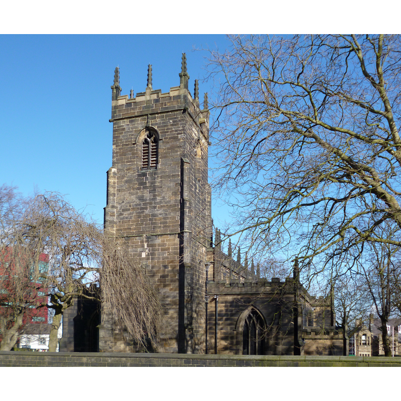
Image copyright © Dave Kelly, 2015
CC-BY-SA-2.0
Results: 1 records
view of church exterior in context - southwest view
Copyright Statement: Image copyright © Dave Kelly, 2015
Image Source: digital photograph taken 3 March 2015 by Dave Kelly [www.geograph.org.uk/photo/4371798] [accessed 3 October 2018]
Copyright Instructions: CC-BY-SA-2.0
INFORMATION
Font ID: 21828BAR
Object Type: Baptismal Font1?
Font Date: ca. 1400?
Font Century and Period/Style: 14th - 15th century, Medieval
Church / Chapel Name: Parish Church of St. Mary
Font Location in Church: [disappeared]
Church Patron Saint(s): St. Mary the Virgin
Church Address: Church Street, Barnsley, South Yorkshire S70 2AH, UK -- Tel.: 07549 876505
Site Location: South Yorkshire, Yorkshire and the Humber, England, United Kingdom
Directions to Site: Located off the A628-A635-A6133 confluence, 20-25 km S of Wakefield
Ecclesiastic Region: Diocese of Leeds
Historical Region: Hundred of Staincross -- formerly WRYrks
Additional Comments: disappeared font? (the one from the early-16thC church here)
Font Notes:
Click to view
There is an entry for this Barnsley [variant spelling] in the Domesday survey [http://opendomesday.org/place/SE3406/barnsley/] [accessed 3 October 2018] but it mentions neither cleric nor church in it. The entry for this church in Historic England [Listing NGR: SE3111009914] [accessed 3 October 2018] notes: "Church. C16, the chancel is dated 1517 and was built by Thomas de Tykyll, Prior of Monk Bretton Priory", but mentions no font in it. Harrman & Pevsner (2017) give the day of the tower as ca. 1400, the church itself having been re-built in 1817-1822. All other churches in this town are modern.
COORDINATES
UTM: 30U 600531 5935138
Latitude & Longitude (Decimal): 53.55549, -1.4824
Latitude & Longitude (DMS): 53° 33′ 19.76″ N, 1° 28′ 56.64″ W