Airmyn
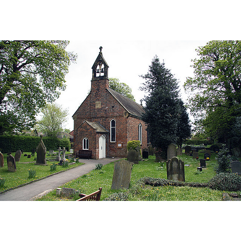
Image copyright © Richard Croft, 2010
CC-BY-SA-2.0
Results: 1 records
view of church exterior - southwest view
Copyright Statement: Image copyright © Richard Croft, 2010
Image Source: digital photograph taken 6 May 2010 by Richard Croft [www.geograph.org.uk/photo/1844279] [accessed 24 September 2018]
Copyright Instructions: CC-BY-SA-2.0
INFORMATION
Font ID: 21818AIR
Object Type: Baptismal Font1
Font Date: ca. 1311?
Font Century and Period/Style: 14th century, Decorated
Church / Chapel Name: Parish Church of St. David
Font Location in Church: [disappeared]
Church Patron Saint(s): St. David [aka David of Wales, Davidus, Dewy]
Church Notes: orig. church early-14thC; re-built 1626; altered mid-19thC
Church Address: 65 High St, Airmyn, Goole DN14 8LF, UK -- Tel.: +44 1405 763678
Site Location: East Riding of Yorkshire, Yorkshire and the Humber, England, United Kingdom
Directions to Site: Located 3-4 km NW of Goole, W of the M62
Ecclesiastic Region: Diocese of Sheffield
Historical Region: formerly in the WRYrks
Additional Comments: disappeared font? (the one from the early-14thC church here; was removed in the 1674 building of the new church)
Font Notes:
Click to view
No individual entry for Airmyn found in the Domesday survey. The entry for this church in Historic England [Listing IoE Number: 164859] notes: "Parish church. Nave dated on tablet to 1676; alterations of 1858 included re-roofing, new bellcote and west porch; chancel and organ chamber of 1884"; it mentions no font in it, nor anything prior to 1676. The Church of England's A Church Near You entry for this church reads: "The present-day church at Airmyn is not the only one that the village has ever had. The first church was built here in 1311 but it had a most inauspicious beginning because the villagers had built it for themselves without asking anyone’s permission. The Archbishop of York, Archbishop Greenfield, declared himself “astounded” at what they had done “in contempt of us and the mother church of Snaith in whose parish they live” and he banned them from conducting services of divine worship in their chapel “on pain of ecclesiastical exclusion [...] This first church served Airmyn in a very constrained way for the next three and a half centuries - no marriages or burials, although it did have a font - until, in 1674, it was described as being “quite out of repaire” and the decision seems to have been taken to demolish it and replace it with the church that we have nowadays."
COORDINATES
UTM: 30U 638461 5954206
Latitude & Longitude (Decimal): 53.71813, -0.9017
Latitude & Longitude (DMS): 53° 43′ 5.27″ N, 0° 54′ 6.12″ W