Mottisfont No. 1 / Modesfunte / Mortelhunte / Mortesfunde / Motes Founton / Motesfonte / Motesfunda / Motsone / Motte Fount / Mottesfont / Mottesfount / Mottson
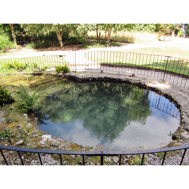
Image copyright © Colin Smith, 2018
Image and permission received from the author (e-mail of 6 January 2019)
Results: 6 records
view of church exterior - spring
Scene Description: said to be the original after which the abbey was named [spring = fons, fontis] -- The entry in Historic England [Listing NGR: SU3261827007] reads: "Spring source. Of medieval origins, now C18, repaired C20. Rubble flint bowl with rubble carved stones at bottom. 3m diameter bowl some 3m deep, wall of bowl opens out on one segment into stream. C18 plain iron fencing around rest."
Copyright Statement: Image copyright © Colin Smith, 2018
Image Source: digital photograph taken 10 July 2018 by Colin Smith
Copyright Instructions: Image and permission received from the author (e-mail of 6 January 2019)
view of church exterior - priory - cellarium
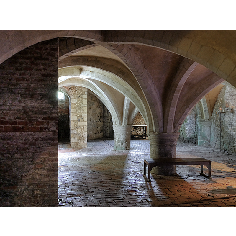
Scene Description: Source caption: "The thirteenth century cellarium, or undercroft, of the original Augustinian priory remains beneath the country house which was built in the sixteenth century."
Copyright Statement: Image copyright © David Dixon, 2017
Image Source: digital photograph taken 6 July 2017 by David Dixon [www.geograph.org.uk/photo/5468460] [accessed 13 September 2018]
Copyright Instructions: CC-BY-SA-2.0
view of church exterior - porch - detail
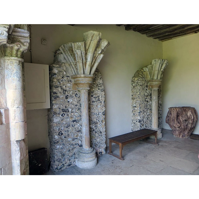
Scene Description: Source caption: "Some of the old pillars from the priory as you walk in the entrance at Mottisfont".
Copyright Statement: Image copyright © Bill Nicholls, 2015
Image Source: digital photograph taken 29 June 2015 by Bill Nicholls [www.geograph.org.uk/photo/4607060] [accessed 13 September 2018]
Copyright Instructions: CC-BY-SA-2.0
view of church exterior - south porch and portal
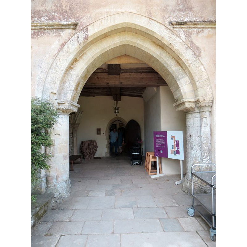
Scene Description: Source caption: "Entrance at Mottisfont. Most likely this was the entrance to Mottisfont priory once till it was made into a house in Tudor times".
Copyright Statement: Image copyright © Bill Nicholls, 2015
Image Source: digital photograph taken 29 June 2015 by Bill Nicholls [www.geograph.org.uk/photo/4607056] [accessed 13 September 2018]
Copyright Instructions: CC-BY-SA-2.0
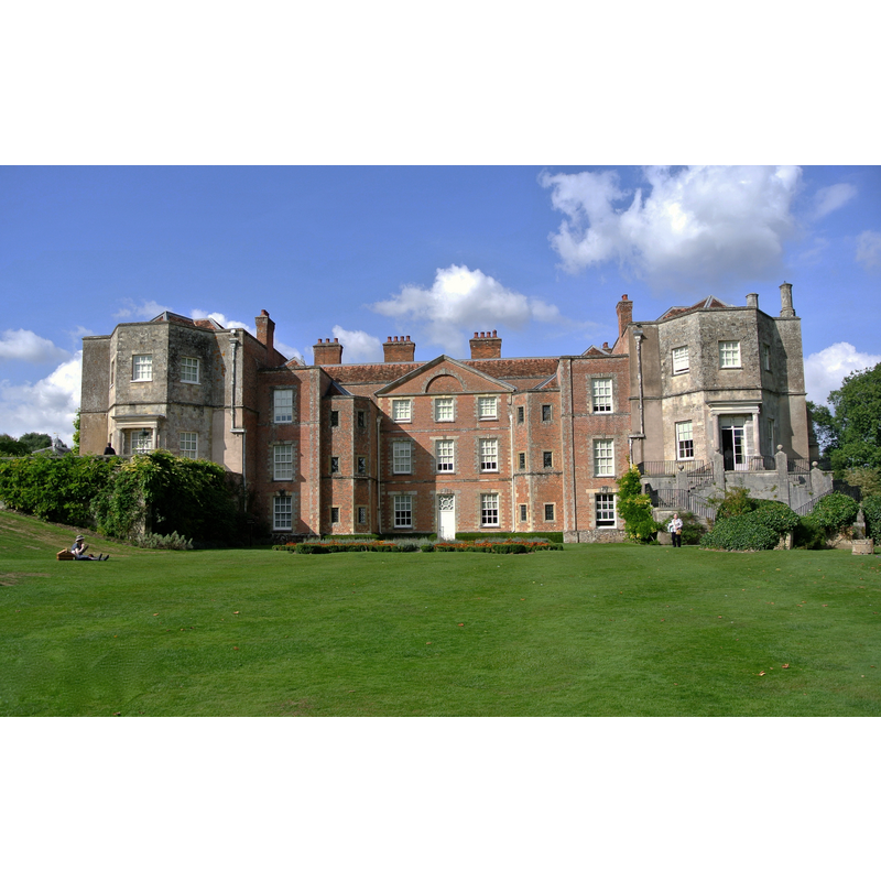
view of church exterior - north view
Scene Description: Source caption: "The rear view of Mottisfont Abbey still shows how the original Priory Church was laid out. The Eastern end, (on the left), still displays some of the arches that would have marked the location of the High Altar. The Nave was converted into the rooms of the house following the dissolution of the Monasteries in 1536."
Copyright Statement: Image copyright © Len Williams, 2013
Image Source: digital photograph taken 6 August 2013 by Len Williams [www.geograph.org.uk/photo/3589271] [accessed 13 September 2018]
Copyright Instructions: CC-BY-SA-2.0
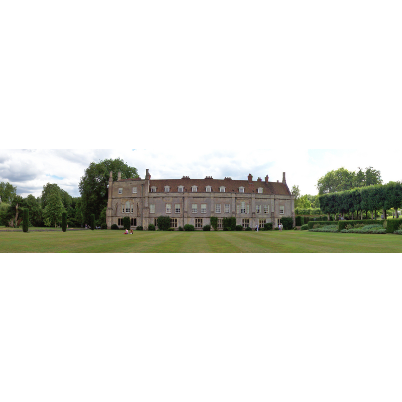
view of church exterior - south view
Scene Description: Present view of the mansion, originally an Augustinian priory founded in 1201; the nave of the church became the centre part of the mansion built after the Dissolution
Copyright Statement: Image copyright © MorganBurness, 2014
Image Source: digital photograph taken 13 September 2014 by MorganBurness [https://commons.wikimedia.org/wiki/File:Mottisfont.Abbey.House.JPG] [accesed 13 September 2018]
Copyright Instructions: CC-BY-SA-2.0
INFORMATION
Font ID: 21814MOT
Object Type: Baptismal Font1?
Font Date: ca. 1200?
Font Century and Period/Style: 12th - 13th century, Transitional / Early English
Church / Chapel Name: Priory [aka Abbey] Church of the Holy Trinity [remains of it in the 16thC mansion]
Font Location in Church: [disappeared]
Church Patron Saint(s): The Holy Trinity
Church Notes: Augustinian priory [never an abbey, though that name was used later, a/o the 19thC] founded ca. 1200; the church nave became part of the new mansion built after the Dissolution; site gifted to the National Trust in 1957
Church Address: Mottisfont, Romsey, Hampshire, SO51 0LP, UK
Site Location: Hampshire, South East, England, United Kingdom
Directions to Site: Located off (W) the A3057, just 1 km N of Kimbridge, 7 km NNW of Romsey
Ecclesiastic Region: Diocese of Winchester
Historical Region: Hundred of Thorngate -- Hunder of Broughton [in Domesday]
Additional Comments: disappeared font? (the one from the ca.1200 Augustinian priory church here)
Font Notes:
Click to view
There are two entries for Mottisfont [variant spellings] in the Domesday survey [http://opendomesday.org/place/SU3226/mottisfont/] [accessed 13 September 2018], one of which reports seven churches in it [NB: a parish church and six ' dependent chapelries' of Mottisfont]. [NB: we have no information on the font of the ca.1201 priory church here]. The entry for this priory in the Victoria County Histoy notes: "This priory of Au[gu]stin[ian] canons, dedicated to the Holy Trinity, was founded by William Briwere about 1200."
COORDINATES
UTM: 30U 602707 5655453
Latitude & Longitude (Decimal): 51.04143, -1.53496
Latitude & Longitude (DMS): 51° 2′ 29.15″ N, 1° 32′ 5.86″ W