Great Steeping / Steeping Magna / Stepinge
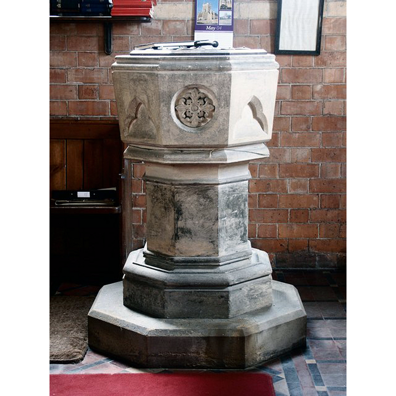
Image copyright © Dave Hitchborne, 2004
CC-BY-SA-2.0
Results: 6 records
view of font and cover
Scene Description: the modern font in the modern Church of All Saints
Copyright Statement: Image copyright © Dave Hitchborne, 2004
Image Source: digital photograph taken 13 May 2004 by Dave Hitchborne [www.geograph.org.uk/photo/436810] [accessed 11 November 2018]
Copyright Instructions: CC-BY-SA-2.0
view of church exterior - southeast view
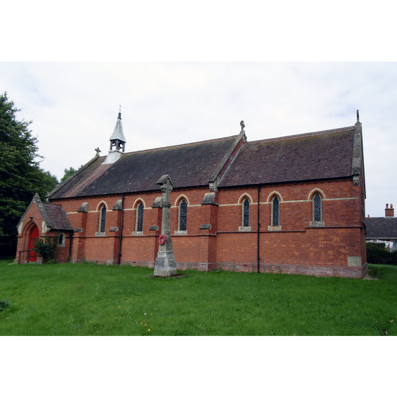
Scene Description: the modern Church of All Saints
Copyright Statement: Image copyright © Ian S, 2014
Image Source: digital photograph taken 3 September 2014 by Ian S [www.geograph.org.uk/photo/4150993] [accessed 11 November 2018]
Copyright Instructions: CC-BY-SA-2.0
view of church exterior - northeast view
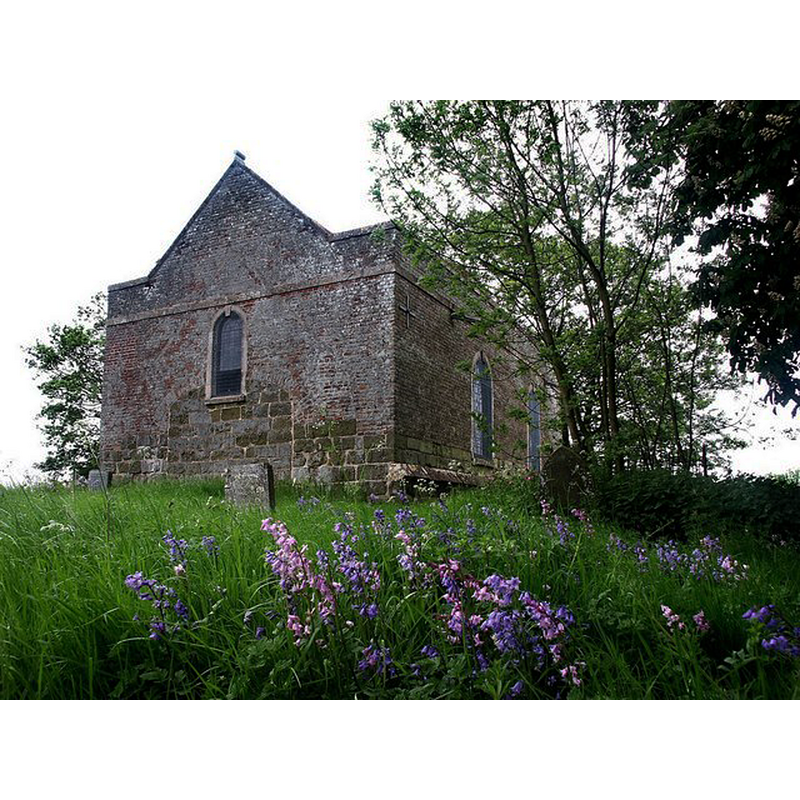
Scene Description: Source caption: "Old All Saints, Great Steeping. East wall, which backs onto the Steeping River."
Copyright Statement: Image copyright © Dave Hitchborne, 2004
Image Source: digital photograph taken 13 May 2004 by Dave Hitchborne [www.geograph.org.uk/photo/436913] [accessed 11 November 2018]
Copyright Instructions: CC-BY-SA-2.0
view of church exterior - southwest view
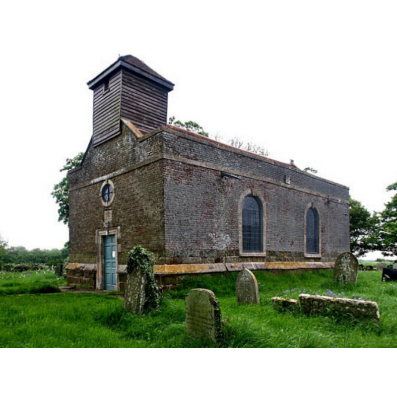
Scene Description: Source caption: "Old All Saints, Great Steeping. Hidden down Old Church Lane."
Copyright Statement: Image copyright © Dave Hitchborne, 2004
Image Source: digital photograph taken 13 May 2004 by Dave Hitchborne [www.geograph.org.uk/photo/436899] [accessed 11 November 2018]
Copyright Instructions: CC-BY-SA-2.0
view of church interior - nave - looking east
Scene Description: the modern Church of All Saints
Copyright Statement: Image copyright © Dave Hitchborne, 2004
Image Source: digital photograph taken 13 May 2004 by Dave Hitchborne [www.geograph.org.uk/photo/436774] [accessed 11 November 2018]
Copyright Instructions: CC-BY-SA-2.0
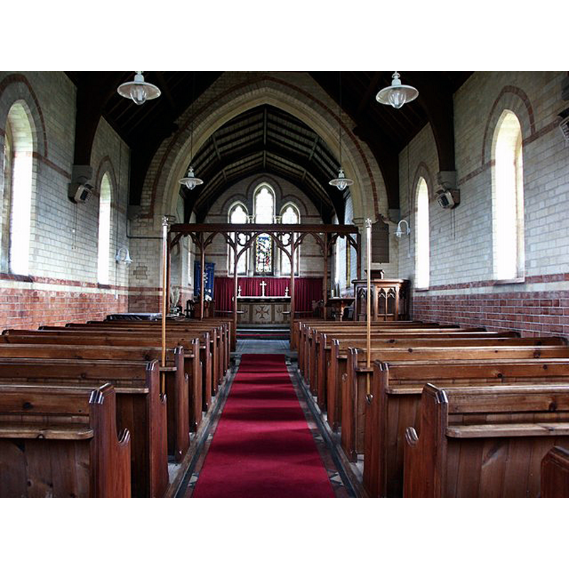
view of church interior - nave - looking west
![the modern Church of All Saints; its modern font is visible at the far [west] end](/static-50478a99ec6f36a15d6234548c59f63da52304e5/compressed/1181111024_compressed.png)
Scene Description: the modern Church of All Saints; its modern font is visible at the far [west] end
Copyright Statement: Image copyright © Dave Hitchborne, 2004
Image Source: digital photograph taken 13 May 2004 by Dave Hitchborne [www.geograph.org.uk/photo/436798] [accessed 11 November 2018]
Copyright Instructions: CC-BY-SA-2.0
INFORMATION
Font ID: 21781STE
Object Type: Baptismal Font1
Font Century and Period/Style: Medieval
Church / Chapel Name: Old Parish Church of All Saints [redundant]
Font Location in Church: [disappeared after 1829?]
Church Patron Saint(s): All Saints
Church Notes: built 1748 on the site of a medieval church; restored 1908 -- new church, also dedicated to All Saints, built nearer the centre of the village in 1891; old church redundant August 1973
Church Address: [address and coordinates given for the old church] Old Church Ln, Great Steeping, Lincolnshire, England, PE23 5PR
Site Location: Lincolnshire, East Midlands, England, United Kingdom
Directions to Site: Located off (S) the B1195, 5 km ESE of Spilsby and the A16, WSW of Bratoft
Ecclesiastic Region: Diocese of Lincoln
Historical Region: Hundred of Candleshoe
Additional Comments: disappeared font? (reported in the old church ca. 1829 but no longer in the old or new churches)
Font Notes:
Click to view
There are two entries for [Great] Steeping [variant spelling] in the Domesday survey [https://opendomesday.org/place/TF4364/great-steeping/] [accessed 11 November 2018], one of which reports two churches in it [cf. infra]. The entry for this church in Edmund Oldfield's A topographical and historical account of Wainfleet and the Wapentake of Candleshoe, in the County of Lincoln (London: Longman, [etc.], 1829: p. 267) notes: "The font is circular, small and entirely void of circulation." Oldfield (ibid.) refers to two entries for churches in [Great] Steeping in Domesday, but adds that since a portion of Gunby [cf. Index entry for Gunby nr Candlesby] was included in that return, "it is highly probable that one of them was situate in that parish". The entry for the old church in Historic England [Listing NGR: TF4347663943] notes: "Parish church, now redundant. 1748 on medieval base, restored 1908"; it mentions no font in it. The entry for the new church in Historic England [Listing NGR: TF4403464344] notes: "Parish church. 1891 designed by William Bassett-Smith. [...] Octagonal bowl and stem font"; no date is given, so presumably contemporary with the modern church. Historic England further lists a medieval cross in the churchyard here [List Entry Number: 1013532]: "The remains of the churchyard cross at the Old Church, Great Steeping, include a medieval carved base surviving in unusually good condition. It is particularly rare in that the carved figures are complete, having escaped mutilation by post-medieval iconoclasts, and due to a long period of partial burial are little weathered. Situated to the south of the nave, the cross is believed to stand in its original position, and archaeological deposits relating to its construction and use will thus survive intact. [...] The monument includes the remains of a standing stone cross located in the churchyard of the Old Church at Great Steeping, formerly the Church of All Saints. The cross is medieval in date and is constructed of limestone. The monument includes the base of the cross and a fragment of the shaft. The base takes the form of a socket stone, approximately 0.8m square in section, now partially buried and standing to a height of about 0.3m above the present ground surface. At each corner of the socket stone is a complete winged figure carved in deep relief symbolising one of the Four Evangelists: on the north east corner a man (St Matthew), on the south east an ox (St Luke), on the south west a lion (St Mark) and on the north west an eagle (St John). Carved on the middle of each side, between the figures, is a plain shield. The socket stone is broken into two pieces, slightly parted, and in the top is a rectangular socket filled with two small fragments of limestone which represent the base of the shaft. Lying on the ground surface adjacent to the east side of the cross is a loose fragment of a cross-shaft, 0.66m long, made of sandstone; this piece is not considered to have been an original part of the cross and is therefore excluded from the scheduling."
COORDINATES
UTM: 31U 309041 5893134
Latitude & Longitude (Decimal): 53.1533, 0.1441
Latitude & Longitude (DMS): 53° 9′ 11.88″ N, 0° 8′ 38.76″ E
MEDIUM AND MEASUREMENTS
Material: stone
Font Shape: round
Basin Exterior Shape: round