Tamaguelos
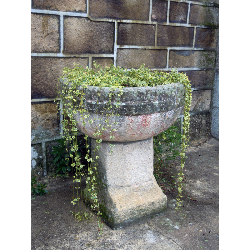
Image copyright © Adrián Estévez, 2011
GFDL / CC-BY-SA-3.0
Results: 2 records
view of font
Scene Description: Source caption: "Pía bautismal xunto á porta sur da igrexa parroquial de Tamaguelos (Verín)."
Copyright Statement: Image copyright © Adrián Estévez, 2011
Image Source: digital photograph taken 10 December 2011 by Adrián Estévez [https://gl.wikipedia.org/wiki/Ficheiro:Pía_bautismal_Tamaguelos,_Verín.jpg] [accessed 6 May 2018]
Copyright Instructions: GFDL / CC-BY-SA-3.0
view of church exterior - northwest view
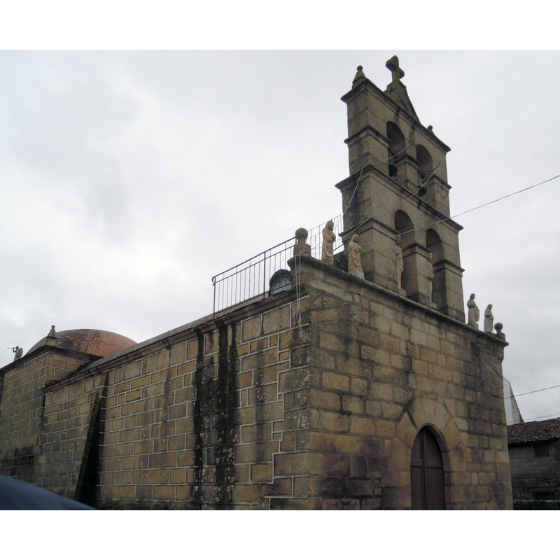
Copyright Statement: Image copyright © Adrián Estévez, 2011
Image Source: digital photograph taken 10 December 2011 by Adrián Estévez [https://gl.wikipedia.org/wiki/Ficheiro:Igrexa_Tamaguelos.jpg] [accessed 6 May 2018]
Copyright Instructions: GFDL / CC-BY-SA-3.0
INFORMATION
Font ID: 21730TAM
Object Type: Baptismal Font1
Font Century and Period/Style: Medieval
Church / Chapel Name: Igrexa parroquial de Santa María de Tamaguelos
Font Location in Church: Outside the church
Church Patron Saint(s): St. Mary the Virgin
Church Notes: present 18thC church built on earlier church, probably medieval
Church Address: Lugar Tamaguelos, 145, 32697 Tamaguelos, Ourense, Spain
Site Location: Orense / Ourense, Galicia, Spain, Europe
Directions to Site: Located off (W) the N-532 and the A-75, in the municipality of and S of Verín, 60-70 km SE of Orense, just N of the border with Portugal
Historical Region: Comarca de Verín
Additional Comments: disused font? (located outside the church)
Font Notes:
Click to view
The entry for this church in Patrimonio Galego [http://patrimoniogalego.net/index.php/66767/2015/01/igrexa-de-santa-maria-de-tamaguelos/] [accessed 6 May 2018] reports: "No adro está tamén o vello baptisterio, unha pía que posiblemente date de época medieval." The font consists of a roughly hemispherical basin raised on a polygonal stem and a quadrangular lower base; the basin has a groove all around; the font could be late-medieval, if not later. It is now located outside the church, by the south doorway.
COORDINATES
UTM: 29T 629274 4636577
Latitude & Longitude (Decimal): 41.870556, -7.442222
Latitude & Longitude (DMS): 41° 52′ 14″ N, 7° 26′ 32″ W
MEDIUM AND MEASUREMENTS
Material: stone
Font Shape: hemispheric, mounted
Basin Interior Shape: round
Basin Exterior Shape: round