Stawell / Stawelle
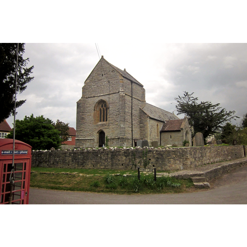
Image copyright © Derek Harper, 2015
CC-BY-SA-2.0
Results: 2 records
view of church exterior - southwest view
Copyright Statement: Image copyright © Derek Harper, 2015
Image Source: digital photograph taken 25 April 2015 by Derek Harper [www.geograph.org.uk/photo/4735874] [accessed 2 May 2018]
Copyright Instructions: CC-BY-SA-2.0
view of church exterior - southeast view
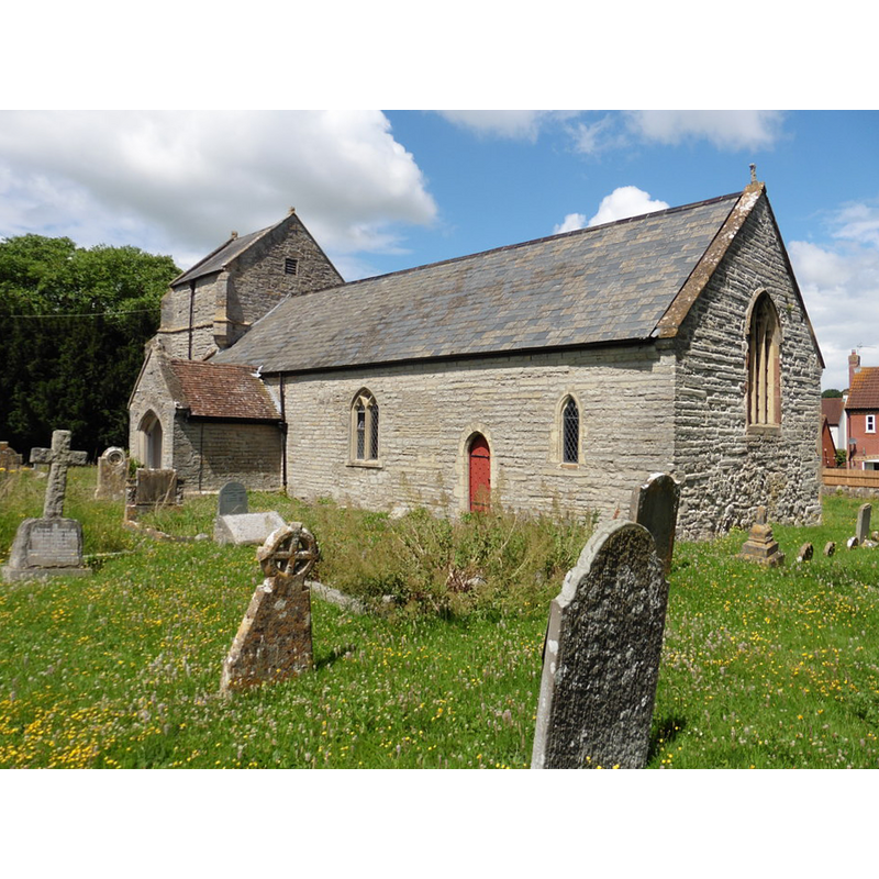
Copyright Statement: Image copyright © Roger Cornfoot, 2016
Image Source: digital photograph taken 13 July 2016 by Roger Cornfoot [www.geograph.org.uk/photo/5034397] [accessed 2 May 2018]
Copyright Instructions: CC-BY-SA-2.0
INFORMATION
Font ID: 21706STA
Object Type: Baptismal Font1
Font Century and Period/Style: 15th century, Perpendicular
Church / Chapel Name: Parish Church of St. Francis
Font Location in Church: Inside the church
Church Patron Saint(s): St. Francis of Assisi [since the 1960s; no recorded dedication earlier]
Church Address: Stawell Road, Stawell, Bridgwater TA7 9AZ , UK
Site Location: Somerset, South West, England, United Kingdom
Directions to Site: Located off (S) the A39 [aka Bath Rd], 7 km ENE of Bridgwater
Ecclesiastic Region: Diocese of Bath & Wells
Historical Region: Hundred of Whitley
Additional Comments: disappeared font? (the one from the 1270 chapel in which baptism was carriet out [cf. FontNotes])
Font Notes:
Click to view
There is an entry for Stawell [variant spelling] in the Domesday survey [http://opendomesday.org/place/ST3638/stawell/] [accessed 2 May 2018], but it mentions neither cleric nor church in it. The entry for this parish in the Victoria County History (Somerset, vol. 8, 2004) notes: "There was a chapel by 1270 when the lord of the manor received permission from the abbot of Glastonbury to have his grandson baptised there and not at the mother church of Moorlinch [...] The church, dedicated to St. Francis from the 1960s but earlier with no recorded dedication, probably originated as a building with undifferentiated chancel and nave in the 13th century [...] A general restoration was undertaken in 1874 [...] during which the seats, furnishings, and nave roof were introduced"; there is no mention of a font in the VCH entry. The entry for this church in Historic England [Listing NGR: ST3680738296] [accessed 2 May 2018] reports a "Octagonal C15 font with quatrefoil panels, C19 cover' in it.
COORDINATES
UTM: 30U 506667 5665442
Latitude & Longitude (Decimal): 51.1404, -2.9047
Latitude & Longitude (DMS): 51° 8′ 25.44″ N, 2° 54′ 16.92″ W
MEDIUM AND MEASUREMENTS
Material: stone
Font Shape: octagonal, mounted
Basin Interior Shape: round
Basin Exterior Shape: octagonal
REFERENCES
- Victoria County History [online], University of London, 1993-. URL: https://www.british-history.ac.uk.