Nordhausen No. 3 / Nordhusa / Nordhuse / Nordhusen / Northusia
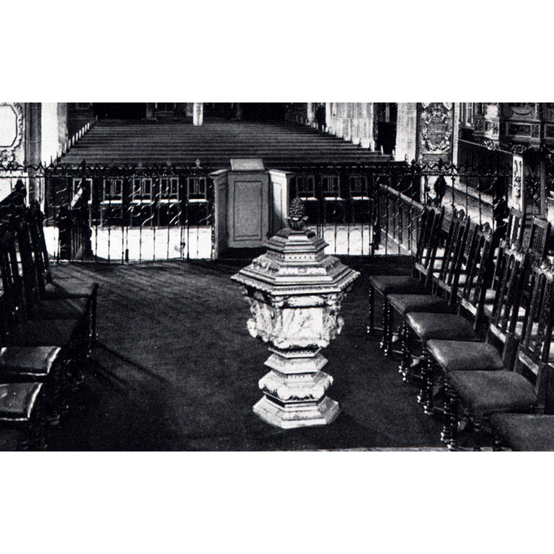
Image copyright © [in the public domain]
CC-Zero
Results: 3 records
view of font and cover in context
Copyright Statement: Image copyright © [in the public domain]
Image Source: edited detail of a digital image of a ca. 1929 B&W photograph by Carl Schiewek in Oskar Doering's Nordhausen (Augsburg: Dr. B. Filser, 1929) [https://nordhausen-wiki.de/index.php?title=Datei:Inneres_der_Marktkirche_Nordhausen_1929_Schiewek.jpg] [accessed 29 April 2018]
Copyright Instructions: CC-Zero
view of church exterior - southwest end
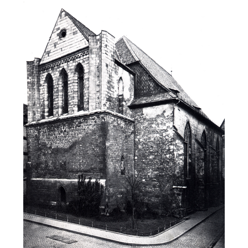
Scene Description: view of the church ca.1929; it had lost its twin towers by this time; the church was totally destroyed in an Allied air raid on 3 April 1945
Copyright Statement: Image copyright © [in the public domain]
Image Source: digital image of a ca. 1929 B&W photograph by Carl Schiewek in Oskar Doering's Nordhausen (Augsburg: Dr. B. Filser, 1929) [https://nordhausen-wiki.de/images/4/47/Marktkirche_Nordhausen_1929_Schiewek.jpg] [accessed 29 April 2018]
Copyright Instructions: CC-Zero
view of church interior - nave - looking west
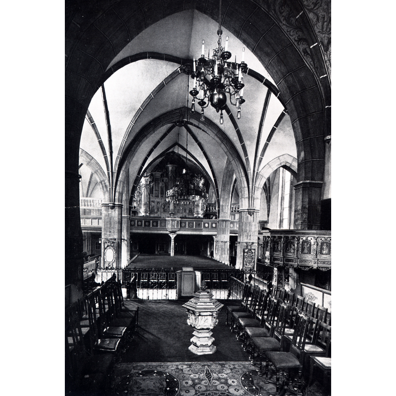
Copyright Statement: Image copyright © [in the public domain]
Image Source: digital image of a ca. 1929 B&W photograph by Carl Schiewek in Oskar Doering's Nordhausen (Augsburg: Dr. B. Filser, 1929) [https://nordhausen-wiki.de/index.php?title=Datei:Inneres_der_Marktkirche_Nordhausen_1929_Schiewek.jpg] [accessed 29 April 2018]
Copyright Instructions: CC-Zero
INFORMATION
Font ID: 21704NOR
Object Type: Baptismal Font1
Font Date: 1588
Font Century and Period/Style: 16th century(late), Late Gothic
Church / Chapel Name: Evangelische Kirche St. Nikolai [aka Marktkirche]
Font Location in Church: Located in the chancel in 1945
Church Patron Saint(s): St. Nicholas of Myra
Church Notes: single-nave church documented 1220; expanded 1490; damaged in fires of 1612, 1710 and 1712; almost totally destroyed in the Allied air raid of 3 April 1945; remains demolished completely 1956
Church Address: NB: coordinates given atr for the present site where the church stood; a parking lot occupied the site after the total demolition of the ruins in 1956
Site Location: Nordhausen, Thüringen, Germany, Europe
Directions to Site: Located off (N) the highways 4-38 crossroads, 60 km E of Göttingen, 80 km W of Halle (Saale)
Additional Comments: destroyed font (wooden font of 1588 destroyed in the WWII air raid of 3 April 1945) -- disappeared font? (the one from the medieval church here)
Font Notes:
Click to view
The font at the time of the destruction of the church in 1945 was a wooden one of 1588; it was located in the chancel; it consisted of a hexagonal (?) basin profusely decorated all around; the upper basin side had six large cherub heads at the angles; the side panels has scenes in them; the underbowl, the pedestal stem and the lower base, also hexagonal, were cover in mouldings and decorations. A hexagonal with matching decoration was on the font. Presumably totally destroyed in the air raid of 3 April 1945.
COORDINATES
UTM: 32U 624500 5707195
Latitude & Longitude (Decimal): 51.502163, 10.793773
Latitude & Longitude (DMS): 51° 30′ 7.79″ N, 10° 47′ 37.58″ E
MEDIUM AND MEASUREMENTS
Material: wood
Font Shape: hexagonal, mounted
Basin Exterior Shape: hexagonal
INSCRIPTION
Inscription Notes: [cf. FontNotes]
LID INFORMATION
Date: 1588?
Material: wood
Apparatus: no
Notes: [cf. FontNotes]