Broomfield / Broomfield nr. Maidstone / Brunfelle
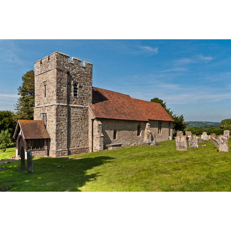
Image copyright © Ian Capper, 2012
CC-BY-SA-2.0
Results: 1 records
view of church exterior - southwest view
Copyright Statement: Image copyright © Ian Capper, 2012
Image Source: digital photograph taken 20 June 2012 by Ian Capper [www.geograph.org.uk/photo/3008875] [accessed 3 April 2018]
Copyright Instructions: CC-BY-SA-2.0
INFORMATION
Font ID: 21653BRO
Object Type: Baptismal Font1?
Font Century and Period/Style: 12th century, Late Norman
Church / Chapel Name: Parish Church of St. Margaret
Font Location in Church: [disappeared]
Church Patron Saint(s): St. Margaret of Antioch [aka Margaret the Virgin, Marina]
Church Notes: original church probably 12thC; restored late-19thC
Church Address: Lower Broomfield Road, Broomfield, Maidstone ME171PT, UK -- Tel.: (01622) 842916 - verger Derek Hadlow tel 021622 861955
Site Location: Kent, South East, England, United Kingdom
Directions to Site: Located off (S) the A20, 10 km SE of Maidstone
Ecclesiastic Region: Diocese of Canterbury
Historical Region: Union of Hollingbourn, Hundred of Eyhorne
Additional Comments: disappeared font? (the one from the 12thC church here]
Font Notes:
Click to view
There is an entry for this Broomfield [variant spelling] in the Domesday survey [http://opendomesday.org/place/TQ8452/broomfield/] [accessed 3 April 2018], but it mentions neither cleric nor church in it. The entry for this church in British Listed Buildings [Listing NGR: TQ8385552452] gives the date of the church as "Late C11 or C12, and C15, restored 1879 by G.M. Hill", but mentions no font in it. The entry for this church in John E. Vigar's Kent Churches [www.kentchurches.info/church.asp?p=Broomfield] [accessed 3 April 2018] reports a Victorian font in this church.
COORDINATES
Latitude & Longitude (Decimal): 51.242, 0.6347
Latitude & Longitude (DMS): 51° 14' 31" N, 0° 38' 4" E