Thorne Coffin / Thorn Coffin / Thorne / Torne
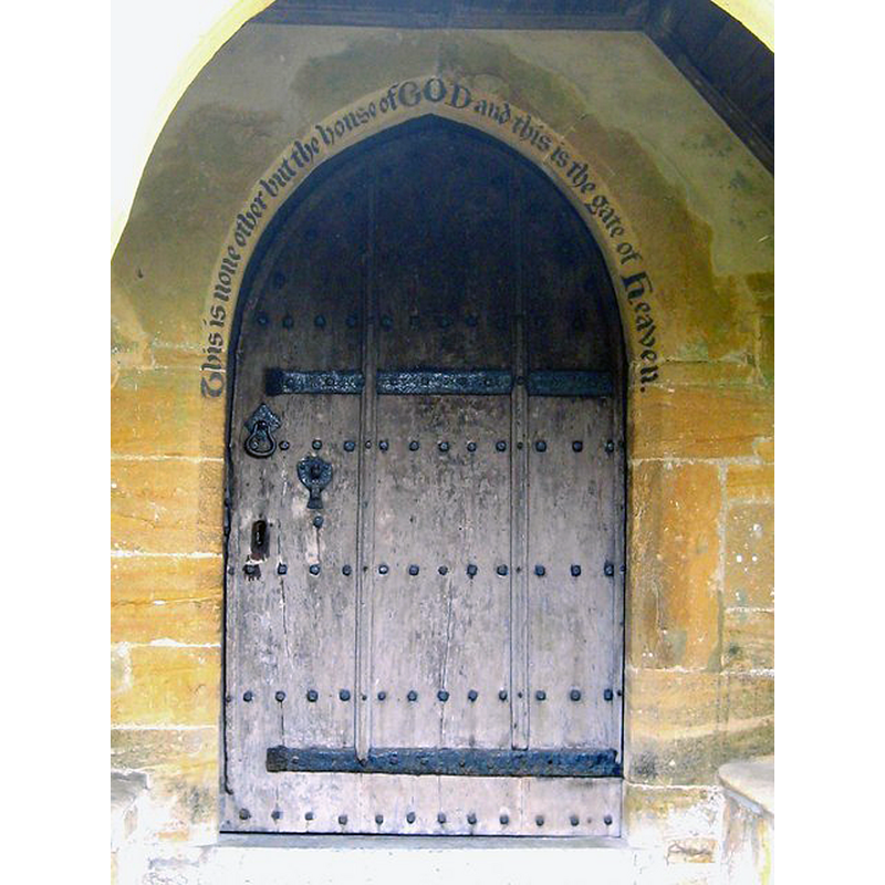
Image copyright © Sarah Smith, 2010
CC-BY-SA-2.0
Results: 2 records
view of church exterior - north portal
Scene Description: Source caption: "North door - St Andrew's Thorne Coffin. Above the top of the north door to the church are written the words: 'This is none other but the house of GOD and this is the gate of Heaven'" [Genesis 28: 17]
Copyright Statement: Image copyright © Sarah Smith, 2010
Image Source: digital photograph taken 8 September 2010 by Sarah Smith [www.geograph.org.uk/photo/2056967] [accessed 13 February 2018]
Copyright Instructions: CC-BY-SA-2.0
view of church exterior - southeast view
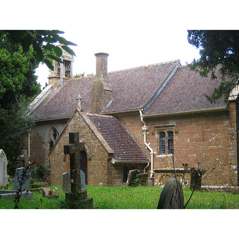
Scene Description: Source caption: "St Andrew's Church Thorne Coffin. Early records show that St Andrews existed in 1327, being partially rebuilt in 1895. The churchyard is now overgrown and the building has become listed with English Heritage."
Copyright Statement: Image copyright © Sarah Smith, 2010
Image Source: digital photograph taken 8 September 2010 by Sarah Smith [www.geograph.org.uk/photo/2056890] [accessed 13 February 2018]
Copyright Instructions: CC-BY-SA-2.0
INFORMATION
Font ID: 21609THO
Object Type: Baptismal Font1?
Font Century and Period/Style: 13th - 14th century, Decorated
Church / Chapel Name: Parish Church of St. Andrew
Church Patron Saint(s): St. Andrew
Church Notes: church documented 1327; re-built 1895
Church Address: Thorne Coffin, Yeovil BA213PZ , UK -- Tel.: (01935) 829058
Site Location: Somerset, South West, England, United Kingdom
Directions to Site: Located between the A3088 (w) and the A37 (E), 5 km WNW of Yeovil
Ecclesiastic Region: Diocese of Bath & Wells
Historical Region: Hundred of Titinhull -- Hundred of Stone [in Domesday]
Additional Comments: disappeared font? (the onne from the 14thC (?) church here)
Font Notes:
Click to view
There are two entries for this Thorne [variant spelling] in the Domesday survey [http://opendomesday.org/place/ST5217/thorne/] [accessed 13 February 2018], neither of which mentions cleric or church in it. The entry for this parish in the Victoria County History (Somerset, vol. 3, 1974) notes: "here was a church at Thorne in 1327. [...] Its omission from the Taxatio of 1291, where the prior of Montacute's estate in the village, but no church, is noted, [...] suggests a foundation after that date [...] and it is possible that the church was founded by them between these two dates. The present building is of that period" [the VCH entry mentions no font in it]. The entry for this church in Historic England [Listing NGR: ST5260417604] reports "a C18" font in it.
COORDINATES
UTM: 30U 522732 5644907
Latitude & Longitude (Decimal): 50.955328, -2.676357
Latitude & Longitude (DMS): 50° 57′ 19.18″ N, 2° 40′ 34.88″ W