Nether Worton / Hortone / Little Worton / Ortune
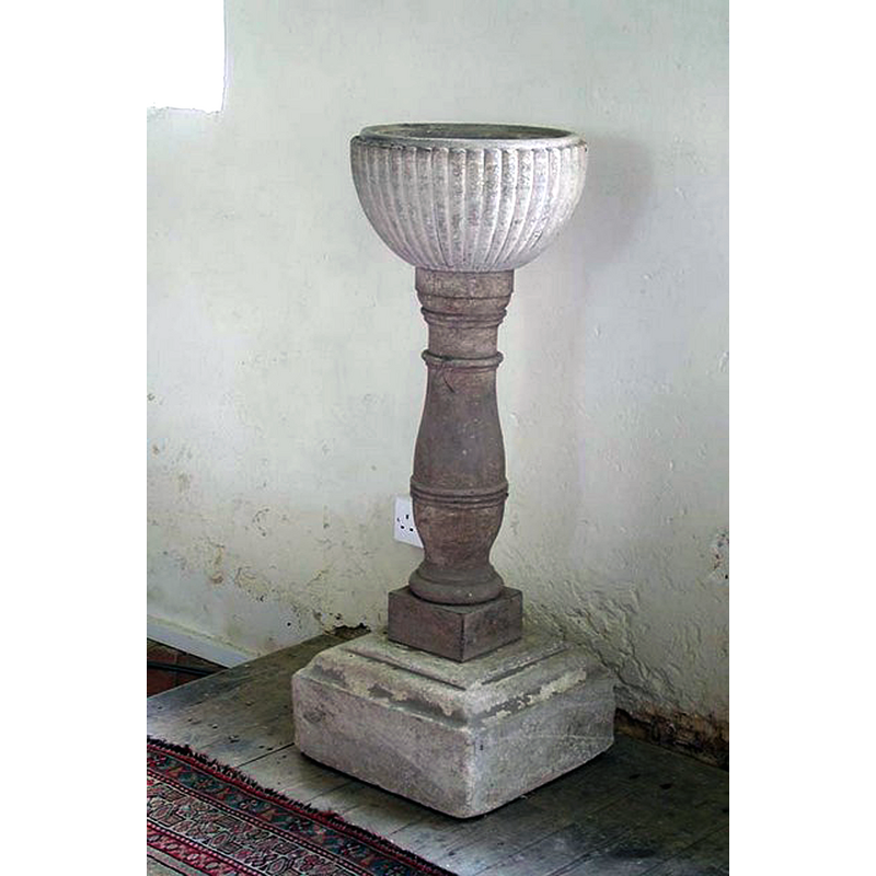
Image copyright © John Salmon, 2009
CC-BY-SA-2.0
Results: 4 records
view of font
Scene Description: the 18thC font
Copyright Statement: Image copyright © John Salmon, 2009
Image Source: digital photograph taken 31 May 2003 by John Salmon [www.geograph.org.uk/photo/1615526] [accessed 27 November 2017]
Copyright Instructions: CC-BY-SA-2.0
view of font and cover
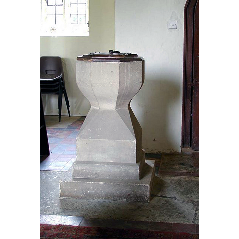
Scene Description: the modern font
Copyright Statement: Image copyright © John Salmon, 2009
Image Source: digital photograph taken 31 May 2003 by John Salmon [www.geograph.org.uk/photo/1615518] [accessed 27 November 2017]
Copyright Instructions: CC-BY-SA-2.0
view of church exterior - southeast view
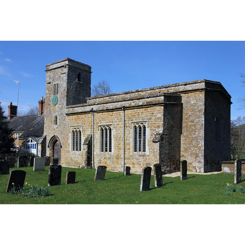
Scene Description: Source caption: "St.James' church. Grade II listed, largely 14th century church with some Norman and Early English details and a tower of 1630, restored in 1883. The chancel was demolished at an unknown date."
Copyright Statement: Image copyright © Richard Croft, 2014
Image Source: digital photograph taken 15 March 2014 by Richard Croft [www.geograph.org.uk/photo/3897318] [accessed 27 November 2017]
Copyright Instructions: CC-BY-SA-2.0
view of church interior - nave - looking east
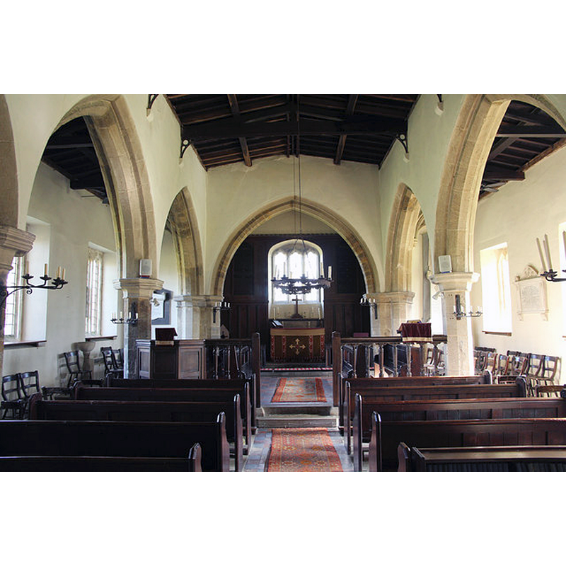
Copyright Statement: Image copyright © Richard Croft, 2014
Image Source: digital photograph taken 15 March 2014 by Richard Croft [www.geograph.org.uk/photo/3897323] [accessed 27 November 2017]
Copyright Instructions: CC-BY-SA-2.0
INFORMATION
Font ID: 21549WOR
Object Type: Baptismal Font1?
Font Century and Period/Style: 12th century, Late Romanesque
Church / Chapel Name: Parish Church of St. James
Font Location in Church: [disappeared]
Church Patron Saint(s): St. James
Church Notes: church originally a chapel-of-ease to Great Tew, until the 17th or 18thC [not clear when the change of status occurred, according to VCH]
Church Address: Nether Worton, Oxfordshire, OX7 7AS, UK
Site Location: Oxfordshire, South East, England, United Kingdom
Directions to Site: Located off (S) the B4031, 6 km W of Deddington, 11 km S of Banbury, 12 km E of Chipping Norton
Ecclesiastic Region: Diocese of Oxford
Historical Region: Hundred of Wootton
Additional Comments: disappeared font? (the one fvrom the 12thC church here)
Font Notes:
Click to view
There are three entries for [Nether and Over] Worton [variant spelling] in the Domesday survey [http://opendomesday.org/place/XX0000/nether-and-over-worton/] [accessed 21 November 2017], none of which mentions priest or church in it. The entry for this parish in the Victoria County History (Oxon., vol. 11, 1983) notes: "The earliest evidence of a church at Nether Worton is 12th-century work in the building [...] In the Middle Ages it was a chapelry of Great Tew, but was later considered a separate parish. [...] It was sometimes called Little Worton [...] The font is modern, but the earlier, 18th-century, font, with a small fluted bowl and baluster stem, survives in the north-west corner of the church."
COORDINATES
UTM: 30U 611198 5758689
Latitude & Longitude (Decimal): 51.96775, -1.381336
Latitude & Longitude (DMS): 51° 58′ 3.9″ N, 1° 22′ 52.81″ W
REFERENCES
- Victoria County History [online], University of London, 1993-. URL: https://www.british-history.ac.uk.