Bouex / Bois / Bosco / Boueix / Bouex / Bouëx / Buchia / Buxo / Buxu [disappeared?]
![Main image for Bouex / Bois / Bosco / Boueix / Bouex / Bouëx / Buchia / Buxo / Buxu [disappeared?]](/static-50478a99ec6f36a15d6234548c59f63da52304e5/compressed/1170916029_compressed.png)
Image copyright © Michel Claveyrolas, 2017
Image and permission received from the author (e-mail of 13 September 2017)
Results: 4 records
view of basin - interior
Scene Description: basin of the later font
Copyright Statement: Image copyright © Michel Claveyrolas, 2017
Image Source: digital photograph taken 30 September 2014 by Michel Claveyrolas
Copyright Instructions: Image and permission received from the author (e-mail of 13 September 2017)
view of church exterior - west portal
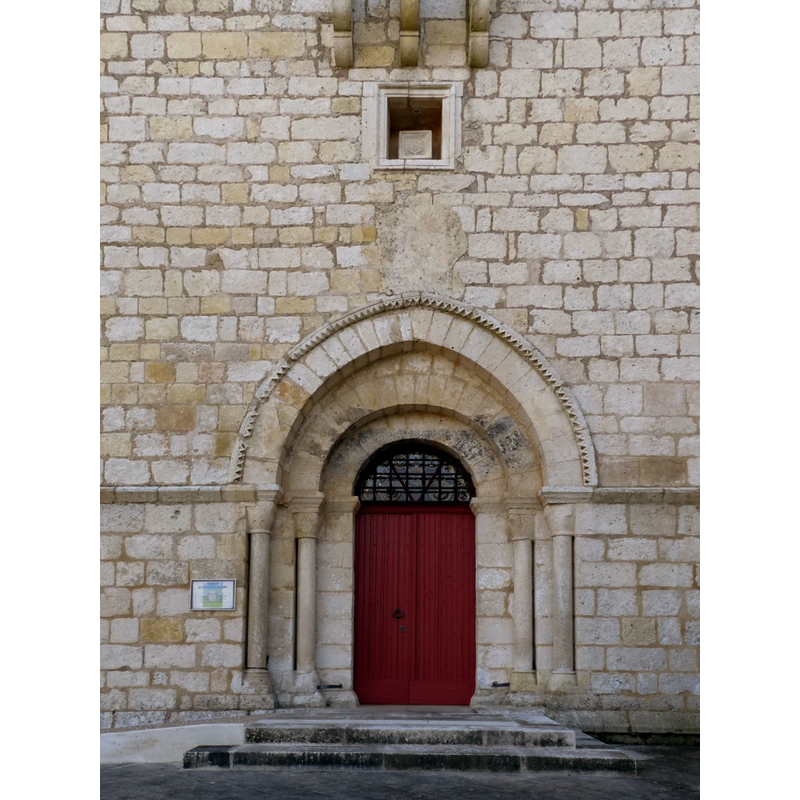
Copyright Statement: Image copyright © Jack ma, 2015
Image Source: edited detail of a digital photograph taken 12 April 2015 by Jack ma [https://commons.wikimedia.org/wiki/File:Bouex_eg2.JPG] [accessed 16 September 2017]
Copyright Instructions: GFDL / CC-BY-SA-3.0,2.5,2.0,1.0
view of church exterior in context - west view
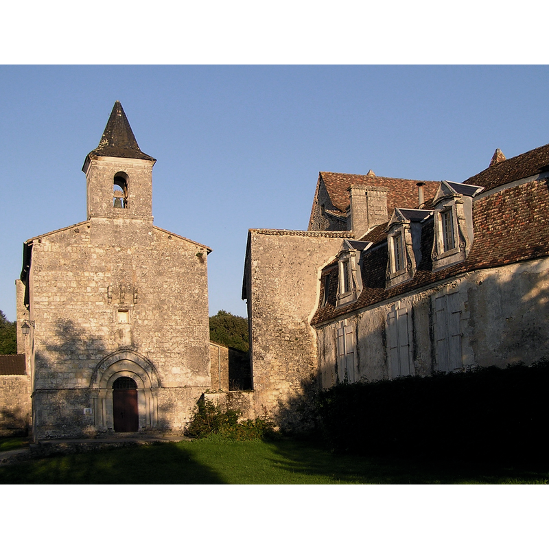
Scene Description: with a partial view of the château on the right
Copyright Statement: Image copyright © Rosier, 2008
Image Source: digital photograph taken in Summer 2008 by Rosier [https://commons.wikimedia.org/wiki/File:Bouex1.8.JPG] [accessed 16 September 2017]
Copyright Instructions: GFDL / CC-BY-SA-4.0,3.0,2.5,2.0,1.0
view of church exterior in context
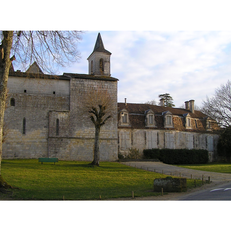
Scene Description: Source caption: "église et château de Bouëx"
Copyright Statement: Image copyright © Rosier, 2009
Image Source: digital photograph taken 6 March 2009 by Rosier [https://commons.wikimedia.org/wiki/File:Bouex2.0.JPG] [accessed 16 September 2017]
Copyright Instructions: GFDL / CC-BY-SA-4.0,3.0,2.5,2.0,1.0
INFORMATION
Font ID: 21510BOU
Object Type: Baptismal Font1?
Font Date: ca. 1146?
Font Century and Period/Style: 12th century (mid?), Romanesque
Church / Chapel Name: Église paroissiale Saint-Étienne
Font Location in Church: [disappeared]
Church Patron Saint(s): St. Stephen
Church Notes: medieval church listed in Mérimée [ref.: PA16000040]: "En 1146, l'église est donnée à l'abbaye de Saint-Cybard par le pape Eugène III. Elle fut ruinée en grande partie par les Calvinistes, puis restaurée après 1631 et au 19e siècle. Le narthex voûté en berceau et fortifié ouvre sur une nef de trois travées, voûtée en 1872 d'un berceau en briques. Un large doubleau sépare la nef du faux carré surmonté d'une voûte d'ogive. Le choeur, surélevé de deux marches, est surmonté d'une voûte d'ogive ornée de triples chevrons toriques. Les baies sont entourées de besants ou de dents de scie affrontés. L'ensemble du chevet peut être daté du troisième tiers du 12e siècle. L'extérieur a été remanié au moment des guerres de Cent ans : sur la façade subsistent les consoles d'une bretèche. Sur le haut du pignon a été monté un petit clocheton quadrangulaire. Les murs de la nef ont été surhaussés. Les fenêtres ont reçu de larges embrasures intérieures pour faciliter le tir des arbalétriers et rétrécies à l'extérieur. Cette église était liée au château."
Church Address: 16410 Bouëx, France
Site Location: Charente, Nouvelle-Aquitaine, France, Europe
Directions to Site: Located off the D4-D25 crossroads, 13 km ESE of Angoulême.
Ecclesiastic Region: Diocèse d'Angoulême
Historical Region: Grand Angoulême, Poitou-Charentes, Angoumois
Additional Comments: disappeared font? (the one from the mid-12thC church here)
Font Notes:
Click to view
[NB: we have no information on the font of the mid-12th century church here].
Credit and Acknowledgements: We are grateful to Michel Claveyrolas for his photographs of the later font in this church
COORDINATES
UTM: 31T 290884 5054750
Latitude & Longitude (Decimal): 45.6148, 0.3179
Latitude & Longitude (DMS): 45° 36′ 53.28″ N, 0° 19′ 4.44″ E