Palkane / Pälkäne
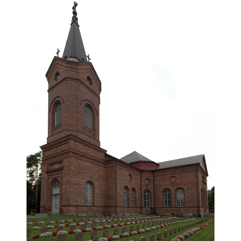
Image copyright © Cryonic07, 2013
CC-BY-SA-3.0
Results: 5 records
view of church exterior - southwest view
Scene Description: the modern church, built 1830s
Copyright Statement: Image copyright © Cryonic07, 2013
Image Source: digital photograph taken 31 August 2013 by Cryonic07 [https://commons.wikimedia.org/wiki/File:Pälkäneen_kirkko.jpg] [accessed 13 September 2017]
Copyright Instructions: CC-BY-SA-3.0
view of church exterior - west façade
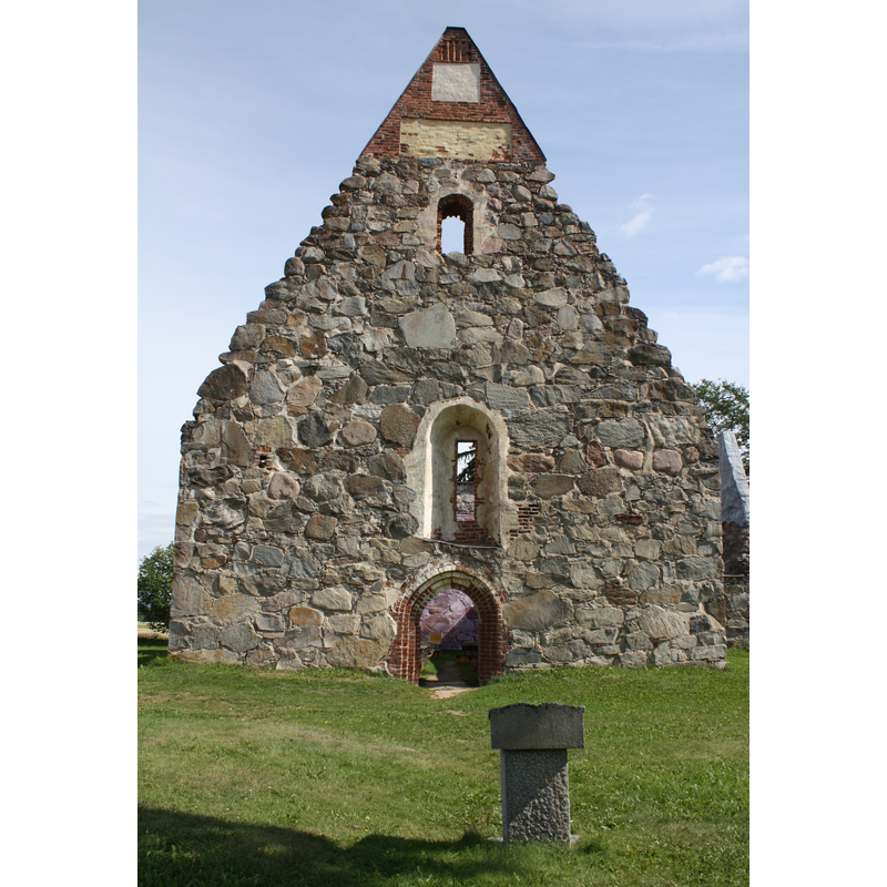
Copyright Statement: Image copyright © Anneli Salo, 2011
Image Source: digital photograph taken 5 August 2011 by Anneli Salo [https://commons.wikimedia.org/wiki/File:Pälkäneen_rauniokirkko_C_IMG_2666.JPG] [accessed 13 September 2017]
Copyright Instructions: CC-BY-SA-3.0
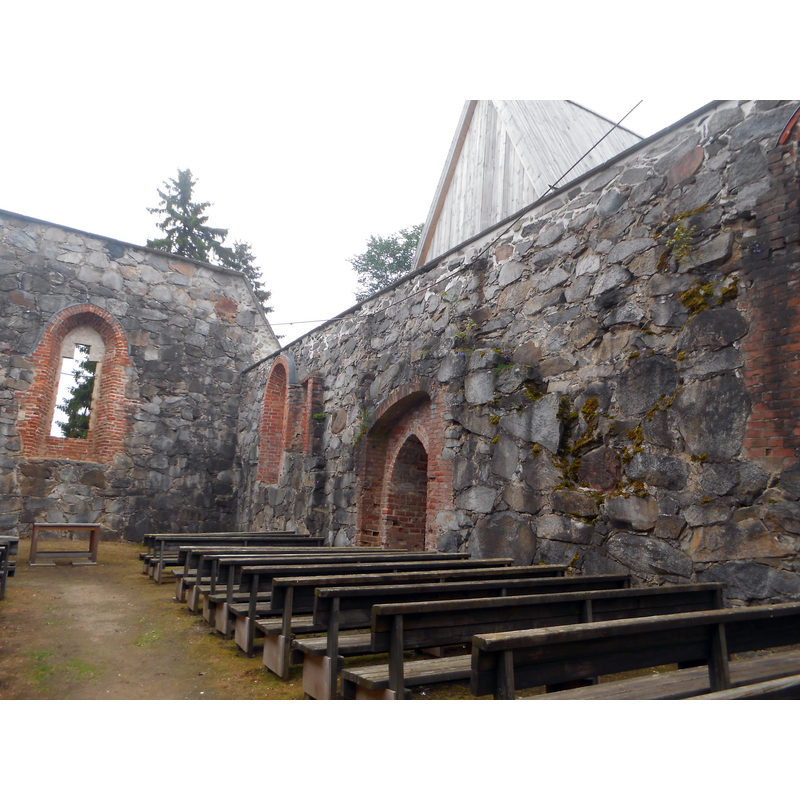
view of church exterior - south view
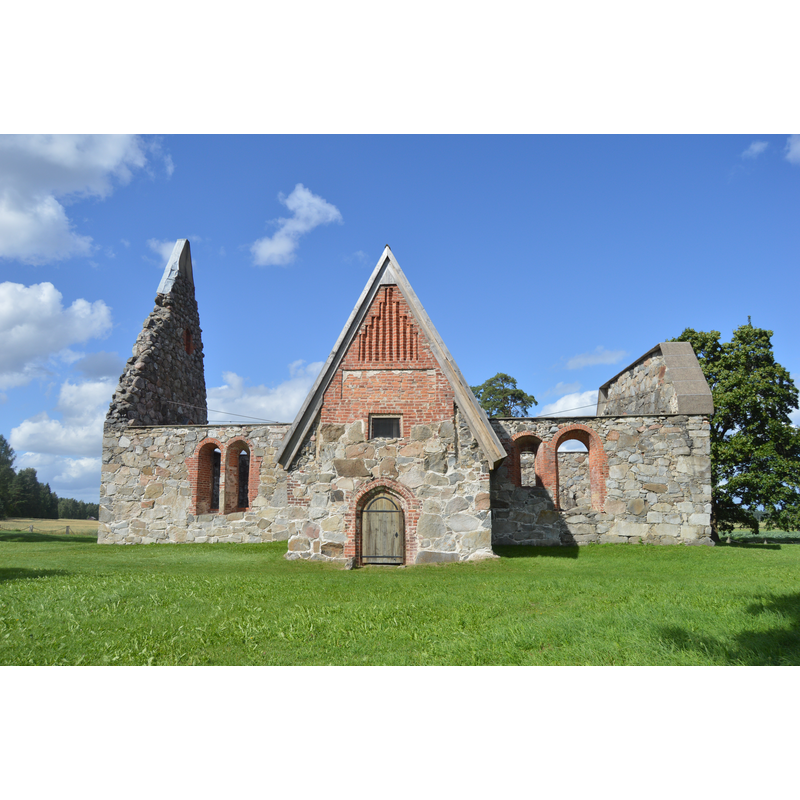
Scene Description: the ruins of the old church
Copyright Statement: Image copyright © Niera, 2016
Image Source: digital photograph taken 9 August 2016 by Niera [https://commons.wikimedia.org/wiki/File:Ruins_of_Saint_Michael_Church_in_Pälkäne,_August_2016.jpg] [accessed 13 September 2017]
Copyright Instructions: CC-BY-SA-4.0
view of church exterior - southwest view
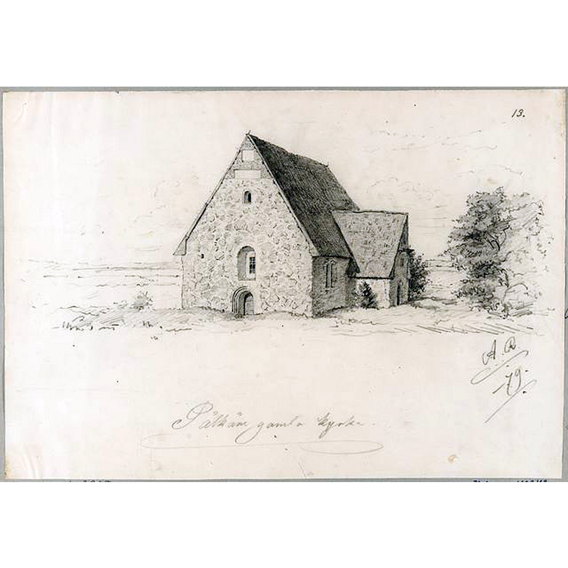
Scene Description: the old church was already disused by this time (1879); the roof would collapse in a storm a few years later, in 1890, and was never repaired
Copyright Statement: Image copyright © [in the public domain]
Image Source: digital image of a 1879 drawing by Reinholm Agathon, in Museoviraston kuvakokoelmat [ref.: HK10000:2898] [https://www.kuvakokoelmat.fi/pictures/view/HK10000_2898] [accessed 13 September 2017]
Copyright Instructions: PD
view of church interior - nave
Scene Description: Source capton: "Pälkäneen rauniokirkko sisältä kesällä 2016."
Copyright Statement: Image copyright © Puppe100, 2016
Image Source: digital photograph taken 4 July 2016 by Puppe100 [https://commons.wikimedia.org/wiki/File:Pälkäneen_rauniokirkko_sisältä.jpg] [accessed 13 September 2017]
Copyright Instructions: CC-BY-SA-4.0
INFORMATION
Font ID: 21500PAL
Object Type: Baptismal Font1?
Font Date: ca. 1500?
Font Century and Period/Style: 15th - 16th century, Late Medieval
Church / Chapel Name: Pälkäneen [vanha] Pyhän Mikaelin rauniokirkko
Font Location in Church: [disappeared]
Church Patron Saint(s): St. Michael? / St. Mary?
Church Notes: 16thC church badly damaged in the early-18thC Swedish-Russian War; abandoned when new church built 1839; now in ruins
Church Address: Old church ruins: Rauniokirkontie 16, 36600 Pälkäne, Finland [NB: the modern church is at: Pappilantie 29, 36600 Pälkäne, Finland]
Site Location: Häme, Hämeen lääni / Tavastehus län, Finland, Europe
Directions to Site: Located 33 km ESE of Tampere
Additional Comments: disappeared font? (the one from the church in ruins?)
Font Notes:
Click to view
[NB: we do not have any information on the font of the church now in ruins]
COORDINATES
UTM: 35V 353558 6804504
Latitude & Longitude (Decimal): 61.346944, 24.261944
Latitude & Longitude (DMS): 61° 20′ 49″ N, 24° 15′ 43″ E