Brandenburg an der Havel No. 3
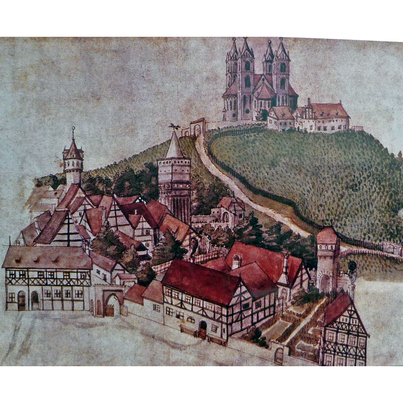
Image copyright © SchiDD, 2013
GFDL / CC-BY-3.0
Results: 3 records
view of church exterior in context
Scene Description: from a 1582 illustration by Zacharias Garcaeus,
Copyright Statement: Image copyright © SchiDD, 2013
Image Source: digital photograph taken 2 October 2013 by SchiDD of an illustration in Otto Tschirch, Geschichte der Chur- und Hauptstadt Brandenburg 1928, Bd.1 [https://commons.wikimedia.org/wiki/File:BRB-Marienberg.jpg?uselang=de] [accessed 4 September 2017]
Copyright Instructions: GFDL / CC-BY-3.0
view of church exterior in context
Scene Description: in the 16thC
Copyright Statement: Image copyright © SchiDD, 2013
Image Source: digital photograph taken 2 October 2013 by SchiDD of an illustration in Otto Tschirch, Geschichte der Chur- und Hauptstadt Brandenburg 1928, Bd.1 [https://commons.wikimedia.org/wiki/File:BRB-Marienberg.jpg?uselang=de] [accessed 4 September 2017]
Copyright Instructions: GFDL / CC-BY-3.0
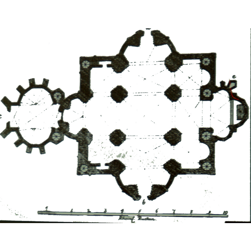
view of church interior - plan
Copyright Statement: Image copyright © [in the public domain]
Image Source: digital image of a 19thC source scanned 28 July 2006 by Kotofeij K. Bajun [https://commons.wikimedia.org/wiki/File:Marienkirchenaufsicht.jpg?uselang=de] [accessed 4 September 2017]
Copyright Instructions: CC-PD-Mark / PD Old
INFORMATION
Font ID: 21471BRA
Object Type: Baptismal Font1?
Font Date: ca. 1150-1160?
Font Century and Period/Style: 12th century (mid?), Romanesque
Church / Chapel Name: Prämonstratenser Konvent [Church of the disappeared Premonstratensian monastery]
Font Location in Church: [disappeared]
Church Patron Saint(s): St. Mary the Virgin
Church Notes: original Premonstratensian church ca. 1150-1160; much damaged in the 16th and 17thC; demolished 1722;
Site Location: Brandenburg, Brandenburg, Germany, Europe
Directions to Site: Located off the 1-102 crossroads, WSW of Berlin [the church is located in the historical centre, just NW of Friendeswarte, off Marienberg]
Ecclesiastic Region: Bistum Brandenburg
Historical Region: Margraviate of Brandenburg
Additional Comments: disappeared font? (the one from the disappeared monastery church here)
Font Notes:
Click to view
[NB: we have no information on the font of the disappeared monastery church here]
COORDINATES
UTM: 33U 333192 5810089
Latitude & Longitude (Decimal): 52.415556, 12.547222
Latitude & Longitude (DMS): 52° 24′ 56″ N, 12° 32′ 50″ E