Rochefort-en-Valdaine
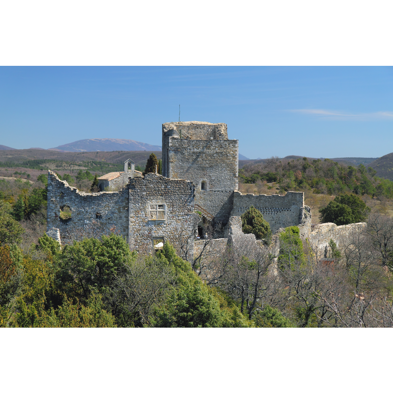
Image copyright © Groumfy69, 2013
CC-BY-SA-3.0
Results: 3 records
view of church exterior in context - west view
Scene Description: Source caption: "Château de Rochefort-en-Valdaine, vu depuis l'ouest" -- the chapel is partially visible at the back
Copyright Statement: Image copyright © Groumfy69, 2013
Image Source: digital photograph taken 14 April 2013 by Groumfy69 [https://commons.wikimedia.org/wiki/File:Château_de_Rochefort-en-Valdaine_-_vue_ouest.JPG] [accessed 1 September 2017]
Copyright Instructions: CC-BY-SA-3.0
view of church exterior - west view
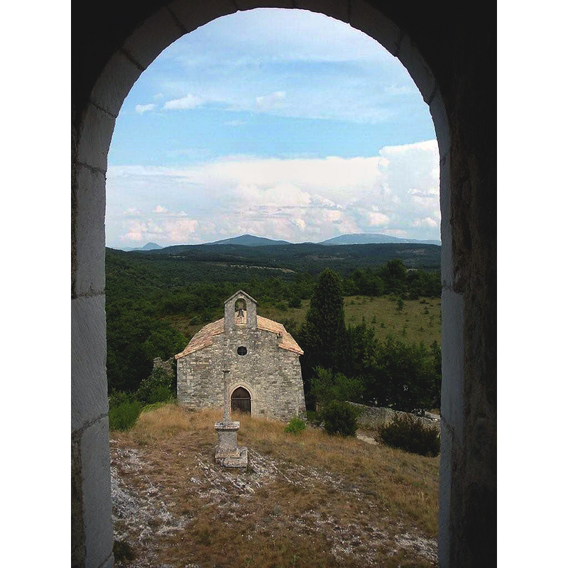
Copyright Statement: Image copyright © Toutaitanous 2, 2012
Image Source: digital photograph taken 7 January 2012 by Toutaitanous 2 [https://commons.wikimedia.org/wiki/File:Chapelle_du_château_de_Rochefort_en_valdaine_drôme_france.jpg] [accessed 1 September 2017]
Copyright Instructions: CC-BY-SA-3.0
view of church exterior - southwest view
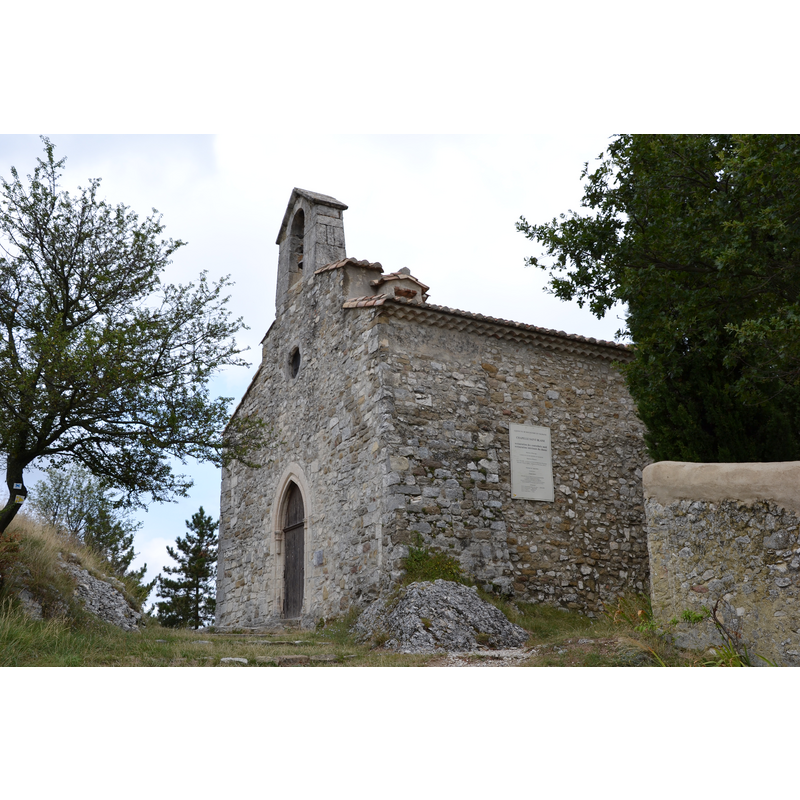
Copyright Statement: Image copyright © Marianne Casamance, 2013
Image Source: digital photograph taken 8 September 2013 by Marianne Casamance [https://commons.wikimedia.org/wiki/File:Rochefort_de_Valdaine_-_Chateau_médiéval_1.JPG] [accessed 1 September 2017]
Copyright Instructions: CC-BY-SA-3.0
INFORMATION
Font ID: 21461ROC
Object Type: Baptismal Font1?
Cognate Fonts: the font at Saint-Marcel-lès-Sauzet?
Church / Chapel Name: Chapelle Saint-Blaise [ancienne paroissiale / ancienne chapelle castrale]
Font Location in Church: [cf. FontNotes]
Church Patron Saint(s): St. Blaise [aka Biagio, Blas, Blásios, Blasius]
Church Notes: the castle itself originally 10th-11thC; the chapel itself may be 1220s -- the castle, including the chapel, is listed in Mérimée [ref.: PA26000010]
Church Address: 26160 Rochefort-en-Valdaine, France
Site Location: Drôme, Auvergne-Rhône-Alpes, France, Europe
Directions to Site: Located off (W) the D127, 14 km SE of Montélimar
Ecclesiastic Region: diocèse de Saint-Paul-trois-Châteaux
Font Notes:
Click to view
The baptismal font of the chapel here was said to be similar to the one at the chapel at Saint-Marcel-lès-Sauzet
COORDINATES
UTM: 31T 647516 4930644
Latitude & Longitude (Decimal): 44.514043, 4.856043
Latitude & Longitude (DMS): 44° 30′ 50.56″ N, 4° 51′ 21.76″ E