Pedersore / Pedersöre / Pietersaari
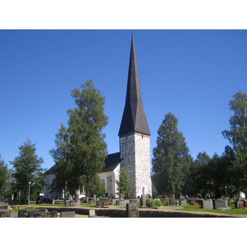
Image copyright © Tomisti, 2005
GFDL / CC-BY-SA-3.0-migrated
Results: 3 records
view of church exterior - northeast view
Copyright Statement: Image copyright © Tomisti, 2005
Image Source: digital photograph taken 31 July 2005 by Tomisty [https://commons.wikimedia.org/wiki/File:Jakobstad_Pedersore_church.jpg] [accessed 28 Augsut 2017]
Copyright Instructions: GFDL / CC-BY-SA-3.0-migrated
view of church exterior - portal
![[south portal?]](/static-50478a99ec6f36a15d6234548c59f63da52304e5/compressed/1170828002_compressed.png)
Scene Description: [south portal?]
Copyright Statement: Image copyright © Asbjørn, 2013
Image Source: digital photograph taken 25 July 2013 by Asbjørn [https://commons.wikimedia.org/wiki/File:Pedersöre_kyrka,_main_entrance.JPG] [accessed 28 August 2017]
Copyright Instructions: CC-BY-SA-3.0
view of church exterior in context
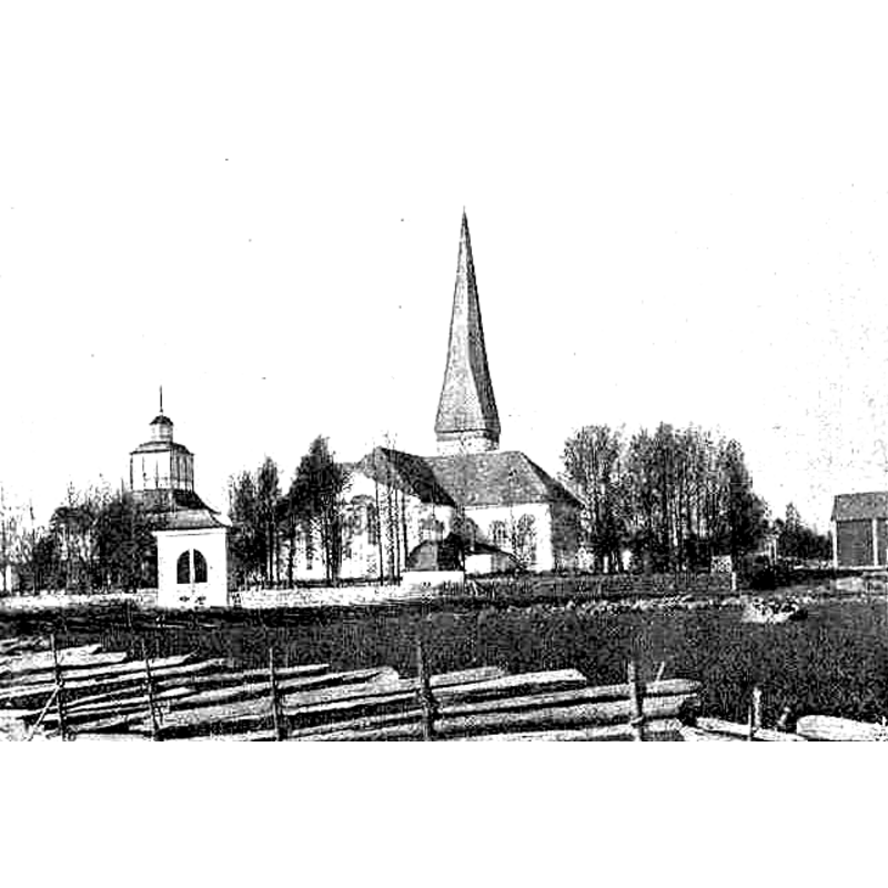
Scene Description: the bell tower is the detached building on the left
Copyright Statement: Image copyright © [in the public domain]
Image Source: digital image of a [ca. 1901] B&W photograph in O.M. Reuter's "Finland i ord och bild" (Stockholm, 1901): 844 [https://commons.wikimedia.org/wiki/File:Pedersöre_kyrka.jpg] [accessed 28 August 2017]
Copyright Instructions: CC-PD-Mark / PD Old
INFORMATION
Font ID: 21445PIE
Object Type: Baptismal Font1
Font Century and Period/Style: 15th century, Late Gothic
Church / Chapel Name: Pedersöre kyrka / Pedersören kirkko / Pietersaari kirkko
Font Location in Church: Inside the church, in the chancel, S side
Church Notes: wooden church of the late-13thC; present stone church of the ca. 1500; modified and new bell tower 18thC; restored late-20thC after a bad fire in 1986
Church Address: Pitäjäntie 5, Pietarsaari, Pohjanmaa, Finland
Site Location: Pohjanmaa / Österbotten, Finland, Europe
Directions to Site: Located off road 741, S of the E8, ESE of Jakobstad
Ecclesiastic Region: Diocese of Borgå / Borgå Stift / Porvoon hiippakunta
Font Notes:
Click to view
Stone baptismal font consisting of a plain round tapering basin on a pedestal; 15th-century? Low-dome metal; modern.
COORDINATES
UTM: 34V 584167 7060712
Latitude & Longitude (Decimal): 63.664167, 22.700556
Latitude & Longitude (DMS): 63° 39′ 51″ N, 22° 42′ 2″ E
MEDIUM AND MEASUREMENTS
Material: stone
Font Shape: round, mounted
Basin Interior Shape: round
Basin Exterior Shape: round
LID INFORMATION
Date: modern?
Apparatus: no
Notes: [cf. FontNotes]