Harslov / Härslöv / Herslof / Herslöf
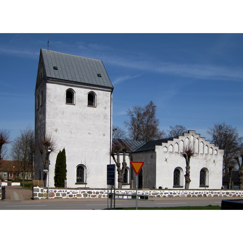
Image copyright © Jorchr, 2010
GFDL / CC-BY-3.0
Results: 1 records
view of church exterior - south view
Scene Description: the tower and the transepts are later additions to the original 12thC church
Copyright Statement: Image copyright © Jorchr, 2010
Image Source: digital photograph taken 25 April 2010 by Jorchr [https://commons.wikimedia.org/wiki/File:Härslövs_kyrka.jpg] [accessed 25 August 2017]
Copyright Instructions: GFDL / CC-BY-3.0
INFORMATION
Font ID: 21440HAR
Object Type: Baptismal Font1?
Font Century and Period/Style: 12th century, Romanesque
Church / Chapel Name: Härslövs kyrka
Church Notes: church 12thC (?); expanded and tower added 15thC; expanded 19thC; 12thC paintings restored 20thC
Church Address: Aspavägen 22, 261 65 Härslöv, Sweden -- Tel.: +46 418 574 00
Site Location: Skåne, Skåne län, Sweden, Europe
Directions to Site: Located off the M1161-M1163 crossroads, E of the E6/E20, SE of Helsingborg
Ecclesiastic Region: Lunds Stift
Historical Region: Rönnebergs härad
Additional Comments: disappeared font? (the one from the 12thC church here)
Font Notes:
Click to view
The entry for this church in Tynell (1913-1921) [NB: spelled Herslöf] states that there was no medieval font in it; the 1830 inventory just mentioned a baptismal dish [="dopfat"] in it. The present font in this church is 19th-century; HD article of 13 November 2015 [https://www.hd.se/2015-11-13/dopfunt-ska-repareras] [accessed 25 August 2017] informed that this font had been damaged and an allocation of 47,000 SVK had been made for its repair by the Lunds stiftsstyrelse. [NB: we have no information on the font of the 12th-century church here]
COORDINATES
UTM: 33U 367168 6200629
Latitude & Longitude (Decimal): 55.932675, 12.8737
Latitude & Longitude (DMS): 55° 55′ 57.63″ N, 12° 52′ 25.32″ E
REFERENCES
- Tynell, Lars, Skånes medeltida Dopfuntar, Stockholm: Cederquists Grafiska Aktiebolag, 1913-1921, p. [86]