Vanaja / Vånå
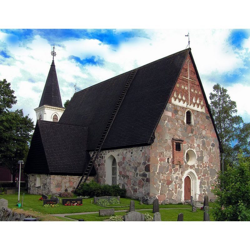
Image copyright © Edwin-Marian, 2008
CC-BY-SA-3.0
Results: 3 records
view of church exterior - northwest view
Scene Description: the new bell tower of 1895 is partially seen in the background
Copyright Statement: Image copyright © Edwin-Marian, 2008
Image Source: digital photograph taken 12 July 2008 by Edwin-Marian [https://commons.wikimedia.org/wiki/File:Vanajan_kirkko_vuodesta_1490_-_Vanaja,_kościółek_z_1490_roku_-_Vanaja,_chappell_since_1490_-_Ваная,_чапелл_с_1490_года_-_panoramio.jpg] [accessed 23 August 2017]
Copyright Instructions: CC-BY-SA-3.0
view of church exterior in context
![Source caption: illustration in Leopold Henrik Stanislaus Mechelin's "Finland in the Nineteenth Century: by Finnish authors. Illustrated by Finnish artists." (Helsingfords: F. Tilgmann, 1894) [British Library HMNTS 10290.i.4] -- showing the old [17thC?] bell tower across the road from the church](/static-50478a99ec6f36a15d6234548c59f63da52304e5/compressed/0170823001_compressed.png)
Scene Description: Source caption: illustration in Leopold Henrik Stanislaus Mechelin's "Finland in the Nineteenth Century: by Finnish authors. Illustrated by Finnish artists." (Helsingfords: F. Tilgmann, 1894) [British Library HMNTS 10290.i.4] -- showing the old [17thC?] bell tower across the road from the church
Copyright Statement: Image copyright © [in the public domain]
Image Source: digital image of a by Albert Edelfelt in 'Finland in the Nineteenth Century: by Finnish authors. Illustrated by Finnish artists' (ed. L. Mechelin, 1894, p. 107)
Copyright Instructions: CC-PD-Mark / PD-old-70-1923
view of church interior - altar and retable
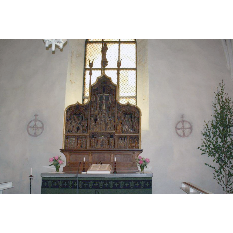
Scene Description: a medieval retable
Copyright Statement: Image copyright © Abc10, 2011
Image Source: digital photograph taken in June 2011 by Abc10 [https://commons.wikimedia.org/wiki/File:Vanajan_kirkko_altarpiece.jpg] [accessed 23 August 2017]
Copyright Instructions: CC-BY-SA-3.0
INFORMATION
Font ID: 21431VAN
Object Type: Baptismal Font1?
Font Date: ca. 1324?
Font Century and Period/Style: 14th century (early?), Medieval
Church / Chapel Name: Vanajan kirkko / Vånå kyrka
Font Location in Church: [disappeared]
Church Notes: original wooden church 1324?; present church ca.1500?
Church Address: Hautausmaantie, Vanaja, 13110 Hämeenlinna, Finland -- Tel.: +358 040 8049452
Site Location: Häme, Hämeen lääni / Tavastehus län, Finland, Europe
Directions to Site: Located 3 km SE of Hämeenlinna, between Tampere (NNW) and Helsinki (SSE)
Ecclesiastic Region: Diocese of Tampere
Additional Comments: disappeared font? (the one from the ca. 1324 church here)
Font Notes:
Click to view
[NB: we have no information on the font of the original church here].
COORDINATES
UTM: 35V 364899 6763010
Latitude & Longitude (Decimal): 60.978889, 24.503333
Latitude & Longitude (DMS): 60° 58′ 44″ N, 24° 30′ 12″ E