Vantaa / Helsinge / Helsingin maalaiskunta / Helsingin Pitäjä / Vanda
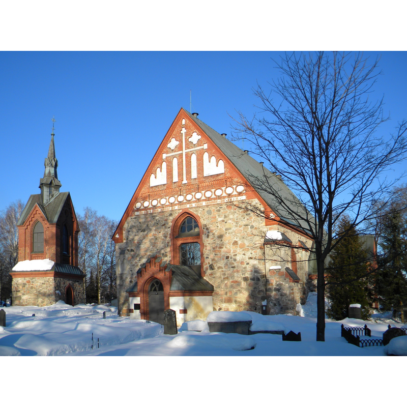
Image copyright © Pöllö, 2010
CC-BY-3.0
Results: 4 records
view of church exterior - southwest view
Scene Description: Source caption: "Saint Lawrence Church in Vantaa, Finland, in winter. The church was established in 1450's. The parish has been the centre of Helsinge (the name of old Vantaa) at least from the 1300's."
Copyright Statement: Image copyright © Pöllö, 2010
Image Source: digital photograph taken 9 March 2010 by Pöllö [https://commons.wikimedia.org/wiki/File:Pyhän_Laurin_kirkko_Helsingin_pitäjän_kirkko_Saint_Lawrence_Church_Vantaa_Finland_in_winter.jpg] [accessed 20 July 2017]
Copyright Instructions: CC-BY-3.0
view of font in context
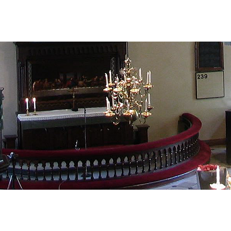
Scene Description: a modern font is seen partially in the bottom right-hand corner
Copyright Statement: Image copyright © [in the public domain]
Image Source: edited detail of a digital photograph; 10 April 2006 (original upload date); No machine-readable source provided. Own work assumed (based on copyright claims).
Copyright Instructions: PD-self
view of church interior - chancel
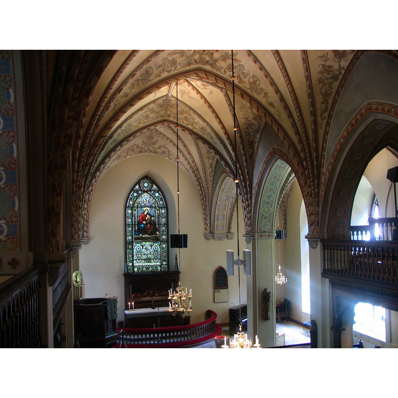
Scene Description: a font is partially visible in the foreground; modern?
Copyright Statement: Image copyright © [in the public domain]
Image Source: digital photograph; 10 April 2006 (original upload date); No machine-readable source provided. Own work assumed (based on copyright claims).
Copyright Instructions: PD-self
view of church interior - nave - looking east
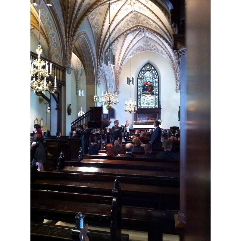
Copyright Statement: Image copyright © Jisis, 2011
Image Source: digital photograph taken 25 June 2011 by Jisis [https://commons.wikimedia.org/wiki/File:Vantaa_Church_Interior.jpg] [accessed 20 July 2017]
Copyright Instructions: CC-BY-SA-3.0
INFORMATION
Font ID: 21334VAN
Object Type: Baptismal Font1?
Font Century and Period/Style: 14th - 15th century, Medieval
Church / Chapel Name: Vantaan Pyhän Laurin kirkko / Helsinge kyrka S:t Lars
Font Location in Church: [disappeared]
Church Patron Saint(s): St. Lawrence [aka Laurence]
Church Notes: present church replaced earlier [pre-1401?] wooden ca. 1450; damaged by fire 1893; reconstructed 1894
Church Address: Kirkkotie 45, 01510 Vantaa, Finland
Site Location: Uusimaa / Nyland, Finland, Europe
Directions to Site: Located off (SE) the E18-45 crossroads, NNE of Helsinki
Historical Region: territory of Sweden in the Middle Ages [12th-13thC]
Additional Comments: disappeared font? (the one from the original 14th-15thC church here)
Font Notes:
Click to view
[NB: we have no information on the font of the original church here]
COORDINATES
UTM: 35V 388635 6684644
Latitude & Longitude (Decimal): 60.283133, 24.985969
Latitude & Longitude (DMS): 60° 16′ 59.28″ N, 24° 59′ 9.49″ E