Barbery No. 1 / Barberia / Barbereium / Bretteville-sur-Laize
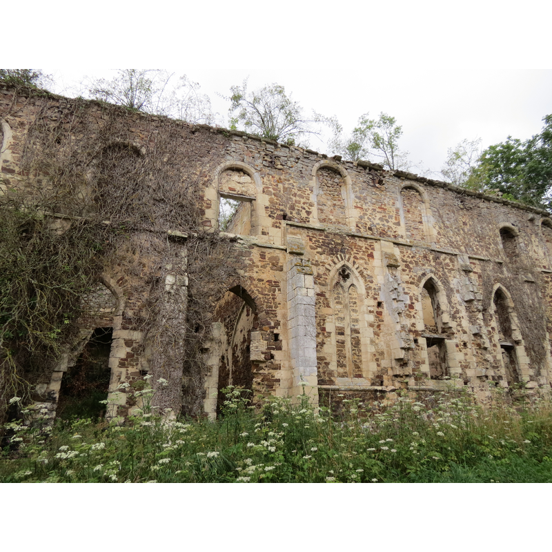
Image copyright © Giogo, 2012
CC-BY-SA-3.0
Results: 2 records
view of church exterior - detail
Copyright Statement: Image copyright © Giogo, 2012
Image Source: digtal photograph taken 14 August 201 by Giogo [https://commons.wikimedia.org/wiki/File:Abbaye_Barbery_2.JPG] [accessed 27 June 2017]
Copyright Instructions: CC-BY-SA-3.0
view of church exterior in context
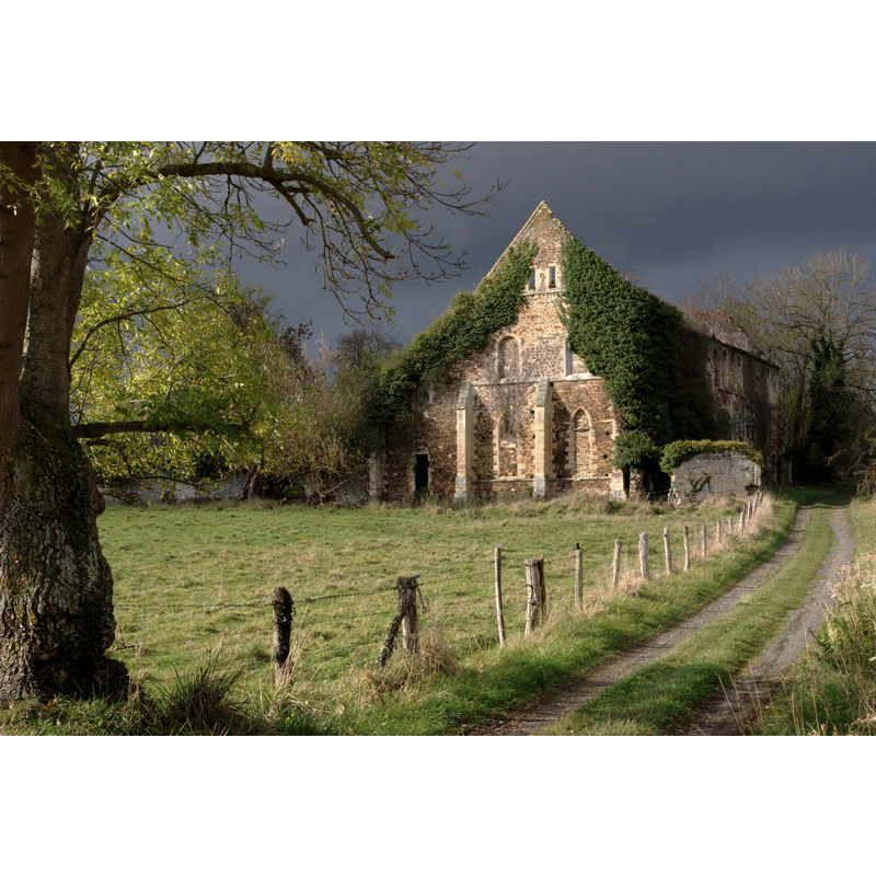
Scene Description: Source caption: "Ancienne abbaye de Barbery, dépendant de l'ordre Cistercien, fondée en 1140 par l'abbaye de Savigny (manche) et dotée de ce territoire par la famille seigneuriale de Marmion, elle fut réformée au XVIIème par Dom Louis Quinet et définitivement abandonnée par les moines au début de la révolution. Un peu à l'écart au bord du chemin, le grand bâtiment du XIIIème sans doute l'ancien logis abbatial, devenu une hôtellerie."
Copyright Statement: Image copyright © hamon jp, 2008
Image Source: digital photograph taken 2 November 2008 by hamon jp [https://commons.wikimedia.org/wiki/File:Barbery_abbaye_01.jpg] [accessed 27 June 2017]
Copyright Instructions: GFDL / CC-BY-SA-3.0,2.5,2.0,1.0
INFORMATION
Font ID: 21300BAR
Object Type: Baptismal Font1?
Font Date: ca. 1176?
Font Century and Period/Style: 12th century (late?), Late Romanesque
Church / Chapel Name: Abbaye de Cistercies Notre-Dame de Barbery en Bretteville-sur-Laize [in ruins]
Font Location in Church: [disappeared]
Church Patron Saint(s): St. Mary the Virgin
Church Notes: abbey founded 1176; abbey church consecrated 1246; raided by Calvinists 1563; restore thereafter; badly damaged in 1776 earthquake -- listed in Mérimée [ref.: IA00000133]
Church Address: 14220 Barbery, France
Site Location: Calvados, Normandie, France, Europe
Directions to Site: This Barbery is located off the D23-D131-D156A crossroads, 10 km ENE of Thury-Harcourt, 25 km S of Caen. The ruins of the abbey are in Bretteville-sur-Laize, a hamlet of Barbery.
Ecclesiastic Region: Diocèse de Bayeux et Lisieux
Historical Region: Basse-Normandie
Additional Comments: disappeared font? (the one from the late-12thC church here)
Font Notes:
Click to view
[NB: we have no information on the font of the late-12thC abbey church here]
COORDINATES
UTM: 30U 694008 5433693
Latitude & Longitude (Decimal): 49.025576, -0.34604
Latitude & Longitude (DMS): 49° 1′ 32.08″ N, 0° 20′ 45.74″ W