Setubal No. 2 / Cetóbriga / Setúbal / Xetubre
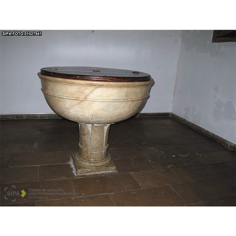
Image copyright © Direção-Geral do Património Cultural _ Ministério da Cultura, 2017
Reproduced a/p Termos e Condições de Utilização dos Conteúdos SIPA
Results: 2 records
view of font and cover
Scene Description: the present font
Copyright Statement: Image copyright © Direção-Geral do Património Cultural _ Ministério da Cultura, 2017
Image Source: digital photograph taken in 2013 by Paula Noé, in SIPA [FOTO.01027941] [www.monumentos.pt/Site/APP_PagesUser/Images/SIPAImage.aspx?pid=2090177] [accessed 8 June 2017]
Copyright Instructions: Reproduced a/p Termos e Condições de Utilização dos Conteúdos SIPA
view of church exterior - west view
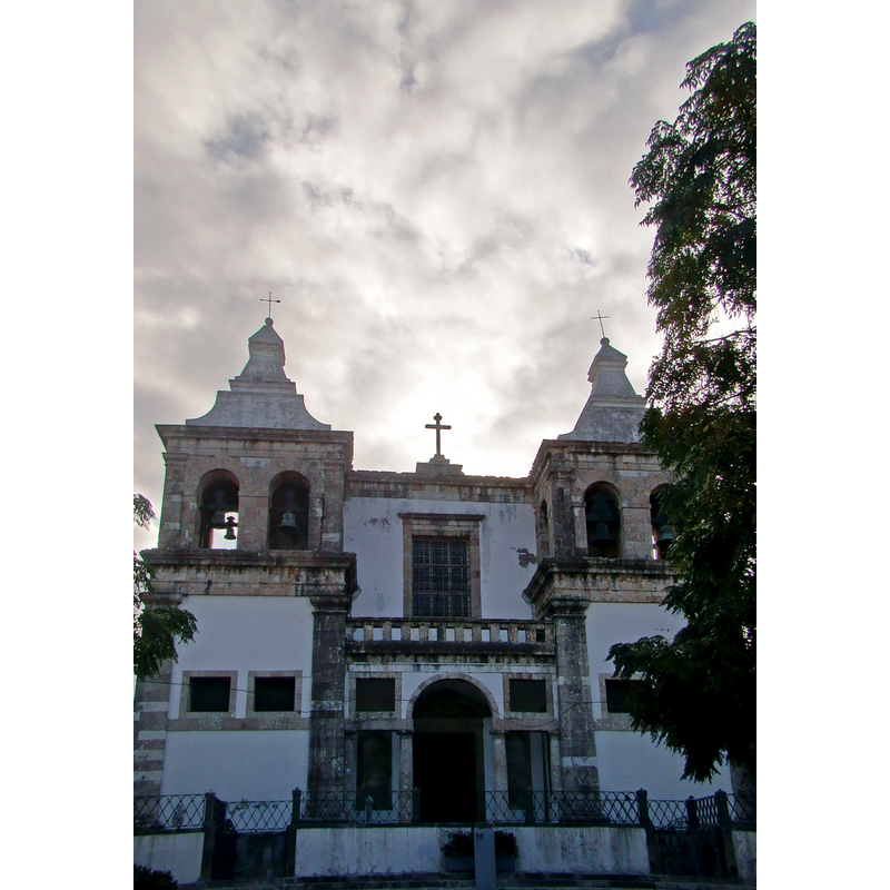
Copyright Statement: Image copyright © Inês Leonardo, 2011
Image Source: edited detail of a digital photograph taken 23 September 2011 by Inês Leonardo [https://commons.wikimedia.org/wiki/File:Igreja_Santa_Maria_Graça_Setúbal.jpg] [accessed 8 June 2017]
Copyright Instructions: CC-BY-SA-3.0
INFORMATION
Font ID: 21250SET
Object Type: Baptismal Font1
Font Century and Period/Style: 17th - 18th century
Church / Chapel Name: Igreja Paroquial de Santa Maria da Graça / Sé de Setúbal / Igreja matriz de Setúbal
Font Location in Church: Inside the church, in a chapel, S side
Church Patron Saint(s): St. Mary the Virgin
Church Notes: original church 13thC; present church re-built 17th-18thC -- listed in SIPA [IPA.00002149]
Church Address: R. Dr. António Joaquim Granjo no 31, 2900-475 Setúbal, Portugal -- Tel.: +351 912 446 179
Site Location: Setúbal, Área Metropolitana de Lisboa, Portugal, Europe
Directions to Site: Located off (S) the N-10, across the rio Tejo from Lisbon. This church is in the medieval centre of town
Ecclesiastic Region: Diocese de Setúbal
Historical Region: Estremadura
Additional Comments: disappeared font? (the one from the original 13thC church here, reported in 1510 [cf. FontNotes])
Font Notes:
Click to view
The entry for this church in SIPA [ref.: IPA.00002149] reports a baptismal font: "Na nave do lado da Epístola, a primeira capela, cerrada por teia em ferro, alberga pia batismal, de taça hemisférica sobre pé cilíndrico, com sulcos verticais e anel no terço inferior", and two holy-water stoups: "pias de água benta hemisféricas, exteriormente gomeadas". The SIPA entry (ibid.) mentions a visitation by D. Jorge de Lencastre on 16-19 July 1510 reported a font beneath the north tower: "No vão da torre N., está a pia batismal"; the font noted in the visitation of 1510 was probably the original one from the 13th-century church, but the present font, described above, dates probably from the 17th-18th century re-building of this church.
COORDINATES
UTM: 29S 509758 4264008
Latitude & Longitude (Decimal): 38.524411, -8.888055
Latitude & Longitude (DMS): 38° 31′ 27.88″ N, 8° 53′ 17″ W
MEDIUM AND MEASUREMENTS
Material: stone
Font Shape: hemispheric, mounted
Basin Interior Shape: round
Basin Exterior Shape: round
LID INFORMATION
Date: modern
Material: wood
Apparatus: no
Notes: flat, round and plain; hinged in the middle; modern