Quimper No. 5 / Kemper
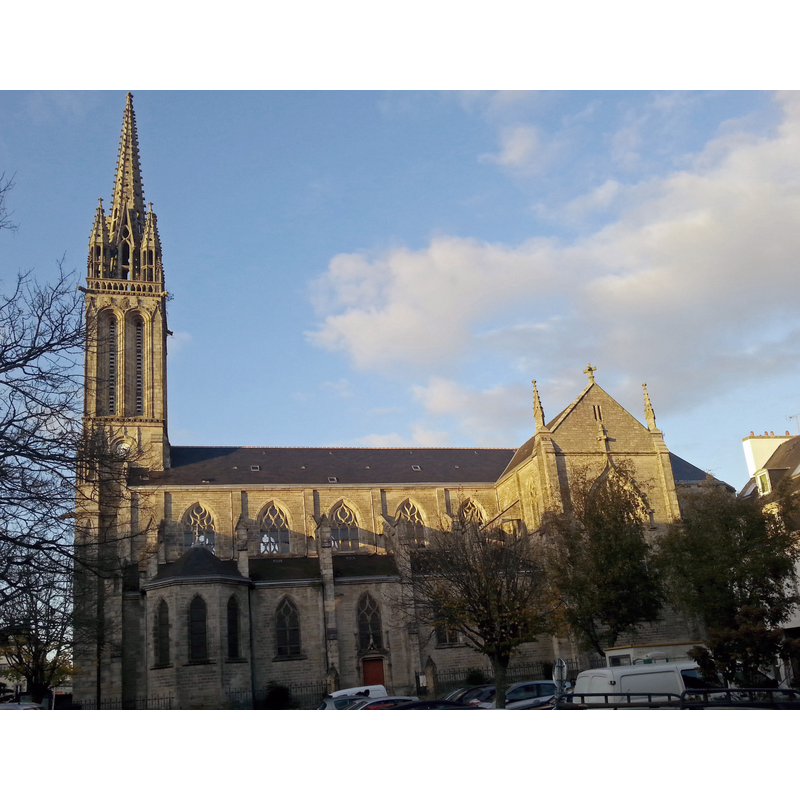
Image copyright © Julien1978, 2013
CC-BY-SA-3.0
Results: 5 records
view of church exterior - south view
Copyright Statement: Image copyright © Julien1978, 2013
Image Source: digital photograph taken 21 November 2013 by Julien1978 [https://commons.wikimedia.org/wiki/File:Eglise_Saint-Mathieu_(Quimper).jpg] [accessed 7 May 2017]
Copyright Instructions: CC-BY-SA-3.0
view of church exterior in context - south view
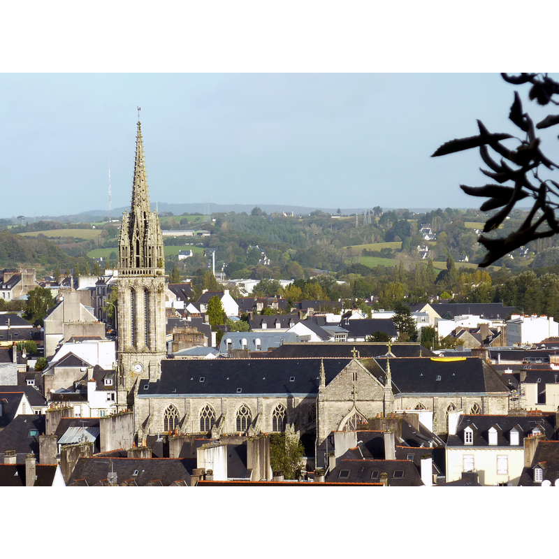
Scene Description: Source caption: "Quimper : l'église Saint-Mathieu vue du mont Frugy".
Copyright Statement: Image copyright © Moreau.henri, 2012
Image Source: digital photograph taken 17 October 2012 by Moreau.henri [https://commons.wikimedia.org/wiki/File:Quimper_95_L'église_Saint-Mathieu_vue_du_mont_Frugy.JPG] [accessed 7 May 2017]
Copyright Instructions: CC-BY-SA-3.0
view of church interior - nave - looking west
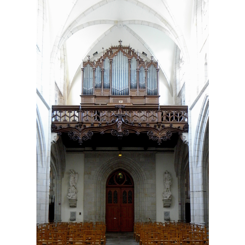
Copyright Statement: Image copyright © GO69, 2012
Image Source: digital photograph taken 8 December 2012 by GO69 [https://commons.wikimedia.org/wiki/File:Quimper_(29)_Église_Saint-Mathieu_03.JPG] [accessed 7 May 2017]
Copyright Instructions: CC-BY-SA-4.0
view of church interior - nave - looking east
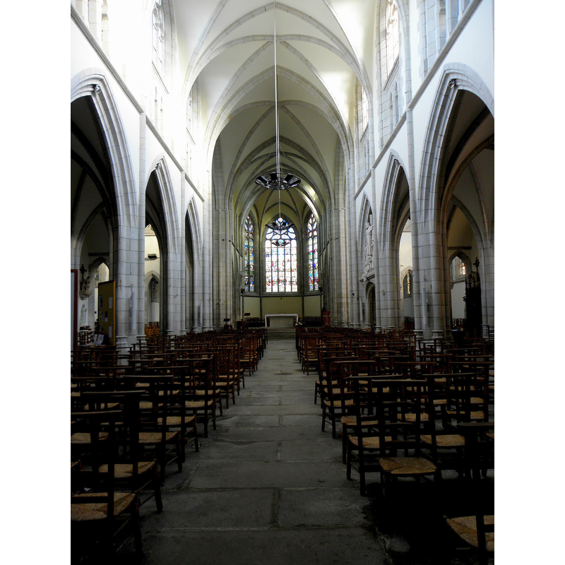
Copyright Statement: Image copyright © GO69, 2012
Image Source: digital photograph taken 8 December 2012 by GO69 [https://commons.wikimedia.org/wiki/File:Quimper_(29)_Église_Saint-Mathieu_02.JPG] [accessed 7 May 2017]
Copyright Instructions: CC-BY-SA-4.0
information
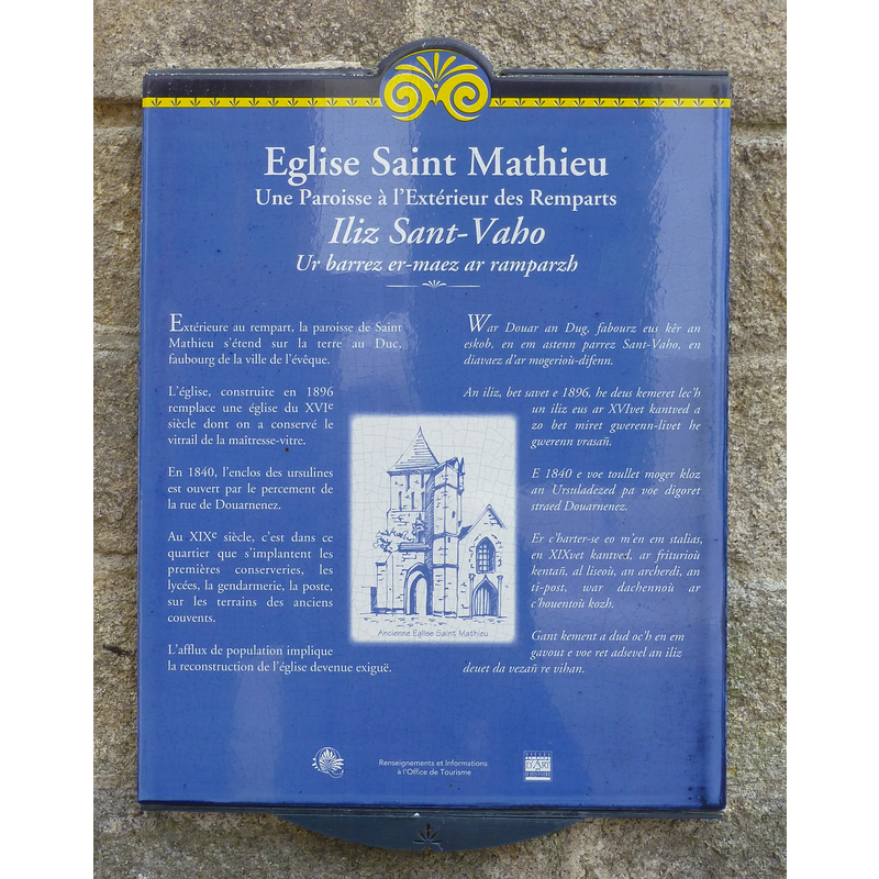
Scene Description: plaque outside the church (it does not mention the earlier Romanesque church that was replaced by the early-16thC church re-built in the 19thC
Copyright Statement: Image copyright © Baptisteria Sacra Index, 2023
Image Source: digital photograph taken 26 April 2017 by BSI
Copyright Instructions: CC-BY-NC-ND-4.0
INFORMATION
Font ID: 21212QUI
Object Type: Baptismal Font1?
Date Visited: 2017-04-26
Font Century and Period/Style: 12th century / 16th century, Romanesque? / Renaissance?
Church / Chapel Name: Église paroissiale Saint-Mathieu / Iliz San Vaho
Font Location in Church: [disappeared]
Church Patron Saint(s): St. Matthew
Church Notes: a church existed here by the end of the 12thC: "Le cartulaire de Saint-Corentin, nous apprend, en effet, qu'en 1209, l'Archevêque de Tours [Note : L'Archevêque de Tours était le Métropolitain de l'Evêque de Quimper, notre diocèse ayant fait partie, avec les autres évêchés de Bretagne, de la province ecclésiastique de Tours, jusque vers 1858] confirma la cession faite par le Duc de Bretagne à l'Evêque de Quimper du droit de patronage qu'il avait dans l'église de Saint-Mathieu. C'est assez dire que notre paroisse existait avant cette époque"; a later church of the late 15thC replaced the medieval one: "il est certain, du moins, qu'une église, de style roman, a précédé la vieille église que nous venons de voir disparaître. Celle-ci avait été construite à la fin du XVème siècle, de 1498 à 1515" [www.infobretagne.com/quimper-saint-mathieu.htm] [accessed 7 May 2017]; present church is 19thC
Church Address: Chapeau Rouge, rue du Paradis, 29000 Quimper, France -- Tel.: +33 2 98 55 58 90
Site Location: Finistère, Bretagne, France, Europe
Directions to Site: The church is located off (E) the D765, across (W) Le Steir from the cathedral
Ecclesiastic Region: Diocèse de Quimper et Léon
Historical Region: Cornouaille
Font Notes:
Click to view
The present font dates from the building of the present building, mid-19th century; this font and the holy-water stoups were made of marble by the Nantes sculptor M. Vallet according to InfoBretagne [www.infobretagne.com/quimper-saint-mathieu.htm] [accessed 7 May 2017] [NB: we have no information on the font(s) of the two earlier churches (12thC? and 15th-16thC) here].
COORDINATES
UTM: 30T 417354 5316440
Latitude & Longitude (Decimal): 47.995918, -4.107846
Latitude & Longitude (DMS): 47° 59′ 45.31″ N, 4° 6′ 28.25″ W