Tulle / Toila / Tuella / Tuelle / Tula / Tulla / Tutela
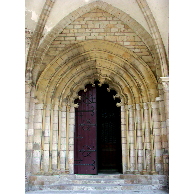
Image copyright © [in the public domain]
PD-self
Results: 2 records
view of church exterior - west portal
Scene Description: Source caption: "Cathédrale Notre-Dame de Tulle.XIIéme siècle.Le portail polylobé."
Copyright Statement: Image copyright © [in the public domain]
Image Source: digital photograph taken 23 July 2007 by Vassil [https://commons.wikimedia.org/wiki/File:Cathédrale_N-D_de_Tulle_03.jpg] [accessed 16 April 2017]
Copyright Instructions: PD-self
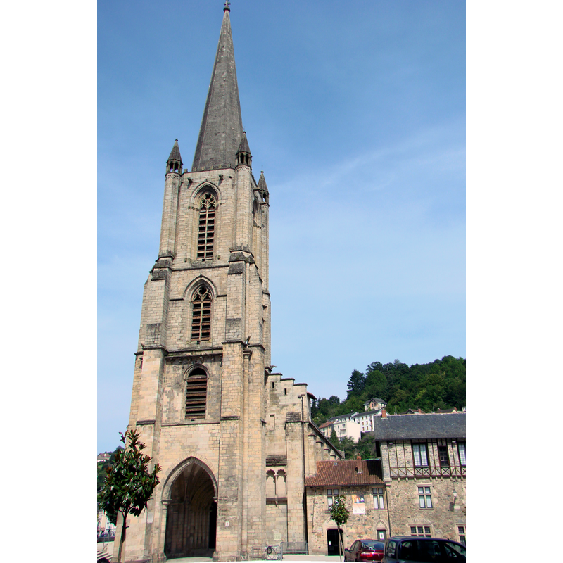
view of church exterior - southwest end
Copyright Statement: Image copyright © [in the public domain]
Image Source: digital photograph taken 23 July 2007 by Vassil [https://commons.wikimedia.org/wiki/File:Cathédrale_N-D_de_Tulle_01.jpg] [accessed 16 April 2017]
Copyright Instructions: PD-self
INFORMATION
Font ID: 21189TUL
Object Type: Baptismal Font1?
Font Century and Period/Style: 7th - 9th century, Medieval
Church / Chapel Name: Cathédrale Notre-Dame de Tulle [formerly Saint-Martin]
Font Location in Church: [destroyed / disappeared]
Church Patron Saint(s): St. Mary the Virgin [earlier dedicated to St. Martin]
Church Notes: listed in Mérimée [ref.: PA00099912]: "Fondé au 7e siècle, le monastère fut détruit par les Normands en 846. Reconstruction au 9e siècle. Au 11e siècle, période de prospérité, l'abbaye de Tulle se met sous la règle de Saint-Benoît. L'église et les bâtiments conventuels étant devenus vétustes et insuffisants, leur reconstruction débute en 1103. L'église, son porche et le premier étage du clocher furent élevés au 12e siècle. Les autres étages du clocher furent bâtis au 13e siècle. La flèche date du début du 14e siècle. En 1317, l'abbatiale devient cathédrale. En 1796, la coupole qui couvrait le carré du transept s'écroule. Le transept et l'abside sont démolis pour permettre la construction du choeur actuel."
Church Address: 19000 Tulle, France
Site Location: Corrèze, Nouvelle-Aquitaine, France, Europe
Directions to Site: Located off the D940, NE of Brive-la-Gaillarde, 90 km from Limoges
Ecclesiastic Region: Diocèse de Tulle [ancien diocèse de Limoges]
Historical Region: Limousin
Additional Comments: disappeared font? (the one from the early church here destroyed by the Vikings in 846)
Font Notes:
Click to view
[NB: we have no information on the baptismal font of the early church destryoyed in 846].
COORDINATES
UTM: 31T 403619 5013432
Latitude & Longitude (Decimal): 45.267778, 1.771389
Latitude & Longitude (DMS): 45° 16′ 4″ N, 1° 46′ 17″ E