Quintanilla de la Berzosa No. 2 / Quintanilla de la Verezosa
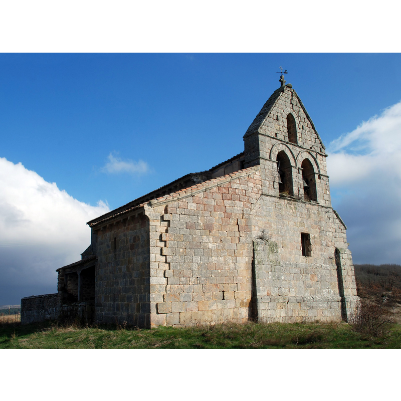
Image copyright © Valdavia, 2008
GFDL / CC-BY-SA-3.0
Results: 4 records
view of church exterior - northwest view
Copyright Statement: Image copyright © Valdavia, 2008
Image Source: digital photograph taken 19 March 2008 by Valdavia [https://commons.wikimedia.org/wiki/File:Quintanilla_de_la_Berzosa_-_Church_of_Saint_Martin_003.JPG] [accessed 26 March 2017]
Copyright Instructions: GFDL / CC-BY-SA-3.0
view of church exterior - southeast view
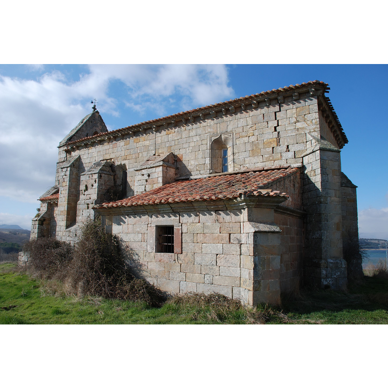
Copyright Statement: Image copyright © Valdavia, 2008
Image Source: digital photograph taken 19 March 2008 by Valdavia [https://commons.wikimedia.org/wiki/File:Quintanilla_de_la_Berzosa_-_Church_of_Saint_Martin_002.JPG] [accessed 26 March 2017]
Copyright Instructions: GFDL / CC-BY-SA-3.0
view of church exterior - detail
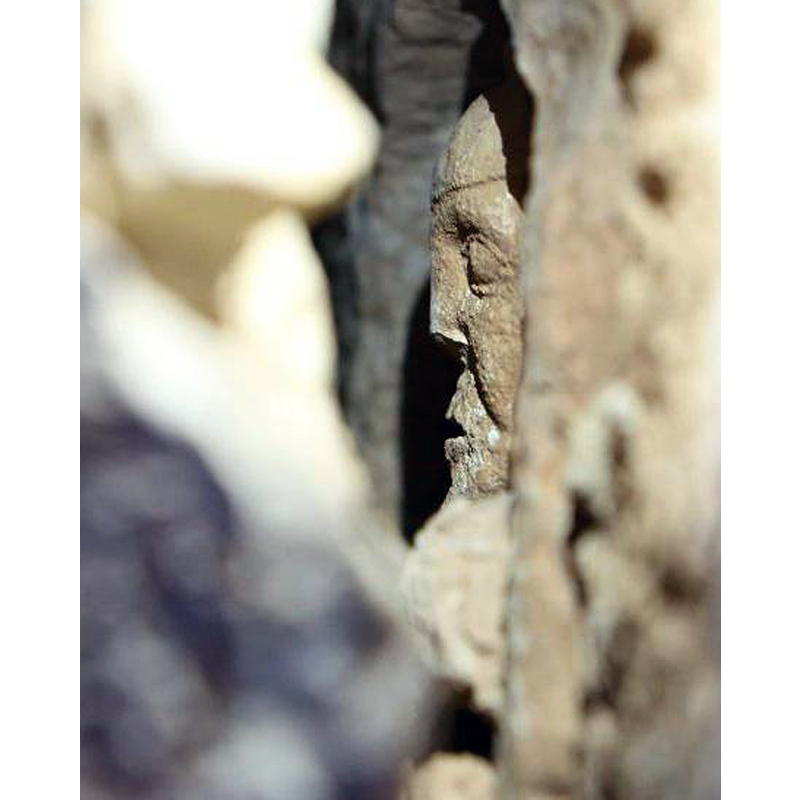
Scene Description: a peek at the hidden frieze (Adoration of th Magi?) reported in El Pais
Copyright Statement: Image copyright © El Pais, 2017
Image Source: edited detail of a digital photograph published in El Pais [http://cultura.elpais.com/cultura/2017/03/17/actualidad/1489763456_338482.html] [accessed 26 March 2017]
Copyright Instructions: No known copyright restriction / Fair Dealing
view of church exterior - porch and portal
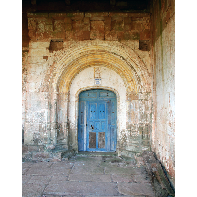
Copyright Statement: Image copyright © Valdavia, 2008
Image Source: digital photograph taken 19 March 2008 by Valdavia [https://commons.wikimedia.org/wiki/File:Quintanilla_de_la_Berzosa_-_Church_of_Saint_Martin_001.JPG] [accessed 26 March 2017]
Copyright Instructions: GFDL / CC-BY-SA-3.0
INFORMATION
Font ID: 21119QUI
Object Type: Stoup
Font Century and Period/Style: 14th - 15th century, Gothic
Church / Chapel Name: Iglesia Parroquial de San Martín [abandoned ca. 1964]
Font Location in Church: Inside the church
Church Patron Saint(s): St. Martin of Tours
Church Address: 34810 Quintanilla de la Berzosa, Palencia, Spain
Site Location: Palencia, Castilla y León, Spain, Europe
Directions to Site: abandoned hamlet located off the PP-2131, 2 km W of Foldada, 7 km W of Aguilar de Campoo, near the Aguilar dam
Ecclesiastic Region: Diócesis de Palencia
Historical Region: Merindad Menor de Aguilar de Campoo -- Montaña Palentina
Font Notes:
Click to view
Holy-water stoup of the 14th-15th century here reported by Artemio Manuel Martínez Tejera, in the Enciclopedia del Románico - Fundación Santa María la Real [www.romaniconorte.org/es/contenido/index.asp?iddoc=87] [accessed 26 March 2017]: "lel templo conserva como mobiliario litúrgico una pequeña pila de agua bendita (de 47 cm. de diámetro y 82 cm. de altura) con pie cuadrangular, esquinas aboceladas y pileta octogonal que podríamos fechar en torno a los siglos XIV-XV."
COORDINATES
Latitude & Longitude (DMS): 42º 47′ 4.82″ N, 4º 19′ 51.31″ W
MEDIUM AND MEASUREMENTS
Material: stone
Diameter (includes rim): 47 cm*
Font Height (less Plinth): 82 cm*
Notes on Measurements: * Románico Norte [www.romaniconorte.org/es/contenido/index.asp?iddoc=87] [accessed 26 March 2017]