Saint-Frejoux / Saint-Fréjoux / Saint-Fréjoux-le-Riche / Sent Frejolh
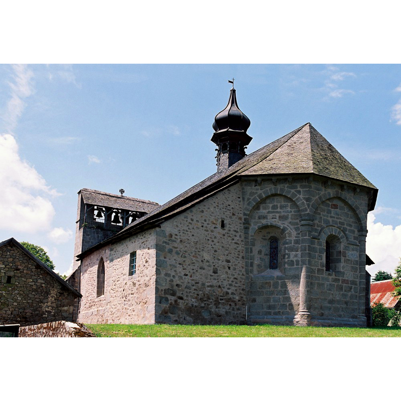
Image copyright © Eglises de Corrèze, 2017
No known copyright restriction / Fair Dealing
Results: 4 records
view of church exterior - southeast view
Scene Description: Source caption: "L’église romane présente un chevet à pans coupés, décoré d’arcades, de colonnettes et de corbeaux, un chœur scandé par des pilastres et une nef voûtée à doubleaux reposant sur des colonnes. De profondes voussures encadrent son portail surmonté d’un clocher-mur à trois baies, flanqué d’une tourelle... Les chapelles latérales, fondées par des familles seigneuriales, datent de la fin du XVe siècle."
Copyright Statement: Image copyright © Eglises de Corrèze, 2017
Image Source: digital photograph taken by Jean-François Amelot, in Eglises de Corrèze [http://eglises.de.correze.online.fr/] [accessed 13 March 2017]
Copyright Instructions: No known copyright restriction / Fair Dealing
view of church exterior - east view
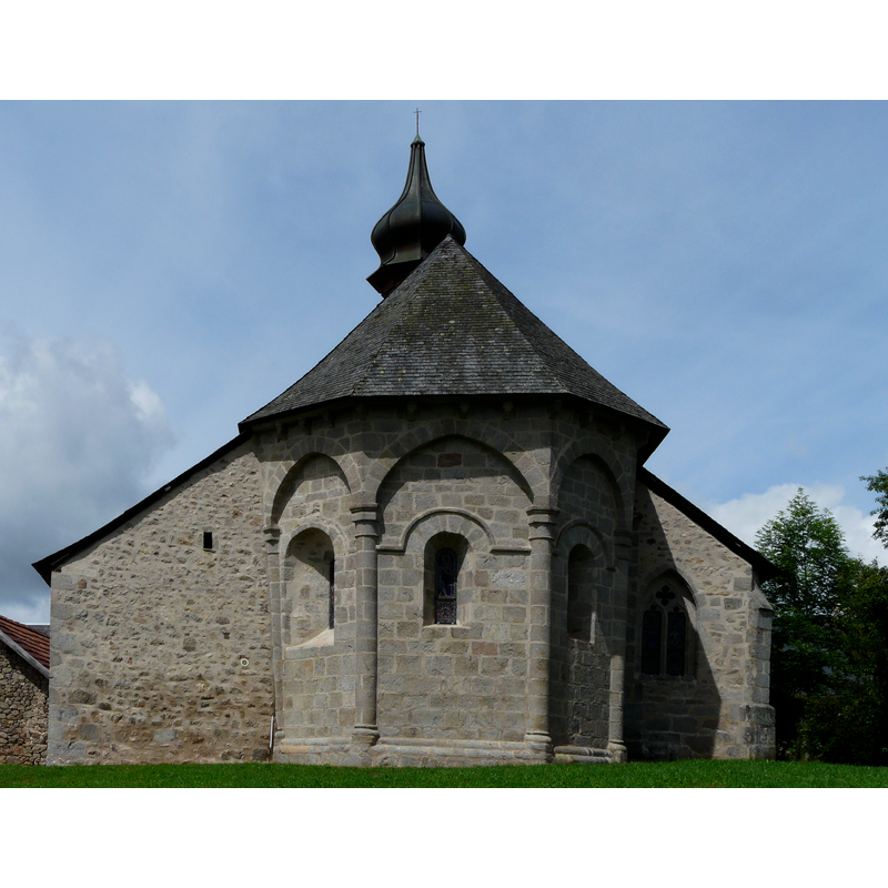
Copyright Statement: Image copyright © Père Igor, 2014
Image Source: edited detail of a digital photograph taken 27 June 2014 by Père Igor [https://commons.wikimedia.org/wiki/File:Saint-Fréjoux_église_chevet.JPG] [accessed 13 March 2017]
Copyright Instructions: CC-BY-SA-3.0
view of church exterior - southwest view
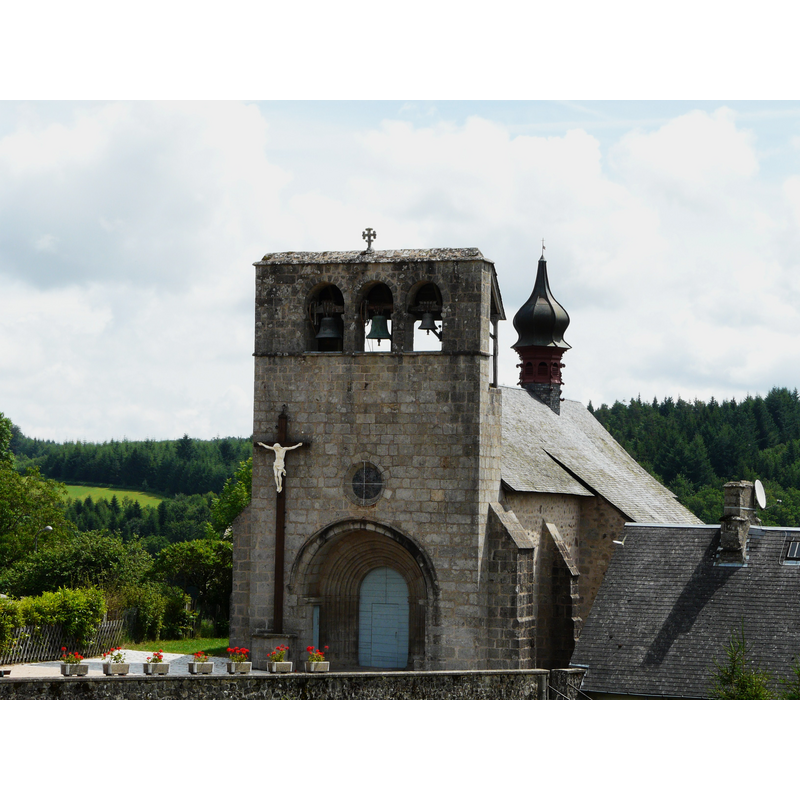
Copyright Statement: Image copyright © Père Igor, 2014
Image Source: digital photograph taken 27 June 2014 by Père Igor [https://commons.wikimedia.org/wiki/File:Saint-Fréjoux_église_(1).JPG] [accessed 13 March 2017]
Copyright Instructions: CC-BY-SA-3.0
view of church exterior - west view
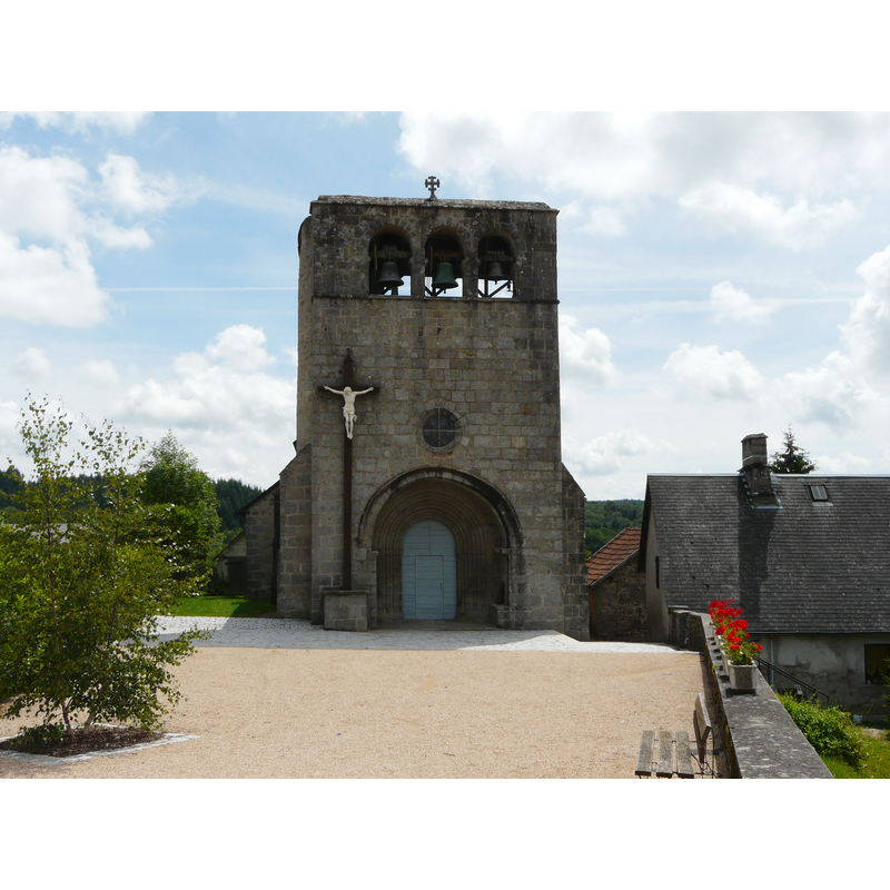
Copyright Statement: Image copyright © Père Igor, 2014
Image Source: digital photograph taken 27 June 2014 by Père Igor [https://commons.wikimedia.org/wiki/File:Saint-Fréjoux_église.JPG] [accessed 13 March 2017]
Copyright Instructions: CC-BY-SA-3.0
INFORMATION
Font ID: 21114FRE
Object Type: Baptismal Font1
Font Century and Period/Style: 12th century, Romanesque
Church / Chapel Name: Église paroissiale Saint-Frédulphe [aka Saint-Frédolphe / Saint-Jean-Baptiste]
Font Location in Church: [disappeared]
Church Patron Saint(s): St. Frecultus? [aka Frédolphe? Frédulphe? Fréjoux?]
Church Notes: 12thC listed in Mérimée [ref.: PA00099858]; modified 15thC
Church Address: 19200 Saint-Fréjoux, France
Site Location: Corrèze, Nouvelle-Aquitaine, France, Europe
Directions to Site: Located off (the D49E3, E of the A89, E of Ussel, NE of Tulle
Ecclesiastic Region: Diocèse de Tulle [ancien diocèse de Limoges]
Historical Region: Limousin
Font Notes:
Click to view
[NB: we have no information on te font of the 12th-century church here].
COORDINATES
UTM: 31T 451066 5043638
Latitude & Longitude (Decimal): 45.544556, 2.373167
Latitude & Longitude (DMS): 45° 32′ 40.4″ N, 2° 22′ 23.4″ E