Saint-Bonnet-pres-Bort / Bonnet-près-Bort / Saint-Bonnet-le Port-Dieu / Saint-Bonnet-près-Bort
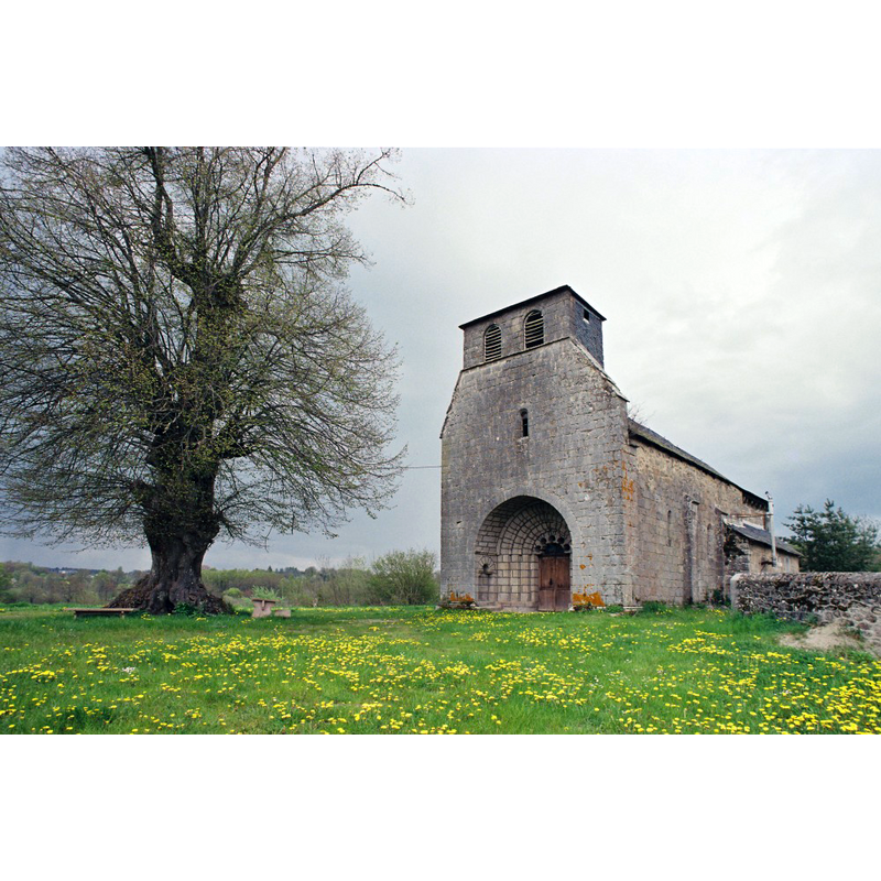
Image copyright © Eglises de Corrèze, 2017
No known copyright restriction / Fair Dealing
Results: 4 records
view of church exterior - southwest view
Scene Description: Source caption: "L’église est un édifice roman bien conservé. Son portail à triple archivolte est orné de ces « lobes à copeaux », fréquents dans nos églises."
Copyright Statement: Image copyright © Eglises de Corrèze, 2017
Image Source: digital photograph taken by Jean-François Amelot, in Eglises de Corrèze [http://eglises.de.correze.online.fr/] [accessed 9 March 2017]
Copyright Instructions: No known copyright restriction / Fair Dealing
view of church exterior - west porch and portal
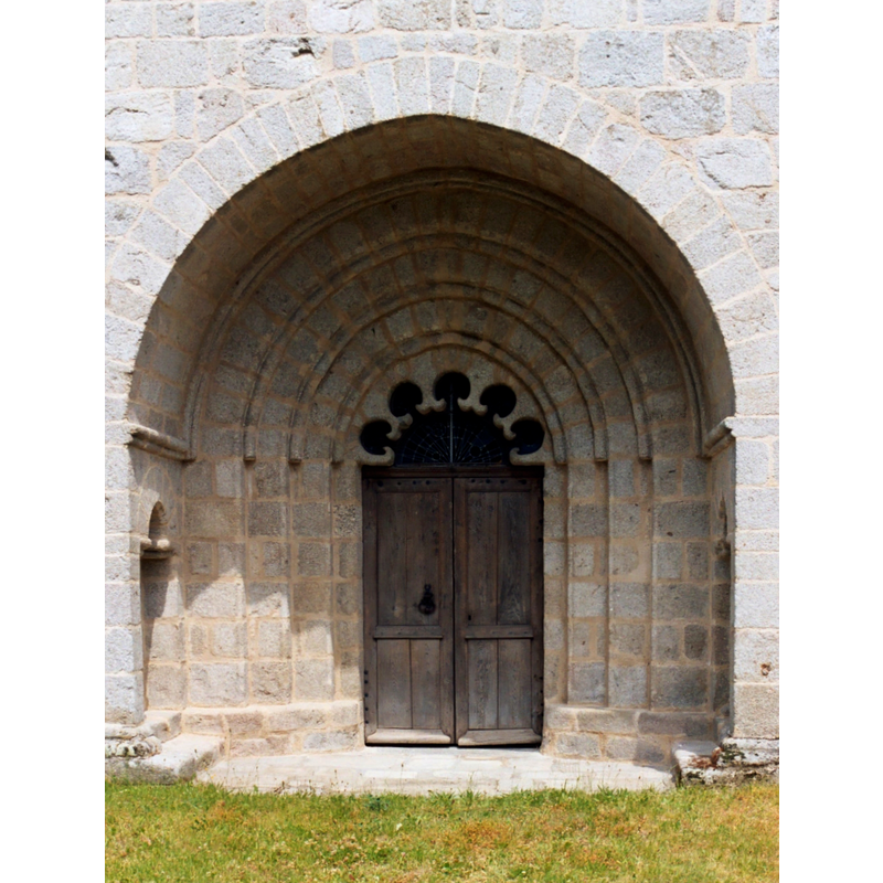
Copyright Statement: Image copyright © EmDee, 2006
Image Source: digital image taken 29 July 2004 by EmDee [https://commons.wikimedia.org/wiki/File:St_Bonnet.JPG] [accessed 9 March 2017]
Copyright Instructions: GFDL / CC-BY-SA-3.0,2.5,2.0,1.0
view of church exterior - southwest end
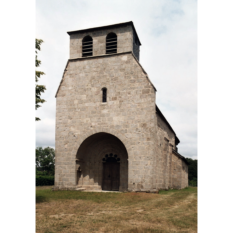
Copyright Statement: Image copyright © EmDee, 2006
Image Source: digital image taken 29 July 2004 by EmDee [https://commons.wikimedia.org/wiki/File:Église_Saint-Bonnet-de-Clermont_de_Saint-Bonnet-près-Bort_1.JPG] [accessed 9 March 2017]
Copyright Instructions: GFDL / CC-BY-SA-3.0,2.5,2.0,1.0
view of church interior - nave - looking east
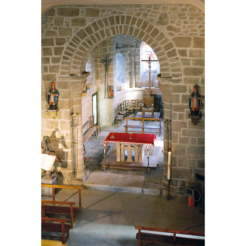
Scene Description: Source caption: "Le chœur et le chevet sont revêtus d’arcatures, simples ou géminées."
Copyright Statement: Image copyright © Eglises de Corrèze, 2017
Image Source: digital photograph taken by Jean-François Amelot, in Eglises de Corrèze [http://eglises.de.correze.online.fr/] [accessed 9 March 2017]
Copyright Instructions: No known copyright restriction / Fair Dealing
INFORMATION
Font ID: 21096BON
Object Type: Baptismal Font1
Font Century and Period/Style: 12th century, Romanesque
Church / Chapel Name: Église paroissiale Saint-Bonnet-de-Clermont [aka Saint-Bonnet et Saint-Clair]
Font Location in Church: [disappeared]
Church Patron Saint(s): St. Bonnet [aka Bonet]
Church Notes: 12thC listed in Mérimée [ref.: PA00099843]
Church Address: 19200 Saint-Bonnet-près-Bort, France
Site Location: Corrèze, Nouvelle-Aquitaine, France, Europe
Directions to Site: Located ESE of Ussel, NE of Tulle
Ecclesiastic Region: Diocèse de Tulle [ancien diocèse de Limoges]
Historical Region: Limousin
Font Notes:
Click to view
[NB: we have no information on the font of the 12th-century church here]
COORDINATES
UTM: 31T 454502 5039128
Latitude & Longitude (Decimal): 45.5042, 2.41764
Latitude & Longitude (DMS): 45° 30′ 15.12″ N, N, 2° 25′ 3.5″ E