Tourouvre / Tortum Robur
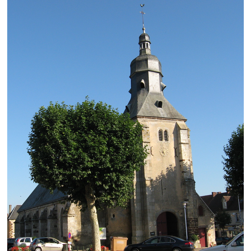
Image copyright © Unozoe, 2011
CC-BY-SA-3.0
Results: 4 records
view of church exterior - northwest view
Scene Description: Source caption: "Vue de l'ouest : tour-clocher 12e- 14e s, dôme 18e s.L'église n'a qu'un seul bas-côté, au nord.ISMH 1991."
Copyright Statement: Image copyright © Unozoe, 2011
Image Source: digital photograph taken 29 September 2011 by Unozoe [https://commons.wikimedia.org/wiki/File:Tourouvre,_Orne,_église_saint_Aubin_bu_IMG_1520.jpg] [accessed 25 February 2017]
Copyright Instructions: CC-BY-SA-3.0
view of church exterior - southeast view
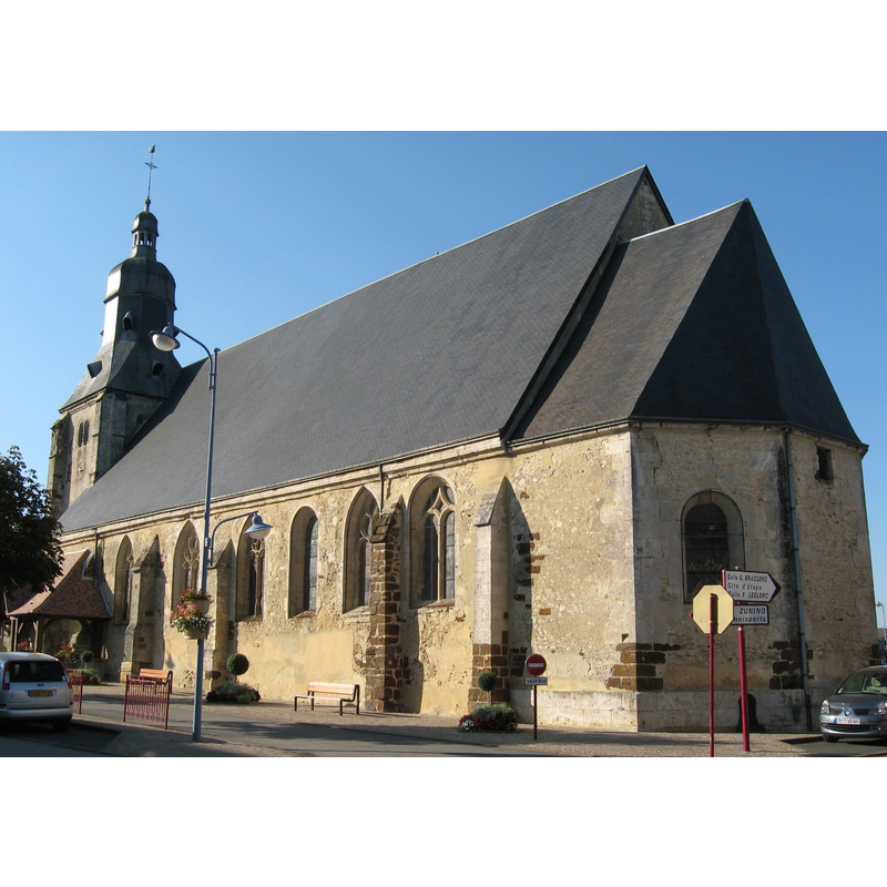
Scene Description: Source caption: "Vue du sud est. Nef 12e s. Abside et baies modifiées au 15e s.ISMH 1991."
Copyright Statement: Image copyright © Unozoe, 2011
Image Source: digital photograph taken 29 September 2011 by Unozoe [https://commons.wikimedia.org/wiki/File:Tourouvre,_Orne,_église_saint_Aubin_bu_IMG_1520_IMG_1530.jpg] [accessed 25 February 2017]
Copyright Instructions: CC-BY-SA-3.0
view of font in context
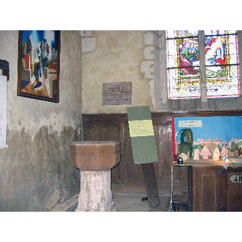
Copyright Statement: Image copyright © [in the public domain]
Image Source: digital photograph taken 30 September 2007 by Paemond [https://commons.wikimedia.org/wiki/File:Baptismal_Tourouvre.jpg] [accessed 25 February 2017]
Copyright Instructions: PD-user
view of church interior - nave - looking east
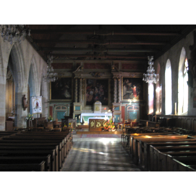
Copyright Statement: Image copyright © Unozoe, 2011
Image Source: digital photograph taken 29 September 2011 by Unozoe [https://commons.wikimedia.org/wiki/File:Tourouvre,_Orne,_église_saint_Aubin_bu_IMG_1520_IMG_1522.jpg] [accessed 25 February 2017]
Copyright Instructions: CC-BY-SA-3.0
INFORMATION
Font ID: 21025TOU
Object Type: Baptismal Font1
Font Century and Period/Style: 15th - 16th century, Late Gothic
Church / Chapel Name: Église paroissiale Saint-Aubin
Font Location in Church: Inside the church
Church Patron Saint(s): St. Aubin [aka Albinus of Angers]
Church Notes: Romanesque church re-built late-15thC -- listed and illustrated in Mérimée [ref.: PA00110991]: "De l'église romane subsiste le mur gouttereau sud. Le reste de l'édifice a été reconstruit aux 15e, 16e et 17e siècles."
Church Address: 61190 Tourouvre, France
Site Location: Orne, Normandie, France, Europe
Directions to Site: Located off the D5-D32-D243-D282-D290 crossroads, NW of Longny-au-Perche [NB: merged with Tourouvre-au-Perche since Jan. 2016]
Ecclesiastic Region: Diocèse de Chartres
Historical Region: Haut-Perche, Nasse-Normandie
Additional Comments: disappeared font? (the one of the original Romanesque church here)
Font Notes:
Click to view
The present font consists of a an octagonal basin of reddish stone decorated with a few shallow mouldings, the sides tapering towards a rounded underbowl; on a pedestal base that appears not to belong. [NB: we have no information on the font of the original Romanesque church here]
COORDINATES
UTM: 31U 326860 5384603
Latitude & Longitude (Decimal): 48.590556, 0.651944
Latitude & Longitude (DMS): 48° 35′ 26″ N, 0° 39′ 7″ E
MEDIUM AND MEASUREMENTS
Material: stone
Font Shape: octagonal, mounted
Basin Exterior Shape: octagonal