Meilhards / Meillards / Meillars / Melhars
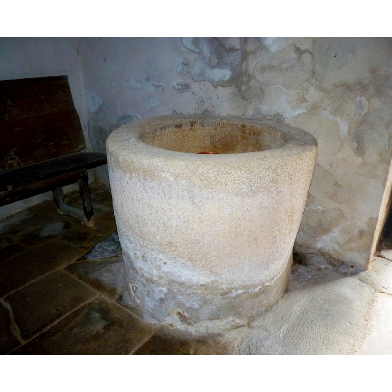
Image copyright © Meilhards, 2017
No known copyright restriction / Fair Dealing
Results: 4 records
view of font
Copyright Statement: Image copyright © Meilhards, 2017
Image Source: digital photograph in the Meilhards web site [www.meilhards.fr/img-photos/xl/1401878308-fonds-baptismaux.jpg] [accessed 21 Fabruary 2017]
Copyright Instructions: No known copyright restriction / Fair Dealing
view of church exterior - northwest view
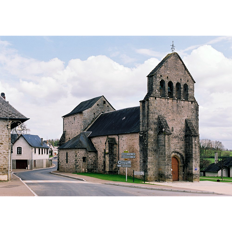
Copyright Statement: Image copyright © Eglises de Corrèze, 2017
Image Source: digital photograph taken by Jean-François Amelot, in Eglises de Corrèze [http://eglises.de.correze.online.fr/] [accessed 21 February 2017]
Copyright Instructions: No known copyright restriction / Fair Dealing
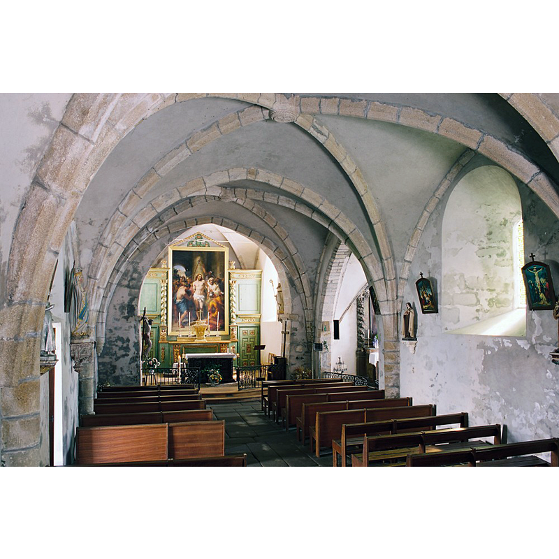
view of church interior - nave - looking west
![the top of the font is just discernible at the far [west] end, left [south] side; and there is a stone holy-water stoup just across the nave on the north side](/static-50478a99ec6f36a15d6234548c59f63da52304e5/compressed/1170221004_compressed.png)
Scene Description: the top of the font is just discernible at the far [west] end, left [south] side; and there is a stone holy-water stoup just across the nave on the north side
Copyright Statement: Image copyright © Meilhards, 2017
Image Source: digital photograph in the Meilhards web site [www.meilhards.fr/img-photos/xl/1401878223-int-eglise-2.jpg] [accessed 21 Fabruary 2017]
Copyright Instructions: No known copyright restriction / Fair Dealing
view of church interior - nave - looking east
Copyright Statement: Image copyright © Eglises de Corrèze, 2017
Image Source: digital photograph taken by Jean-François Amelot, in Eglises de Corrèze [http://eglises.de.correze.online.fr/] [accessed 21 February 2017]
Copyright Instructions: No known copyright restriction / Fair Dealing
INFORMATION
Font ID: 21014MEI
Object Type: Baptismal Font1
Font Century and Period/Style: 12th - 13th century, Romanesque
Church / Chapel Name: Église paroissiale Saint-Yrieix
Font Location in Church: Inside the church, at the W end of the nave, S side
Church Patron Saint(s): St. Yrieix [aka Aredius]
Church Address: 19519 Meilhards, France
Site Location: Corrèze, Nouvelle-Aquitaine, France, Europe
Directions to Site: Located off the D20-D137 crossroads, 16 km NNE of Uzerche, NNW of Tulle
Ecclesiastic Region: Diocèse de Tulle [ancien diocèse de Limoges]
Historical Region: Limousin
Font Notes:
Click to view
Bucket-shaped monolithic font totally plain located at the west end of the nave, on the south side. No cover present.
COORDINATES
Latitude & Longitude (Decimal): 45.557667, 1.6509
Latitude & Longitude (DMS): 45° 33′ 27.6″ N, 1° 39′ 3.24″ E
MEDIUM AND MEASUREMENTS
Material: stone
Font Shape: bucket-shaped, unmounted
Basin Interior Shape: round
Basin Exterior Shape: round
Drainage Notes: no lining