Gimel-les-Cascades No. 2 / Saint-Etienne-de-Braguse
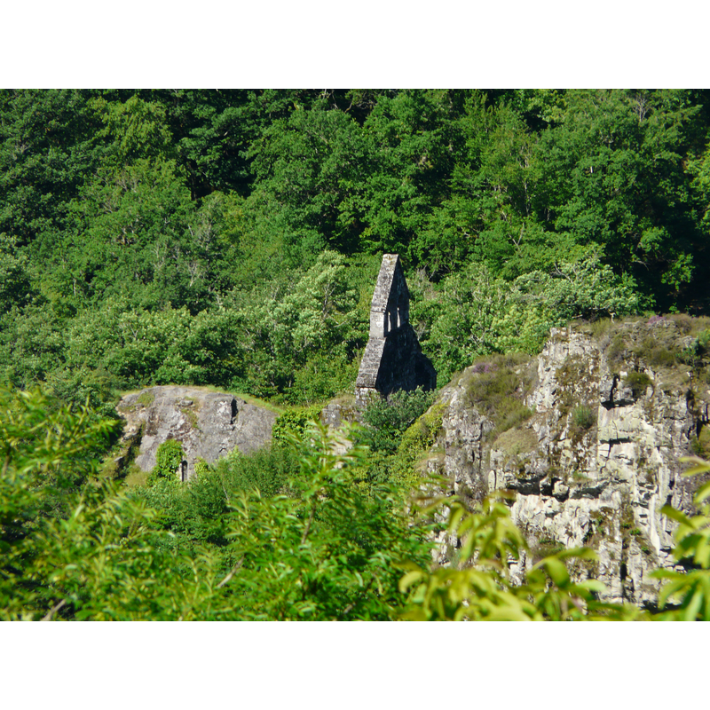
Image copyright © Père Igor, 2009
GFDL / CC-BY-SA-3.0,2.5,2.0,1.0
Results: 2 records
view of church exterior in context
Copyright Statement: Image copyright © Père Igor, 2009
Image Source: digital photograph taken 1 June 2009 by Père Igor [https://commons.wikimedia.org/wiki/File:Gimel_église_St_Étienne_de_Braguse_(11).JPG] [accessed 11 February 2017]
Copyright Instructions: GFDL / CC-BY-SA-3.0,2.5,2.0,1.0
view of church interior - looking west
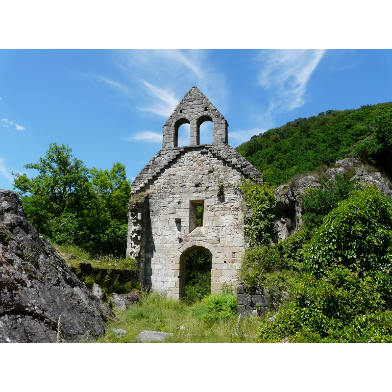
Scene Description: the ruins of Saint-Etienne-de-Braguse
Copyright Statement: Image copyright © Père Igor, 2009
Image Source: digital photograph taken 1 June 2009 by Père Igor [https://commons.wikimedia.org/wiki/File:Gimel_église_St_Étienne_de_Braguse_(2).JPG] [accessed 11 February 2017]
Copyright Instructions: GFDL / CC-BY-SA-3.0,2.5,2.0,1.0
INFORMATION
Font ID: 20965GIM
Object Type: Baptismal Font1?
Font Century and Period/Style: 12th century, Romanesque
Church / Chapel Name: Église [autrefois paroissiale] Saint-Etienne-de-Braguse [in ruins]
Font Location in Church: [disappeared]
Church Patron Saint(s): St. Stephen
Church Notes: noted and illustrated in Mérimée [ref.: PA00099776]: "Eglise édifiée sur le site où serait retiré l'ermite Dumine qui y aurait élevé son oratoire. Construite sur un promontoire rocheux, à moitié creusée dans la roche, l'église autrefois paroissiale domine les cascades [...] A l'intérieur, table d'autel du 12e siècle et deux pierres tombales du 13e et 14e siècle." The original site of the hermitage may date to the 6thC. The church was abandoned in the 18thC.
Church Address: the ruins of Saint-Etienne are located about 1/2 a km from Gimel-les-Cascades -- 19800 Gimel-les-Cascades, France
Site Location: Corrèze, Nouvelle-Aquitaine, France, Europe
Directions to Site: Located off (S) the A89, 8 km NE of Tulle, 8 km S of Corrèze -- the ruins of Saint-Etienne are located about 1/2 a km from Gimel-les-Cascades village centre
Ecclesiastic Region: Diocèse de Tulle [ancien diocèse de Limoges]
Historical Region: Limousin
Additional Comments: disappeared font? (the one from the 12thC parish church here)
Font Notes:
Click to view
[NB: we have no information on the font of the 12th-century parish church here]
COORDINATES
UTM: 31T 409463 5016710
Latitude & Longitude (Decimal): 45.298056, 1.845278
Latitude & Longitude (DMS): 45° 17′ 53″ N, 1° 50′ 43″ E