Curemonte No. 1/ Curamonta / La Combe
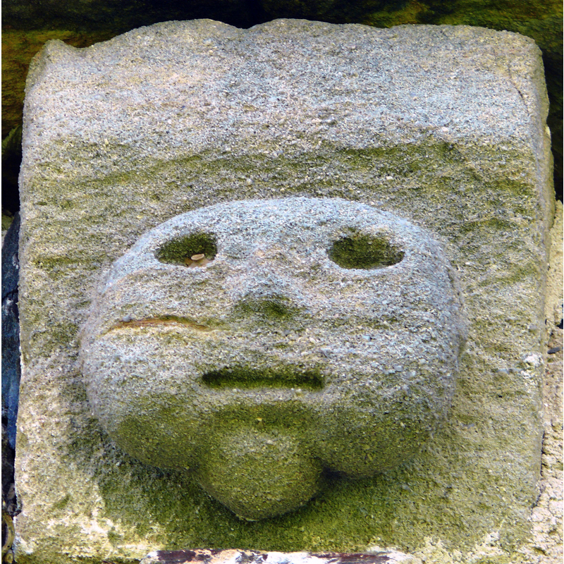
Image copyright © MOSSOT, 2008
GFDL / CC-BY-SA-3.0,2.5,2.0,1.0
Results: 4 records
view of church exterior - corbel
Copyright Statement: Image copyright © MOSSOT, 2008
Image Source: digital photograph taken 19 July 2008 by Jacques Mossot [https://commons.wikimedia.org/wiki/File:Curemonte_-_Eglise_Saint-Hilaire_de_la_Combe_-8.JPG] [accessed 26 January 2017]`
Copyright Instructions: GFDL / CC-BY-SA-3.0,2.5,2.0,1.0
view of church exterior - north view
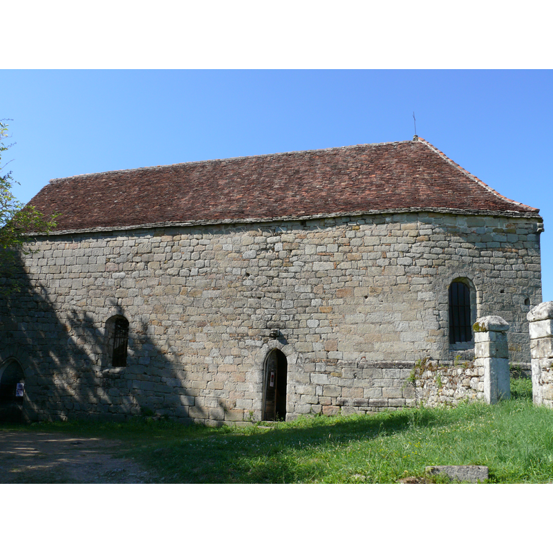
Scene Description: NB: the orientation of this church is reversed, with the chancel at the west end
Copyright Statement: Image copyright © MOSSOT, 2008
Image Source: digital photograph taken 19 July 2008 by Jacques Mossot [https://commons.wikimedia.org/wiki/File:Curemonte_-_Eglise_Saint-Hilaire_de_la_Combe_-4.JPG] [accessed 26 January 2017]`
Copyright Instructions: GFDL / CC-BY-SA-3.0,2.5,2.0,1.0
view of church exterior - west view
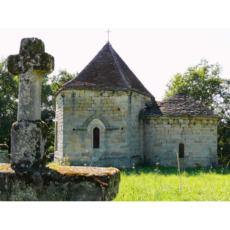
Scene Description: NB: the orientation of this church is reversed, with the chancel at the west end
Copyright Statement: Image copyright © MOSSOT, 2008
Image Source: digital photograph taken 19 July 2008 by Jacques Mossot [https://commons.wikimedia.org/wiki/File:Curemonte_-_Eglise_Saint-Hilaire_de_la_Combe_-3.JPG] [accessed 26 January 2017]`
Copyright Instructions: GFDL / CC-BY-SA-3.0,2.5,2.0,1.0
view of church interior - nave
![viewed from the south side [church orientation is reversed]](/static-50478a99ec6f36a15d6234548c59f63da52304e5/compressed/1170126024_compressed.png)
Scene Description: viewed from the south side [church orientation is reversed]
Copyright Statement: Image copyright © MOSSOT, 2008
Image Source: digital photograph taken 19 July 2008 by Jacques Mossot [https://commons.wikimedia.org/wiki/File:Curemonte_-_Eglise_Saint-Hilaire_de_la_Combe_-5.JPG] [accessed 26 January 2017]`
Copyright Instructions: GFDL / CC-BY-SA-3.0,2.5,2.0,1.0
INFORMATION
Font ID: 20882CUR
Object Type: Baptismal Font1?
Font Century and Period/Style: 12th century, Romanesque
Church / Chapel Name: Ancienne église Saint-Hilaire à La Combe
Font Location in Church: [disappeared]
Church Patron Saint(s): St. Hilary of Poitiers
Church Notes: some local sources claim an earlier church of Merovingian origins here; present church listed and illustrated in Mérimée [ref.: PA00099757] as a late-12thC church dependent on Curemont; damaged, burned down in the Guerre du Bien Public in 1465; it has reversed orientation [chancel on the west]
Church Address: La Combe, 19500 Curemonte, France
Site Location: Corrèze, Nouvelle-Aquitaine, France, Europe
Directions to Site: Located off the D15/D106, between Puy-d'Arnac (N) and Vegennes (S), just N of the Dordogne border -- this church is somewhat distant from the village centre, in La Combe
Ecclesiastic Region: Diocèse de Tulle [ancien diocèse de Limoges]
Historical Region: Limousin
Additional Comments: disappeared font? (the one from the 12thC church here)
Font Notes:
Click to view
[NB: we have no information on the font of the 12th-century church here]
COORDINATES
UTM: 31T 399564 4984263
Latitude & Longitude (Decimal): 45.004706, 1.72557
Latitude & Longitude (DMS): 45° 0′ 16.94″ N, 1° 43′ 32.05″ E