Cublac
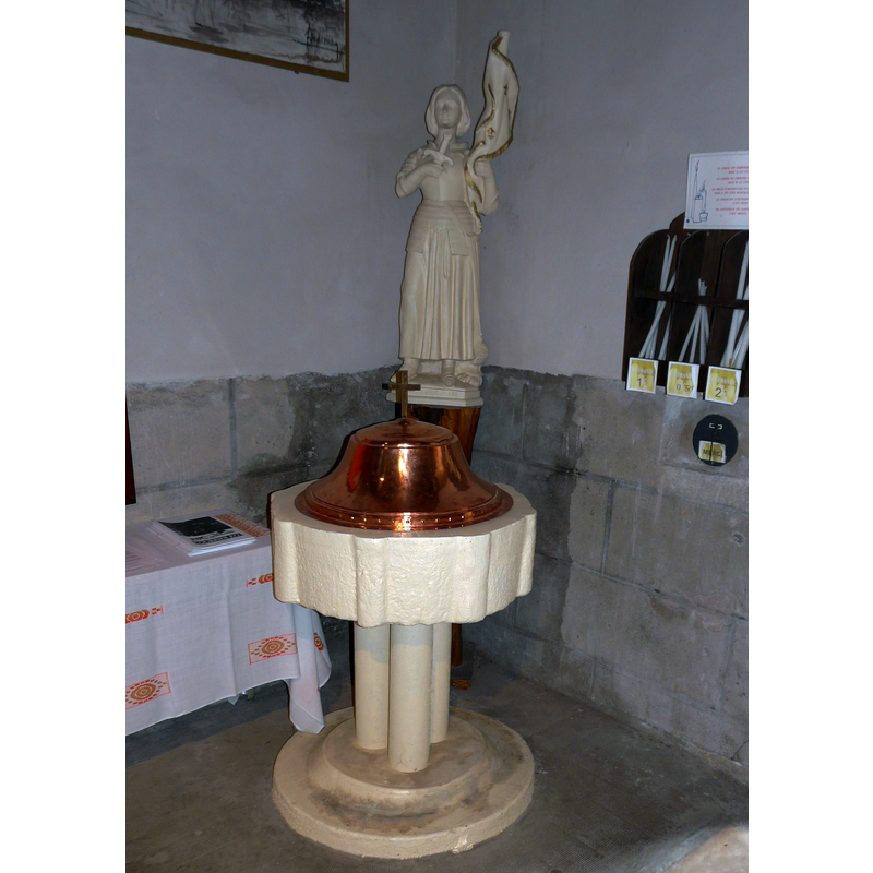
Image copyright © Père Igor, 2015
CC-BY-SA-4.0
Results: 9 records
view of font and cover
Scene Description: the modern font and cover
Copyright Statement: Image copyright © Père Igor, 2015
Image Source: digital photograph taken 1 August 2015 by Père Igor [https://commons.wikimedia.org/wiki/File:Cublac_église_fonts.JPG] [accessed 26 January 2017]
Copyright Instructions: CC-BY-SA-4.0
view of church exterior - west portal
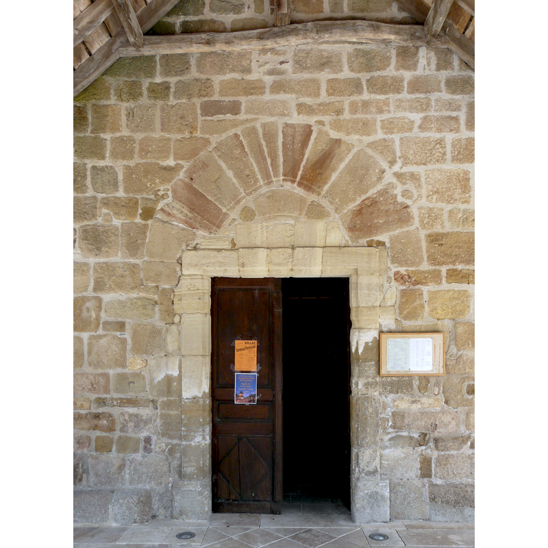
Scene Description: Source caption: "Le portail du XIXe siècle de l'église Saint-Barthélemy, Cublac, Corrèze, France. Au-dessus se voit la forme ogivale de l'ancien portail du XVe siècle."
Copyright Statement: Image copyright © Père Igor, 2015
Image Source: digital photograph taken 1 August 2015 by Père Igor [https://upload.wikimedia.org/wikipedia/commons/2/23/Cublac_église_portail.JPG] [accessed 26 January 2017]
Copyright Instructions: CC-BY-SA-4.0
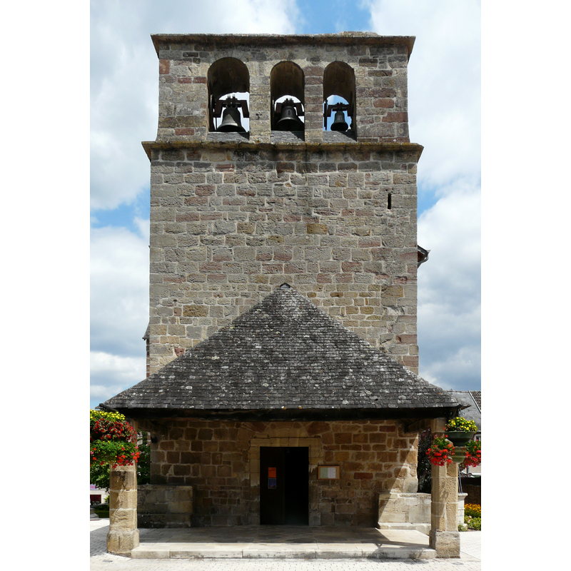
view of church exterior - northwest view
Copyright Statement: Image copyright © Père Igor, 2015
Image Source: digital photograph taken 1 August 2015 by Père Igor [https://commons.wikimedia.org/wiki/File:Cublac_église_(2).JPG] [accessed 26 January 2017]
Copyright Instructions: CC-BY-SA-4.0
view of church exterior - west view
Copyright Statement: Image copyright © Père Igor, 2015
Image Source: digital photograph taken 1 August 2015 by Père Igor [https://commons.wikimedia.org/wiki/File:Cublac_église_(3).JPG] [accessed 26 January 2017]
Copyright Instructions: CC-BY-SA-4.0
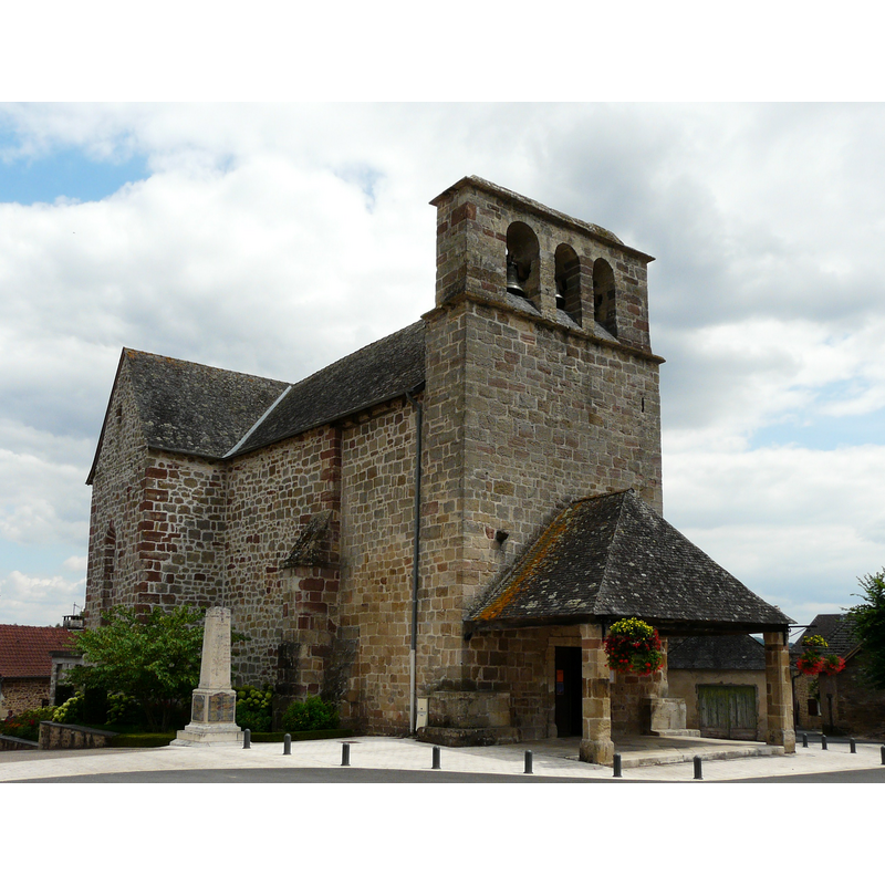
view of church exterior in context - southwest view
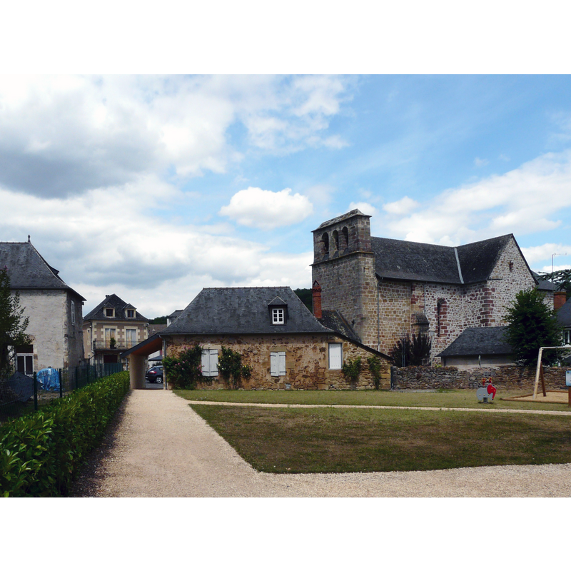
Copyright Statement: Image copyright © Père Igor, 2015
Image Source: digital photograph taken 1 August 2015 by Père Igor [https://commons.wikimedia.org/wiki/File:Cublac_bourg.JPG] [accessed 26 January 2017]
Copyright Instructions: CC-BY-SA-4.0
view of church interior - altar and retable
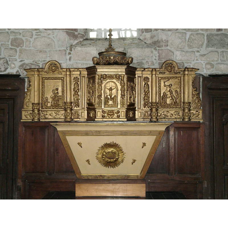
Scene Description: mid-18thC tabernacle -- Source caption: "Le tabernacle de l'église Saint-Barthélemy, Cublac, Corrèze, France."
Copyright Statement: Image copyright © Père Igor, 2015
Image Source: digital photograph taken 1 August 2015 by Père Igor [https://commons.wikimedia.org/wiki/File:Cublac_église_autel_tabernacle.JPG] [accessed 26 January 2017]
Copyright Instructions: CC-BY-SA-4.0
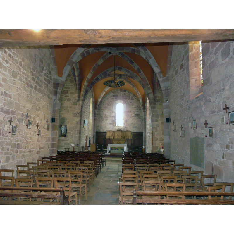
view of church interior - nave - looking west
![with the modern font and cover partly visible at the far [west] end, left [south] side](/static-50478a99ec6f36a15d6234548c59f63da52304e5/compressed/1170126018_compressed.png)
Scene Description: with the modern font and cover partly visible at the far [west] end, left [south] side
Copyright Statement: Image copyright © Père Igor, 2015
Image Source: digital photograph taken 1 August 2015 by Père Igor [https://commons.wikimedia.org/wiki/File:Cublac_église_nef_(1).JPG] [accessed 26 January 2017]
Copyright Instructions: CC-BY-SA-4.0
view of church interior - nave - looking east
Copyright Statement: Image copyright © Père Igor, 2015
Image Source: digital photograph taken 1 August 2015 by Père Igor [https://commons.wikimedia.org/wiki/File:Cublac_église_nef.JPG] [accessed 26 January 2017]
Copyright Instructions: CC-BY-SA-4.0
view of stoup

Copyright Statement: Image copyright © Père Igor, 2015
Image Source: digital photograph taken 1 August 2015 by Père Igor [https://commons.wikimedia.org/wiki/File:Cublac_église_bénitier.JPG] [accessed 26 January 2017]
Copyright Instructions: CC-BY-SA-4.0
INFORMATION
Font ID: 20881CUB
Object Type: Stoup
Font Century and Period/Style: 15th - 16th century, Late Medieval
Church / Chapel Name: Église paroissiale Saint-Barthelemy
Font Location in Church: wall-mounted
Church Patron Saint(s): St. Bartholomew
Church Notes: a chapel-of-ease to Brignac built in 935; became parish 1107; church consecrated 1131; destroyed in the Hundred-Year War; present church re-built 1490; modified 18thC
Church Address: 19520 Cublac, France
Site Location: Corrèze, Nouvelle-Aquitaine, France, Europe
Directions to Site: Located off the D2-D3 crossroads, between Brignac-la-Plaine (N) and Rerasson-Lavilledieu (S), 20 km W of Brive-la-Gaillarde, N of the border with the Dordogne
Ecclesiastic Region: Diocèse de Tulle [ancien diocèse de Limoges]
Historical Region: Limousin
Additional Comments: disappeared font? (the one from the 10th-12thC church here)
Font Notes:
Click to view
Wall-mounted stoup decorated with a thick pipe on each side. The present font and cover are modern [NB: we have no information on the font of the 10th-12th century church here; may have been destroyed in the 15th century with the rest of the church].
COORDINATES
UTM: 31T 366863 5000422
Latitude & Longitude (Decimal): 45.144717, 1.306501
Latitude & Longitude (DMS): 45° 8′ 40.98″ N, 1° 18′ 23.41″ E