Collonges-la-Rouge
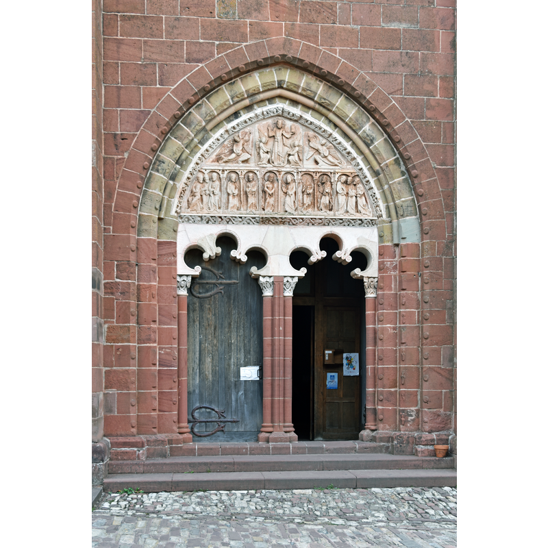
Image copyright © Pline, 2015
CC-BY-SA-4.0
Results: 4 records
view of church exterior - portal
Copyright Statement: Image copyright © Pline, 2015
Image Source: digital photograph taken 27 August 2015 by Pline [https://commons.wikimedia.org/wiki/File:Eglise-Saint-Pierre-ou-Saint-Sauveur-à-Collonges-la-Rouge-DSC_0860.jpg] [accessed 20 January 2017]
Copyright Instructions: CC-BY-SA-4.0
view of church exterior - portal - tympanum
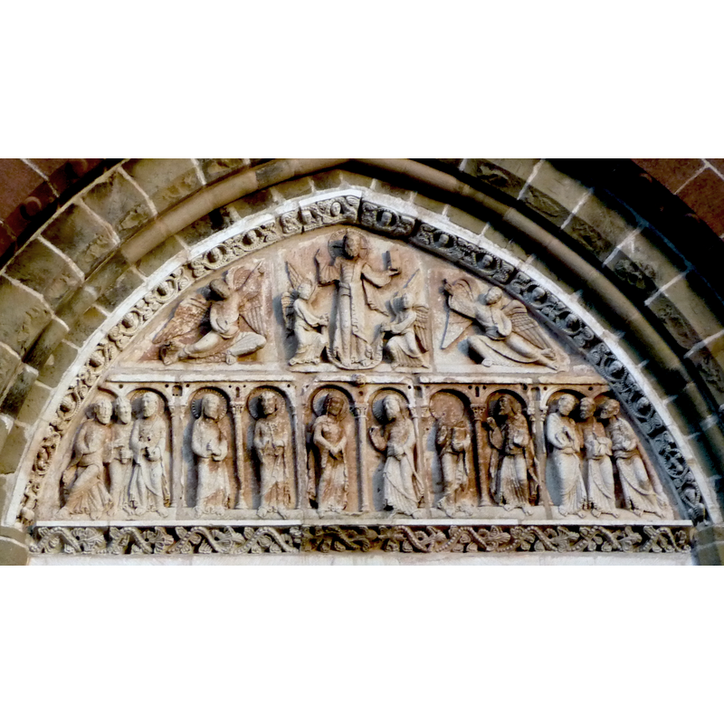
Scene Description: white limestone tympanum of the 12th century; it was hidden from view in the façade during the late-16thC wars of religion, and re-installed in 1923
Copyright Statement: Image copyright © Chavakia84, 2011
Image Source: digital photograph taken 1 November 2011 by Chavakia84 [https://commons.wikimedia.org/wiki/File:Tympan_de_l'église_Saint-Sauveur_de_Collonges-la-Rouge.JPG] [accessed 20 January 2017]
Copyright Instructions: CC-BY-SA-3.0
view of church exterior
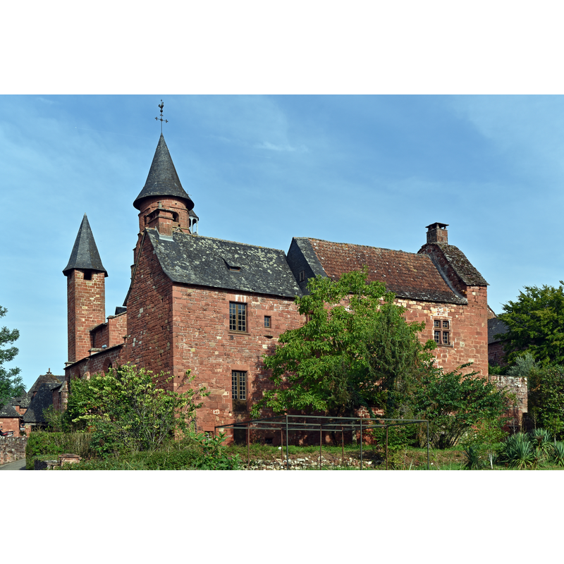
Copyright Statement: Image copyright © Pline, 2015
Image Source: digital photograph taken 27 August 2015 by Pline [https://commons.wikimedia.org/wiki/File:Eglise-Saint-Pierre-ou-Saint-Sauveur-à-Collonges-la-Rouge-DSC_0852.jpg] [accessed 20 January 2017]
Copyright Instructions: CC-BY-SA-4.0
view of church interior
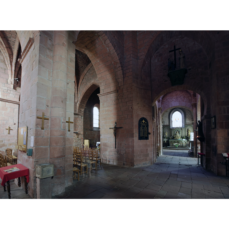
Scene Description: a stone holy-water stoup is visible in the foreground
Copyright Statement: Image copyright © PMRMaeyaert, 2011
Image Source: digital photograph taken 24 September 2011 by PMRMaeyaert [https://commons.wikimedia.org/wiki/File:Collonges-la-Rouge,_église_Saint-Pierre_PM_18606.jpg] [accessed 20 January 2017]
Copyright Instructions: CC-BY-SA-3.0
INFORMATION
Font ID: 20862COL
Object Type: Baptismal Font1?
Font Date: ca. 1070?
Font Century and Period/Style: 11th century (late?), Romanesque
Church / Chapel Name: Église paroissiale Saint-Pierre de Collonges-la-Rouge
Font Location in Church: [disappeared]
Church Patron Saint(s): St. Peter
Church Notes: church ca.1070; listed and illustrated in Mérimée [ref.: PA00099722]: "Edifice bâti vers 1060-1070, agrandi du 12e au 15e siècle et fortifié au 16e lors des guerres de Religion."
Church Address: 37 Pl. de l'Église, 19500 Collonges-la-Rouge, France
Site Location: Corrèze, Nouvelle-Aquitaine, France, Europe
Directions to Site: Located off the D38, 2 km NW of Meyssac, 15-20 km SE of Brive-la-Gaillarde
Ecclesiastic Region: Diocèse de Tulle [ancien diocèse de Limoges]
Historical Region: Limousin
Additional Comments: disappeared font? (the one from the ca.1070 church here)
Font Notes:
Click to view
[NB: we have no information on the font of the ca.1070 church here]
COORDINATES
UTM: 31T 394073 4990529
Latitude & Longitude (Decimal): 45.0603, 1.6546
Latitude & Longitude (DMS): 45° 3′ 37.08″ N, 1° 39′ 16.56″ E