Chapelle-Saint-Geraud / La Chapèla Sent Geraud / La Chapelle-Saint-Géraud
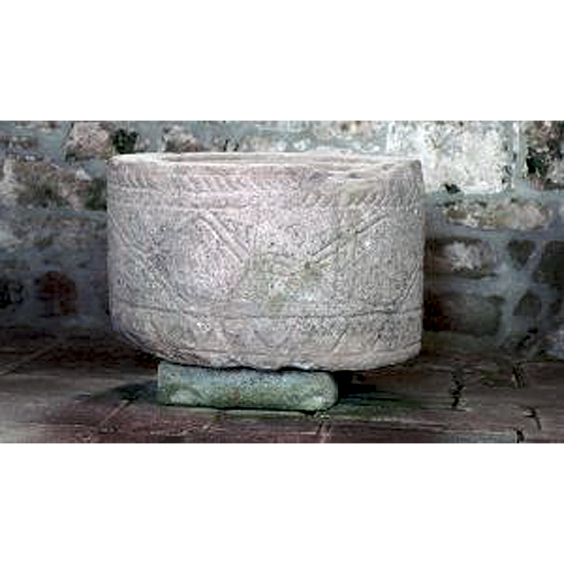
Image copyright © Gérard d'Alboy, 2009
CC-BY-SA-4.0
Results: 8 records
view of font
Copyright Statement: Image copyright © Gérard d'Alboy, 2009
Image Source: digital photograph taken 13 June 2009 by Gérard d'Alboy [http://pormenaz.free.fr/La-chapelle-st-geraud.php] [accessed 18 January 2017]
Copyright Instructions: CC-BY-SA-4.0
design element - motifs - braid
Copyright Statement: Image copyright © Gérard d'Alboy, 2009
Image Source: digital photograph taken 13 June 2009 by Gérard d'Alboy [http://pormenaz.free.fr/La-chapelle-st-geraud.php] [accessed 18 January 2017]
Copyright Instructions: CC-BY-SA-4.0
design element - motifs - diamond or lozenge
Copyright Statement: Image copyright © Gérard d'Alboy, 2009
Image Source: digital photograph taken 13 June 2009 by Gérard d'Alboy [http://pormenaz.free.fr/La-chapelle-st-geraud.php] [accessed 18 January 2017]
Copyright Instructions: CC-BY-SA-4.0
design element - motifs - sawtooth
Copyright Statement: Image copyright © Gérard d'Alboy, 2009
Image Source: digital photograph taken 13 June 2009 by Gérard d'Alboy [http://pormenaz.free.fr/La-chapelle-st-geraud.php] [accessed 18 January 2017]
Copyright Instructions: CC-BY-SA-4.0
view of church exterior - north portal - tympanum
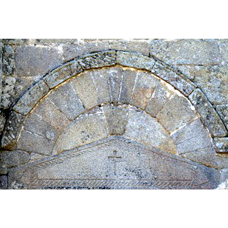
Copyright Statement: Image copyright © Gérard d'Alboy, 2009
Image Source: digital photograph taken 13 June 2009 by Gérard d'Alboy [http://pormenaz.free.fr/La-chapelle-st-geraud.php] [accessed 18 January 2017]
Copyright Instructions: CC-BY-SA-4.0
view of church exterior - southeast view
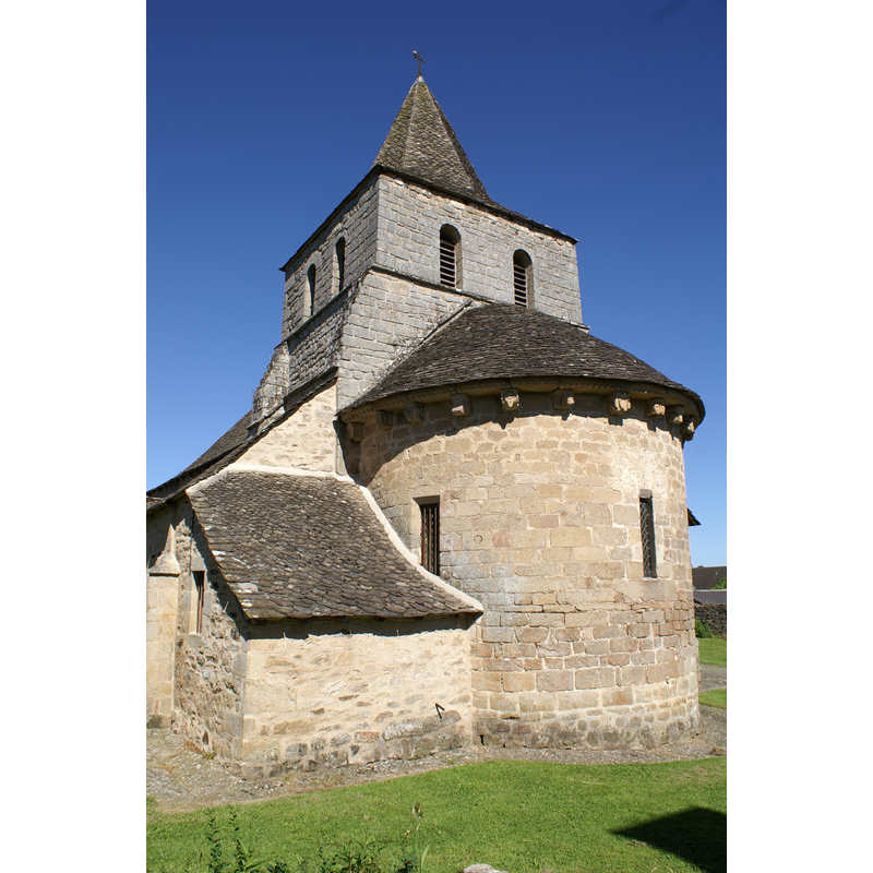
Copyright Statement: Image copyright © Gérard d'Alboy, 2009
Image Source: digital photograph taken 13 June 2009 by Gérard d'Alboy [https://commons.wikimedia.org/wiki/File:13_juin_2009_(39).JPG] [accessed 18 January 2017]
Copyright Instructions: CC-BY-SA-4.0
view of church exterior in context
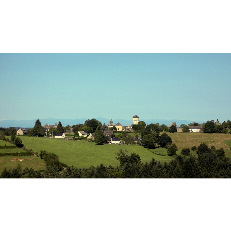
Scene Description: the tower of the church, dwarfed by the water tower, in the centre of the image
Copyright Statement: Image copyright © Pascalou petit, 2008
Image Source: digital photograph taken 19 July 2008 by Pascalou petit [https://commons.wikimedia.org/wiki/File:Chapelle_saint_geraud.JPG] [accessed 18 January 2017]
Copyright Instructions: GFDL / CC-BY-SA-3.0,2.5,2.0,1.0
view of church interior - nave - looking east
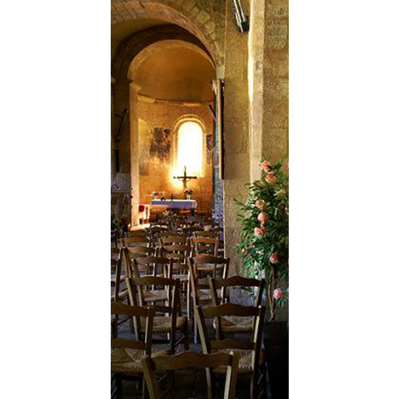
Copyright Statement: Image copyright © Gérard d'Alboy, 2009
Image Source: digital photograph taken 13 June 2009 by Gérard d'Alboy [http://pormenaz.free.fr/La-chapelle-st-geraud.php] [accessed 18 January 2017]
Copyright Instructions: CC-BY-SA-4.0
INFORMATION
Font ID: 20846CHA
Object Type: Baptismal Font1
Font Century and Period/Style: 12th - 13th century, Late Romanesque
Church / Chapel Name: Église paroissiale [ancienne abbatiale] Saint-Géraud
Font Location in Church: Inside the church
Church Notes: 12thC church listed in Mérimée [ref.: PA00099710]: "Petit sanctuaire construit au 12e siècle, modifié au 15e et remanié au milieu du 19e suite à un incendie".
Church Address: 19430 La Chapelle-Saint-Géraud, France
Site Location: Corrèze, Nouvelle-Aquitaine, France, Europe
Directions to Site: Located off the D33-D41 crossroads, SSE of Tulle, 45 km ESE of Brive-la-Gaillarde, SW of Mauriac
Ecclesiastic Region: Diocèse de Tulle [ancien diocèse de Limoges]
Historical Region: Limousin
Font Notes:
Click to view
Baptismal font consisting of a large cylindrical basin raised on a squat makeshift base that probably had nothing to do with the font; the sides are decorated with a wide braid all around just below the upper rim, a wide band of large lozenge motifs in the centre, and a narrower band of saw-tooth below; the inner well has an indentation all around at the top, probably to fit a flat wooden cover; there is also damage to the upper rim that is probably due to hardware from an old cover. No cover present.
COORDINATES
UTM: 31T 417672 4987959
Latitude & Longitude (Decimal): 45.040317, 1.953327
Latitude & Longitude (DMS): 45° 2′ 25.14″ N, 1° 57′ 11.98″ E
MEDIUM AND MEASUREMENTS
Material: stone
Font Shape: cylindrical, unmounted
Basin Interior Shape: round
Basin Exterior Shape: round
Drainage Notes: no lining
LID INFORMATION
Notes: [cf. FontNotes]