Hertford No. 1 / Hartfelde / Hertforde / Herutford
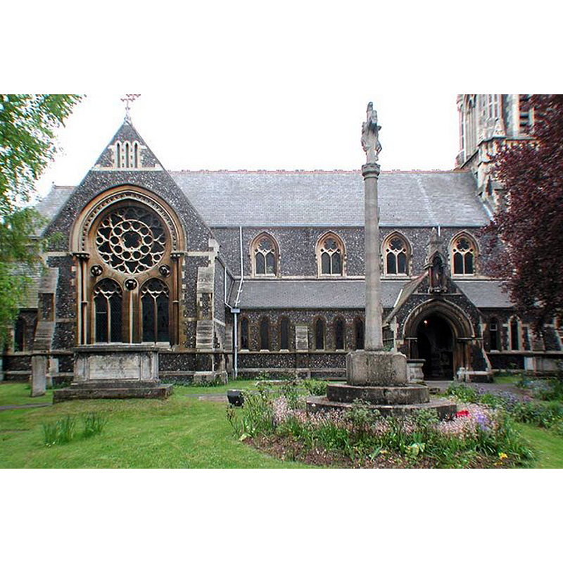
Image copyright © John Salmon, 2007
CC-BY-SA-2.0
Results: 3 records
view of church exterior - north view
Copyright Statement: Image copyright © John Salmon, 2007
Image Source: digital photograph taken 11 May 2002 by John Salmon [www.geograph.org.uk/photo/348905] [accessed 9 November 2016]
Copyright Instructions: CC-BY-SA-2.0
view of church exterior - southwest end
![EXT SW END digital photograph taken 27 January 2008 by Dave Kelly [www.geograph.org.uk/photo/3222015] [accessed 9 November 2016]
EXT N digital photograph taken 11 May 2002 by John Salmon [www.geograph.org.uk/photo/348905] [accessed 9 November 2016]
INT E digital photograph taken 11 May 2002 by John Salmon [www.geograph.org.uk/photo/348909] [accessed 9 November 2016]](/static-50478a99ec6f36a15d6234548c59f63da52304e5/compressed/1161109005_compressed.png)
Scene Description: EXT SW END digital photograph taken 27 January 2008 by Dave Kelly [www.geograph.org.uk/photo/3222015] [accessed 9 November 2016]
EXT N digital photograph taken 11 May 2002 by John Salmon [www.geograph.org.uk/photo/348905] [accessed 9 November 2016]
INT E digital photograph taken 11 May 2002 by John Salmon [www.geograph.org.uk/photo/348909] [accessed 9 November 2016]
Copyright Statement: Image copyright © Dave Kelly, 2008
Image Source: digital photograph taken 27 January 2008 by Dave Kelly [www.geograph.org.uk/photo/3222015] [accessed 9 November 2016]
Copyright Instructions: CC-BY-SA-2.0
view of church interior - nave - looking east
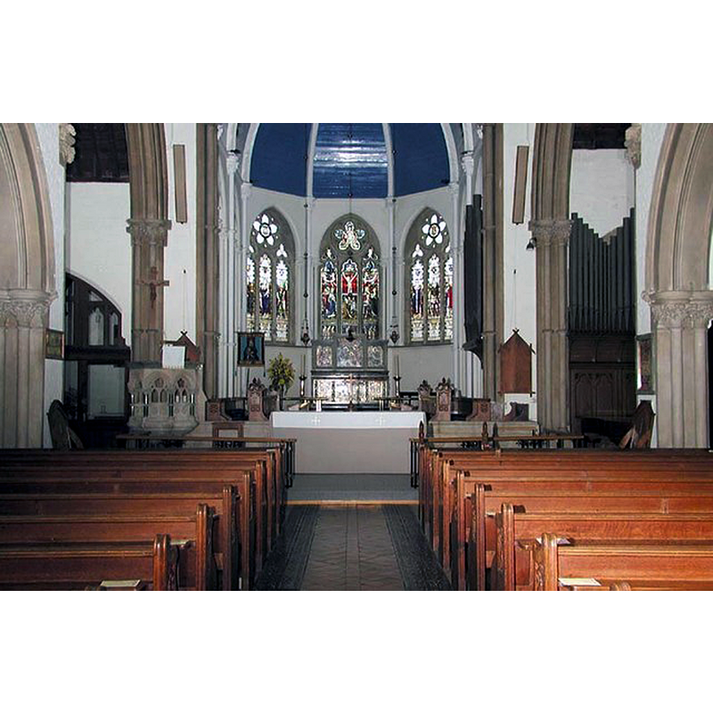
Copyright Statement: Image copyright © John Salmon, 2007
Image Source: digital photograph taken 11 May 2002 by John Salmon [www.geograph.org.uk/photo/348909] [accessed 9 November 2016]
Copyright Instructions: CC-BY-SA-2.0
INFORMATION
Font ID: 20786HER
Object Type: Baptismal Font1?
Font Date: ca. 1200?
Font Century and Period/Style: 12th - 13th century, Transitional / Early English
Church / Chapel Name: Parish Church of St. Andrew
Church Patron Saint(s): St. Andrew
Church Address: Bridges Court, Hertford SG14 1JA
Site Location: Hertfordshire, East, England, United Kingdom
Ecclesiastic Region: Diocese of St. Albans
Historical Region: Hundred of Hertford
Additional Comments: disappeared font? (the one from the ca. 1209 church here)
Font Notes:
Click to view
There are five entries for Hertford [variant spelling] in the Domesday survey [http://opendomesday.org/place/TL3212/hertford/] [accessed 9 November 2016]; one of the entries mentions a church in it; another mentions two churches in it. The Victoria County History {Hertford, vol. 3, 1912) notes: "St. Andrew's Church is first mentioned by name in 1208, when King John granted it to Master Adam of Essex, his clerk, for life. [...] The church of ST. ANDREW was erected on the site of the former church in 1869 [...]; it consists of an apsidal chancel, nave with aisles, north and south transepts and west tower. It is built of flint with stone dressings in the style of the early 14th century"; no font mentioned in this VCH entry for St. Andrew's. The entry for this church in English Heritage [Listing NGR: TL3234312564] (1973) notes: "Font, at west end in front of tower arch was raised on present stepped podium in 1890, cream sandstone, C14 style, octagonal, with arcaded surround to bowl with ogee arches."
COORDINATES
UTM: 30U 701206 5742421
Latitude & Longitude (Decimal): 51.796394, -0.082045
Latitude & Longitude (DMS): 51° 47′ 47.02″ N, 0° 4′ 55.36″ W
REFERENCES
- Victoria County History [online], University of London, 1993-. URL: https://www.british-history.ac.uk.