Hertingfordbury / Herefordingberie / Hertfordburia / Hertfordiggebiry / Hertfordingebyre
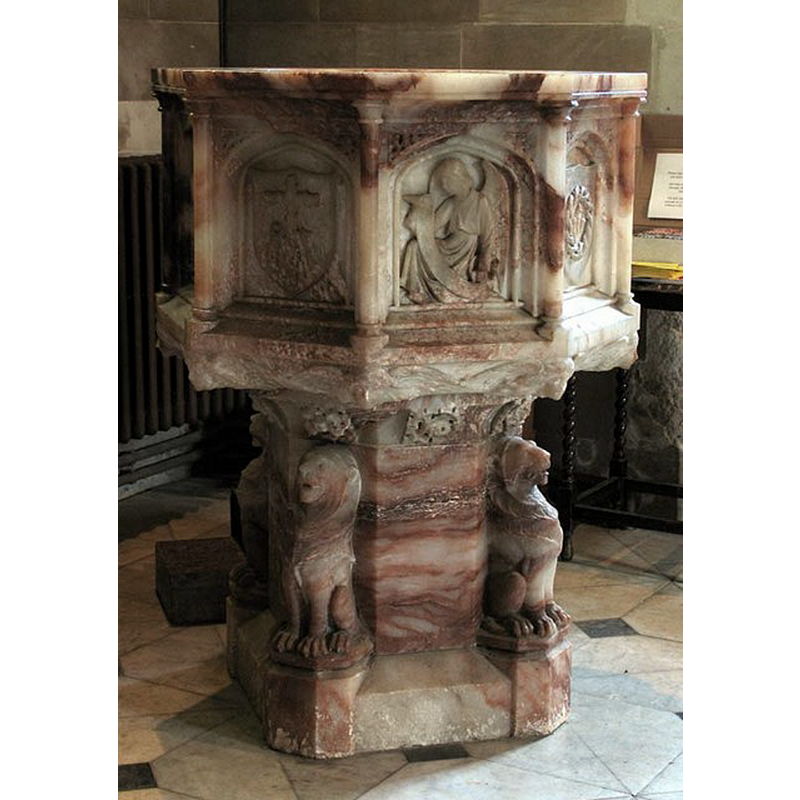
Image copyright © John Salmon, 2007
CC-BY-SA-2.0
Results: 4 records
view of font
Scene Description: the modern font
Copyright Statement: Image copyright © John Salmon, 2007
Image Source: digital photograph taken 16 December 2005 by John Salmon [www.geograph.org.uk/photo/363054] [accessed 7 November 2016]
Copyright Instructions: CC-BY-SA-2.0
view of church exterior - southwest view
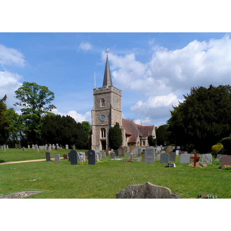
Copyright Statement: Image copyright © Bikeboy, 2013
Image Source: digital photograph taken 6 May 2013 by Bikeboy [www.geograph.org.uk/photo/3450951] [accessed 7 November 2016]
Copyright Instructions: CC-BY-SA-2.0
view of church exterior - southeast view
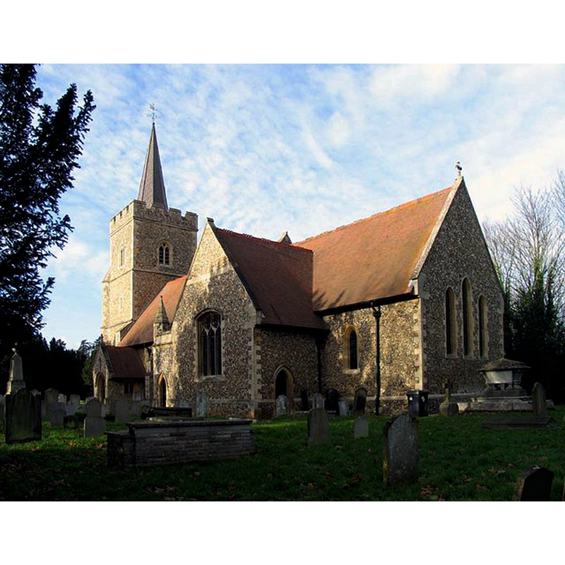
Copyright Statement: Image copyright © John Salmon, 2007
Image Source: digital photograph taken 16 December 2005 by John Salmon [www.geograph.org.uk/photo/363045] [accessed 7 November 2016]
Copyright Instructions: CC-BY-SA-2.0
view of church interior - nave - looking east
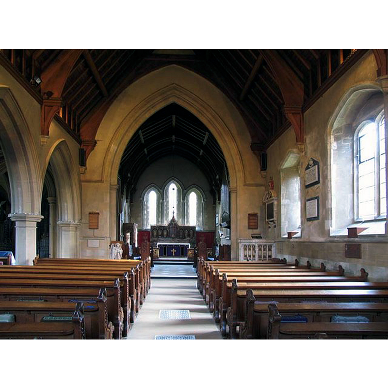
Copyright Statement: Image copyright © John Salmon, 2007
Image Source: digital photograph taken 16 December 2005 by John Salmon [www.geograph.org.uk/photo/363053] [accessed 7 November 2016]
Copyright Instructions: CC-BY-SA-2.0
INFORMATION
Font ID: 20784HER
Object Type: Baptismal Font1?
Font Century and Period/Style: 13th century, Early English
Church / Chapel Name: Parish Church of St. Mary and St. John
Church Patron Saint(s): St. Mary the Virgin & St. John
Church Address: St. Mary's Lane, Hertingfordbury, Hertfordshire SG14 2NX
Site Location: Hertfordshire, East, England, United Kingdom
Directions to Site: Located off (S) the A414, WSW of Hertford
Ecclesiastic Region: Diocewse of St. Albans
Historical Region: Hundred of Hertford
Additional Comments: disappeared font? (the one fvrom the 13thC church here)
Font Notes:
Click to view
There is an entry for Hertingfordbury [variant spelling] in the Domesday survey [http://opendomesday.org/place/TL3011/hertingfordbury/] [accessed 7 November 2016] but it mentions neither cleric nor church in it. The Victoria County History (Hertford, vol. 3, 1912) notes: "The church was extensively restored and altered in 1845, and in 1890 it was practically rebuilt. The chancel and possibly the nave walls were built in the 13th century, the north aisle and west tower being added in the 15th century"; there is no font mentioned in the VCH entry. The entry for this church in English Heritage [Listing NGR: TL3085411948] (1950) notes: "font elaborately carved alabaster bowl on octagonal column with 4 carved lions sejant". This alabaster font is modern.
COORDINATES
UTM: 30U 699715 5741770
Latitude & Longitude (Decimal): 51.791086, -0.104021
Latitude & Longitude (DMS): 51° 47′ 27.91″ N, 0° 6′ 14.48″ W
REFERENCES
- Victoria County History [online], University of London, 1993-. URL: https://www.british-history.ac.uk.