Little Berkhamsted / Berchehamstede
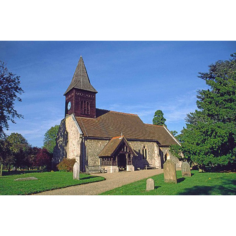
Image copyright © Christine Matthews, 2006
CC-BY-SA-2.0
Results: 3 records
view of church exterior - southwest view
Copyright Statement: Image copyright © Christine Matthews, 2006
Image Source: digital image of a photograph taken in October 1999 by Christine Matthews [www.geograph.org.uk/photo/102087] [accessed 2 November 2016]
Copyright Instructions: CC-BY-SA-2.0
view of church exterior - northwest view

Scene Description: Source caption: "St Andrew's church, Little Berkhamsted. The church originates from the mid C17 but was virtually rebuilt in 1857."
Copyright Statement: Image copyright © Bikeboy, 2014
Image Source: digital photograph taken 22 December 2014 by Bikeboy [www.geograph.org.uk/photo/4287046] [accessed 2 November 2016]
Copyright Instructions: CC-BY-SA-2.0
view of church interior - nave - looking east
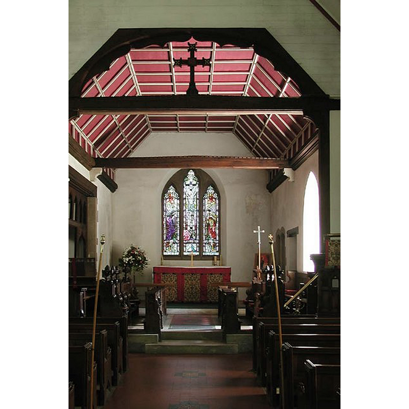
Scene Description: view into the chancel
Copyright Statement: Image copyright © John Salmon, 2007
Image Source: digital photograph taken 14 June 2003 by John Salmon [www.geograph.org.uk/photo/355371] [accessed 2 November 2016]
Copyright Instructions: CC-BY-SA-2.0
INFORMATION
Font ID: 20783BER
Object Type: Baptismal Font1?
Font Century and Period/Style: 11th century, Pre-Conquest
Church / Chapel Name: Parish Church of St. Andrew
Church Patron Saint(s): St. Andrew
Church Notes: no details of the original church available but it was re-built ca. 1647 on the site of an earlier building, of which building very little remains
Church Address: 1 Church Road, Little Berkhamsted, Hertfordshire SG13 8LY
Site Location: Hertfordshire, East, England, United Kingdom
Directions to Site: Located just W of Bayford, SW of Hertford
Ecclesiastic Region: Diocese of St. Albans
Historical Region: Hundred of Hertford
Additional Comments: disappeared font? (the one from the likely pre-Conquest church here)
Font Notes:
Click to view
There is an entry for Little Berkhamsted [variant spelling] in the Domesday survey [http://opendomesday.org/place/TL2907/little-berkhamsted/] [accessed 2 November 2016], but it mentions no church in it; the Domesday entry shows a priest named Saemer as one of the three lords here in 1066, which may mean that there was a church here before the Conquest. The Victoria County History (Hertford, vol. 3, 1912) notes: "Hugh de Scales, lord of the manor in the 12th century, gave the church of Little Berkhampstead to the priory of Lewes [...] The church is said to have been rebuilt about 1647 on the site of an older building, but the only remains of that date are parts of the east and west walls, the rest of the church being modern"; there is no font mentioned in the VCH entry, but it gives the date for the first register for baptisms, burials and marriages as starting in 1647. The entry for this church in English Heritage [Listing NGR: TL2921007886] (1966) reports an octagonal font introduced in the S. Harris' restoration of 1894.
COORDINATES
UTM: 30U 698130 5737697
Latitude & Longitude (Decimal): 51.755072, -0.129292
Latitude & Longitude (DMS): 51° 45′ 18.26″ N, 0° 7′ 45.45″ W
REFERENCES
- Victoria County History [online], University of London, 1993-. URL: https://www.british-history.ac.uk.