Great Amwell / Ammewell / Amwell / Amwell Magna / Emmeswelle / Emmewell / Emwell / Much Amwell
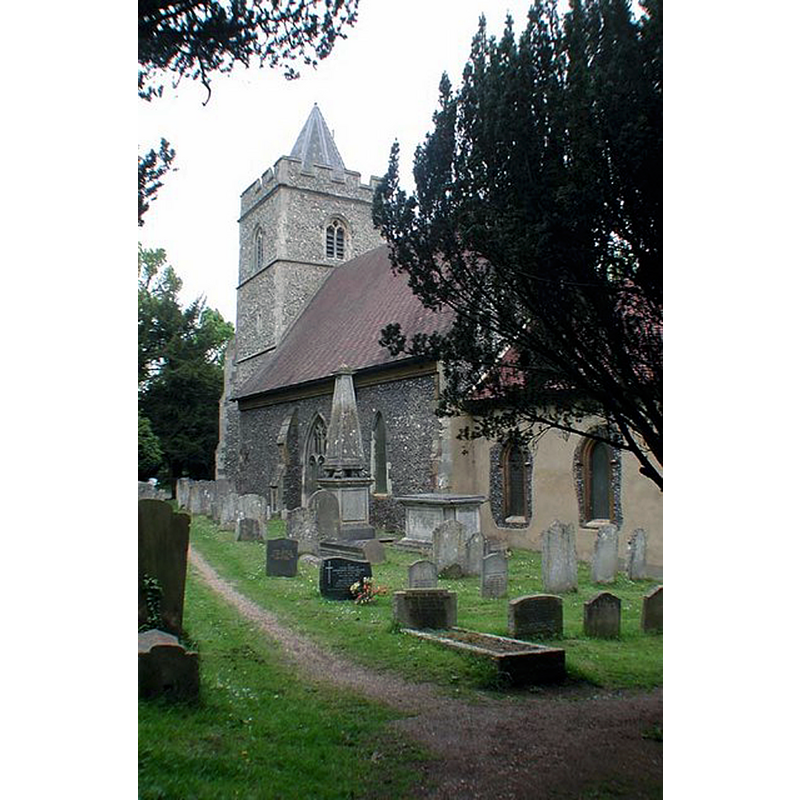
Image copyright © John Salmon, 2007
CC-BY-SA-2.0
Results: 2 records
view of church exterior - southeast view
Copyright Statement: Image copyright © John Salmon, 2007
Image Source: digital photograph taken 11 May 2002 by John Salmon [www.geograph.org.uk/photo/348894] [accessed 1 November 2016]
Copyright Instructions: CC-BY-SA-2.0
view of church interior - nave - looking east
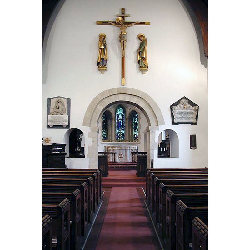
Copyright Statement: Image copyright © John Salmon, 2007
Image Source: digital photograph taken 11 May 2002 by John Salmon [www.geograph.org.uk/photo/348898] [accessed 1 November 2016]
Copyright Instructions: CC-BY-SA-2.0
INFORMATION
Font ID: 20782AMW
Object Type: Baptismal Font1?
Font Century and Period/Style: 11th century, Pre-Conquest? / Norman
Church / Chapel Name: Parish Church of St. John the Baptist
Church Patron Saint(s): St. John the Baptist
Church Address: St John's Lane, Great Amwell, Hertfordshire SG12 9SF
Site Location: Hertfordshire, East, England, United Kingdom
Directions to Site: Located off (E) the A1170, ESE of Ware, NW of Roydon
Ecclesiastic Region: Diocese of St. Albans
Historical Region: Hundred of Hertford
Additional Comments: disappeared font? (the one from the Domesday-time church here)
Font Notes:
Click to view
There are two entries for [Great and Little] Amwell [variant spelling] in the Domesday survey [http://opendomesday.org/place/XX0000/great-and-little-amwell/] [accessed 1 November 2016]; one mentions a priest, the other a church in it. The Victoria County History (Hertford, vol. 3, 1912) notes: "A priest was among the tenants of Ralf de Limesy at Amwell in 1086. [...] The church of Amwell with all its tithes was apparently given to Hertford Priory by Ralf. [...] The chancel and nave date from the close of the 11th century, [...] the west tower was built about 1420–30, the vestry is modern. The church was restored in 1866 [...] The font is modern." [NB: the modern font shows at the southwest corner of the nace in the VCH plan of the interior of the church]. [NB: the Parish Church of the Holy Trinity in Little Amwell is mid-19thC].
COORDINATES
UTM: 30U 706028 5742397
Latitude & Longitude (Decimal): 51.79443, -0.01223
Latitude & Longitude (DMS): 51° 47′ 39.95″ N, 0° 0′ 44.03″ W