Totteridge / Taregh / Tataridge / Taterugg / Tateryche / Thariges
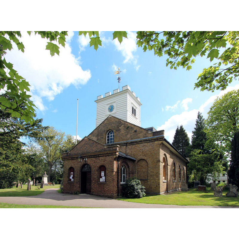
Image copyright © John Salmon, 2013
CC-BY-SA-2.0
Results: 3 records
view of church exterior - southwest view
Scene Description: the 18th-19thC church
Copyright Statement: Image copyright © John Salmon, 2013
Image Source: digital photograph taken 9 May 2013 by John Salmon [www.geograph.org.uk/photo/3521914] [accessed 17 October 2016]
Copyright Instructions: CC-BY-SA-2.0
view of church interior - nave - looking west
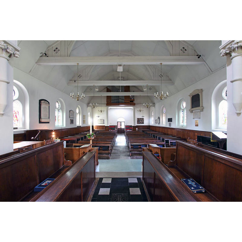
Scene Description: the 18th-19thC church
Copyright Statement: Image copyright © John Salmon, 2013
Image Source: digital photograph taken 9 May 2013 by John Salmon [www.geograph.org.uk/photo/3521926] [accessed 17 October 2016]
Copyright Instructions: CC-BY-SA-2.0
view of church interior - nave - looking east
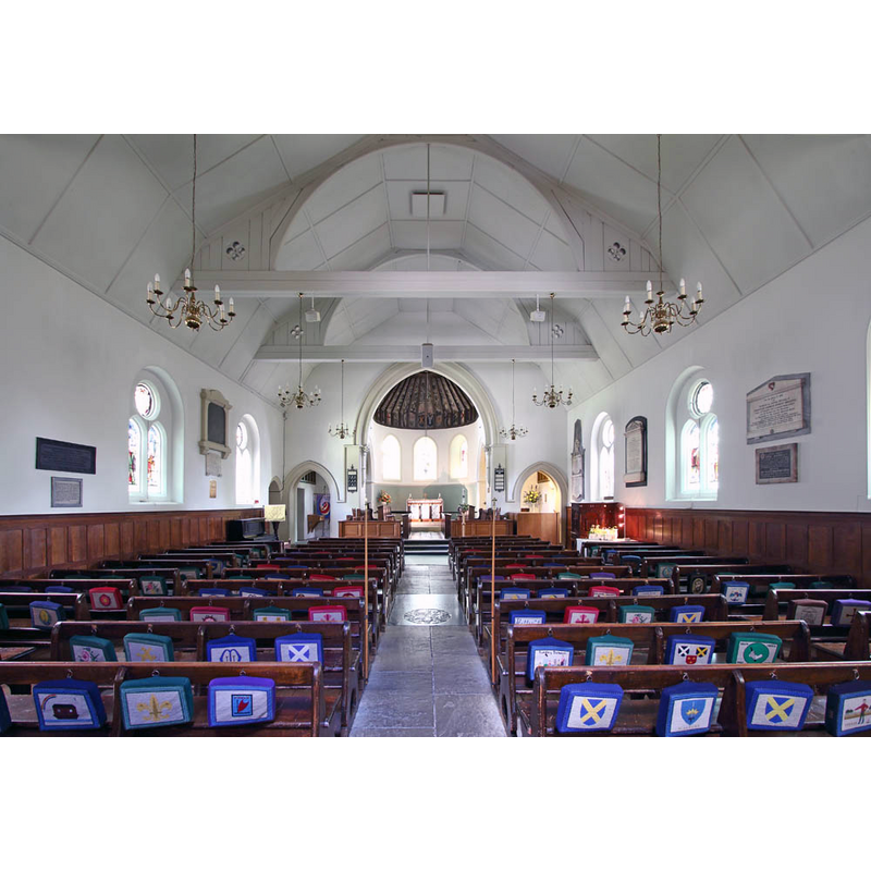
Scene Description: the 18th-19thC church
Copyright Statement: Image copyright © John Salmon, 2013
Image Source: digital photograph taken 9 May 2013 by John Salmon [www.geograph.org.uk/photo/3521916] [accessed 17 October 2016]
Copyright Instructions: CC-BY-SA-2.0
INFORMATION
Font ID: 20768TOT
Object Type: Baptismal Font1?
Font Century and Period/Style: 13th century, Medieval
Church / Chapel Name: Parish Church of St. Andrew [formerly St. Etheldreda's / St. Audrey's]
Church Patron Saint(s): St. Andrew [Etheldreda? / Audrey? [cf. Font Notes]]
Church Address: Totteridge Village, Totteridge, London, N20 8PR
Site Location: Greater London, South East, England, United Kingdom
Directions to Site: Located 4 km SW of Barnet, 16 km S of Hatfield
Ecclesiastic Region: Diocese of St. Albans
Historical Region: Hundred of Broadwater [formerly in Hertfordshire]
Additional Comments: disappeared font? (the one from the disappeared 13thC church here)
Font Notes:
Click to view
No entry found for Totteridge in the Domesday survey. The Victoria County History (Hertford, vol. 3, 1912) notes: "The church of St. Andrew at Totteridge has changed its invocation since the 16th century, […] when it was dedicated in honour of St. Etheldreda or Audrey, an invocation evidently borrowed from Ely. […] It is suggested that St. Andrew is a corruption of St. Audrey […] The present church dates wholly from the 18th and 19th centuries, but is on the old site, and in the churchyard is a yew tree 27 ft. in circumference. A church is known to have existed here at least from the end of the 13th century"; no font mentioned in the VCH entry.
COORDINATES
UTM: 30U 693759 5723860
Latitude & Longitude (Decimal): 51.63234, -0.20022
Latitude & Longitude (DMS): 51° 37′ 56.42″ N, 0° 12′ 0.79″ W
REFERENCES
- Victoria County History [online], University of London, 1993-. URL: https://www.british-history.ac.uk.