Sacombe / Savecampe / Savecome / Sawcompe / Sawecampe / Seuechampe / Sevechampe / Sevechaumpre / Stuochampa / Stuochampe / Sueuecampe / Sueuechamp / Suevecampe
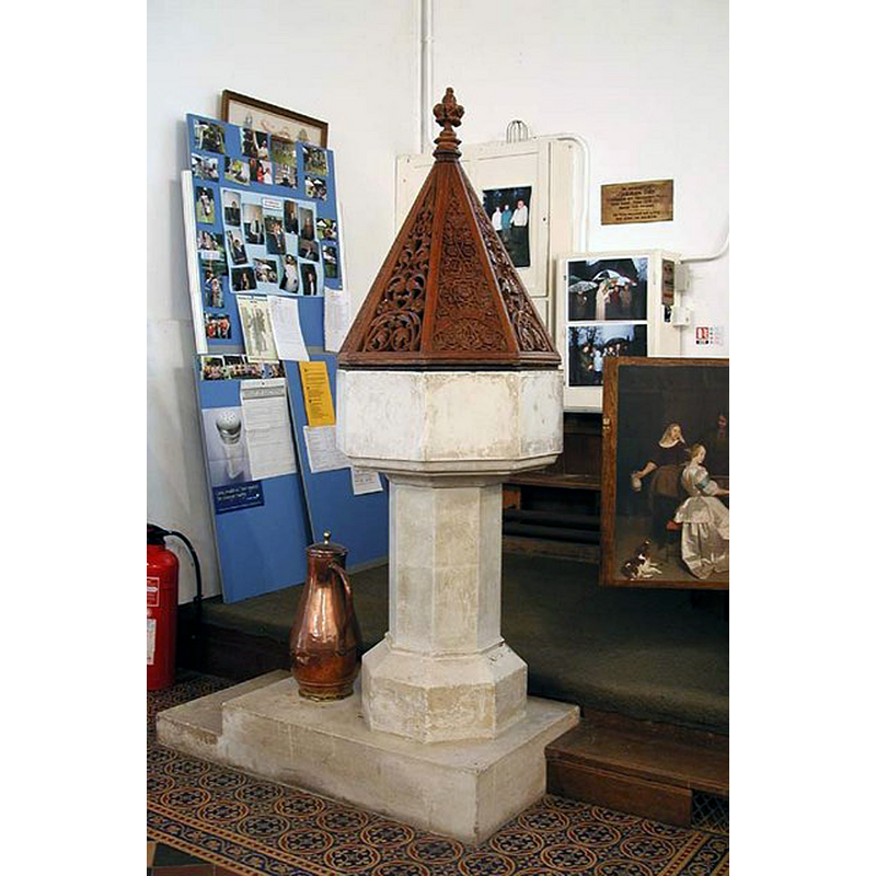
Image copyright © John Salmon, 2007
CC-BY-SA-2.0
Results: 4 records
view of font and cover
Scene Description: the modern font
Copyright Statement: Image copyright © John Salmon, 2007
Image Source: digital photograph taken 13 September 2003 by John Salmon [www.geograph.org.uk/photo/357758] [accessed 17 October 2016]
Copyright Instructions: CC-BY-SA-2.0
view of church exterior - southeast view
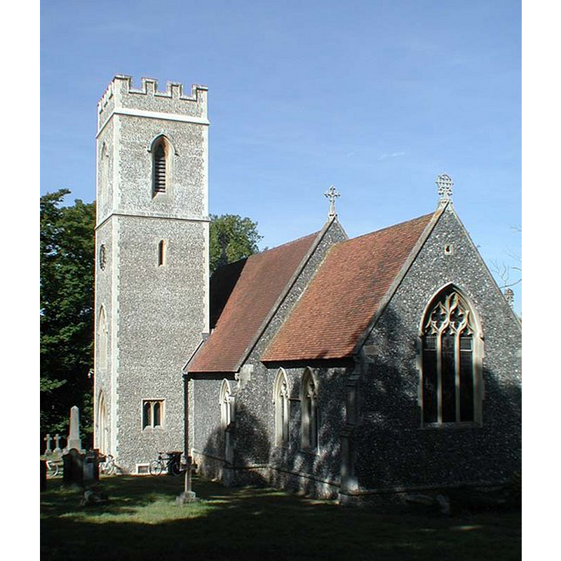
Copyright Statement: Image copyright © John Salmon, 2007
Image Source: digital photograph taken 13 September 2003 by John Salmon [www.geograph.org.uk/photo/357756] [accessed 17 October 2016]
Copyright Instructions: CC-BY-SA-2.0
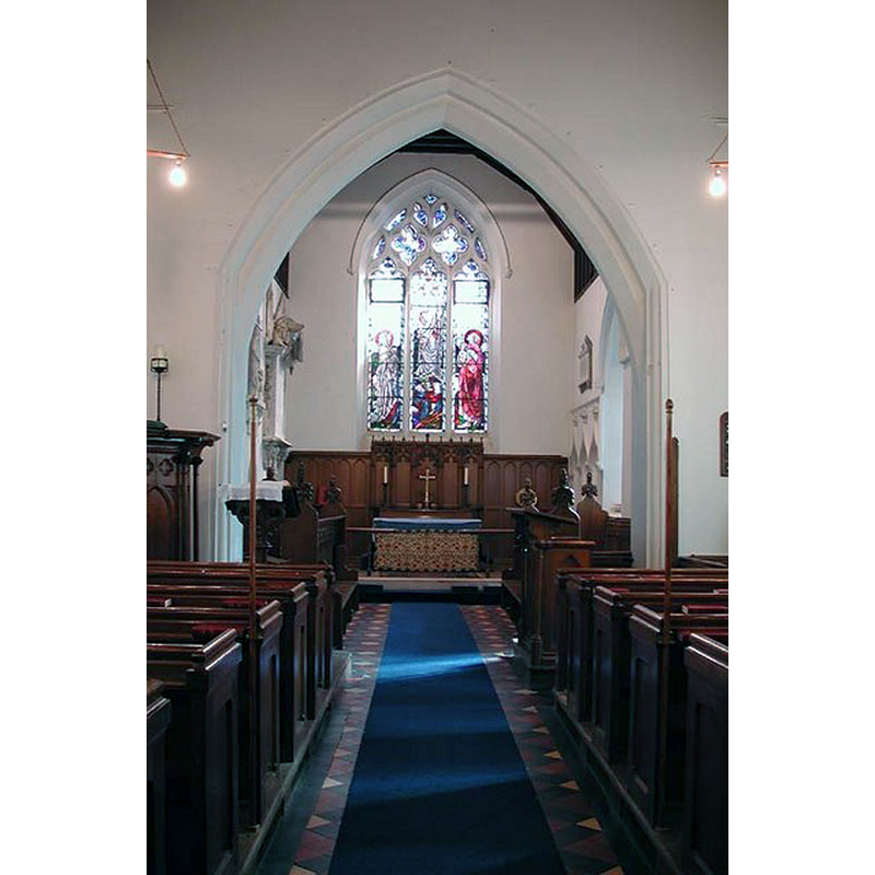
view of church interior - nave - looking west
![the modern font at the far [west] end, left [south] side, by the south entranceway](/static-50478a99ec6f36a15d6234548c59f63da52304e5/compressed/1161017004_compressed.png)
Scene Description: the modern font at the far [west] end, left [south] side, by the south entranceway
Copyright Statement: Image copyright © John Salmon, 2007
Image Source: digital photograph taken 13 September 2003 by John Salmon [www.geograph.org.uk/photo/357763] [accessed 17 October 2016]
Copyright Instructions: CC-BY-SA-2.0
view of church interior - nave - looking east
Copyright Statement: Image copyright © John Salmon, 2007
Image Source: digital photograph taken 13 September 2003 by John Salmon [www.geograph.org.uk/photo/357759] [accessed 17 October 2016]
Copyright Instructions: CC-BY-SA-2.0
INFORMATION
Font ID: 20767SAC
Object Type: Baptismal Font1?
Font Century and Period/Style: 11th century, Pre-Conquest? / Norman
Church / Chapel Name: Parish Church of St. Katherine [at some point St. Mary's]
Church Patron Saint(s): St. Catherine of Alexandria [aka Katherine]
Church Address: Sacombe Green Rd, Ware SG12 0JJ, United Kingdom
Site Location: Hertfordshire, East, England, United Kingdom
Directions to Site: Located off (E) the A602, NNW of Hertford
Ecclesiastic Region: Diocese of St. Albans
Historical Region: Hundred of Broadwater
Additional Comments: disappeared font? (the one from the Domesday-time church here)
Font Notes:
Click to view
There are five entries for Sacombe [variant spelling] in the Domesday survey [http://opendomesday.org/place/TL3319/sacombe/] [accessed 17 October 2016], one of which, in the lordship and tenancy-in-chief of Peter of Valognes mentions a cleric among the householders, but not a church in it, although there probably was one there. The Victoria County History (Hertford, vol. 3, 1912) notes: "In 1086 there was a clerk [sic] among the tenants of the manor, […] so that there was probably then a church there […] The church is now generally known as the church of St. Catherine, but the earlier invocation seems to have been St. Mary […] The original plan of the 14th-century church was the same as that of the present building, and the chancel and nave are of that date. The tower was rebuilt in 1855–6, and the north vestry was added at the same time, when the whole church was restored, faced with flint and re-roofed. A great part of the stonework of this church was brought from the demolished church of Thundridge"; there is no mention of a font in the VCH entry. The present font in this church, octagonal all over and almost totally plain, is modern, as is its pyramidal wooden cover.
COORDINATES
UTM: 30U 702354 5749139
Latitude & Longitude (Decimal): 51.856305, -0.061492
Latitude & Longitude (DMS): 51° 51′ 22.7″ N, 0° 3′ 41.37″ W
REFERENCES
- Victoria County History [online], University of London, 1993-. URL: https://www.british-history.ac.uk.