Pirton / Pedritone
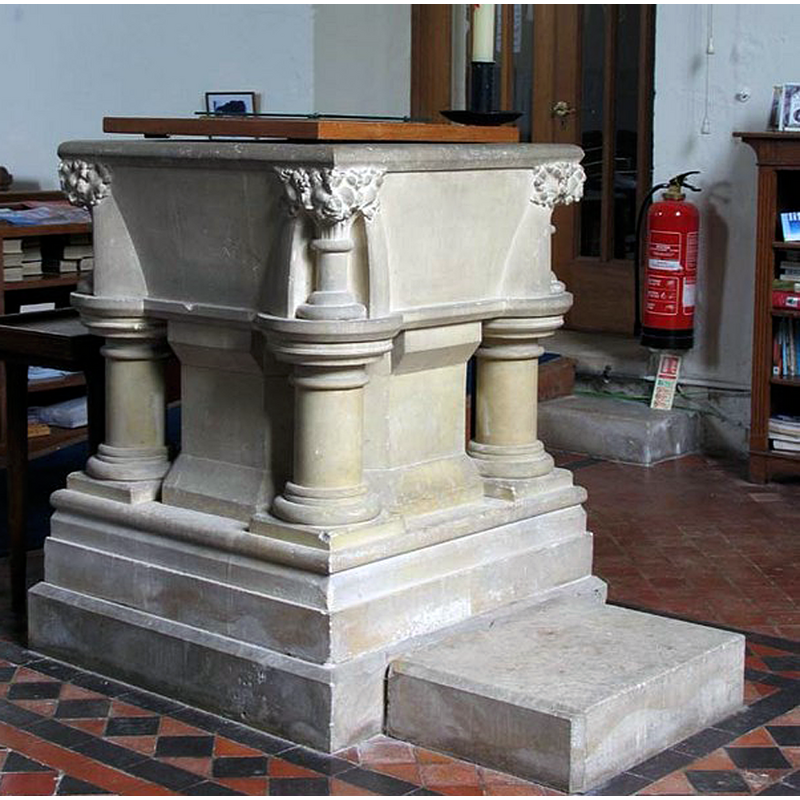
Image copyright © John Salmon, 2007
CC-BY-SA-2.0
Results: 4 records
view of font and cover
Scene Description: the modern font
Copyright Statement: Image copyright © John Salmon, 2007
Image Source: digital photograph taken 18 May 2007 by John Salmon [www.geograph.org.uk/photo/471783] [accessed 12 October 2016]
Copyright Instructions: CC-BY-SA-2.0
view of church exterior - northeast view
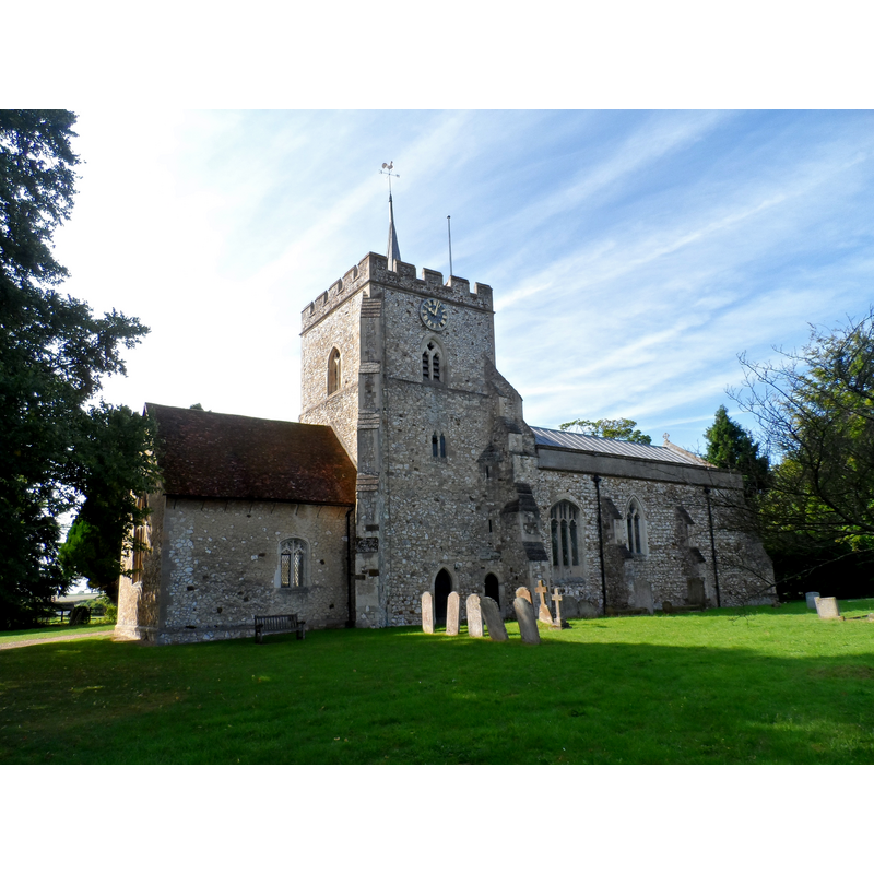
Scene Description: Source caption: "St Mary's, Pirton. The original church was built in C12 and had a central tower, chancel and nave. Alterations were made in C14 and C15 and during the restoration of 1883, the tower was rebuilt." -- showing here the chancel to the left of the tower, the nave to the right
Copyright Statement: Image copyright © Bikeboy, 2015
Image Source: digital photograph taken 15 August 2015 by Bikeboy [www.geograph.org.uk/photo/4619085] [accessed 12 October 2016]
Copyright Instructions: CC-BY-SA-2.0
view of church interior - nave - looking west
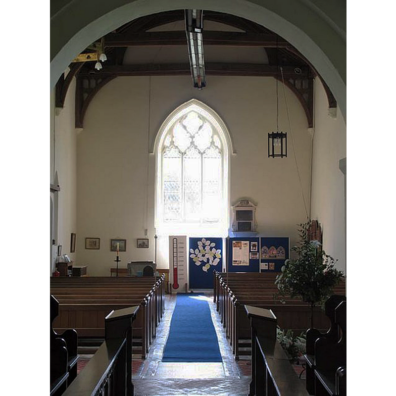
Copyright Statement: Image copyright © John Salmon, 2007
Image Source: digital photograph taken 18 May 2007 by John Salmon [www.geograph.org.uk/photo/471789] [accessed 12 October 2016]
Copyright Instructions: CC-BY-SA-2.0
view of church interior - nave - looking east
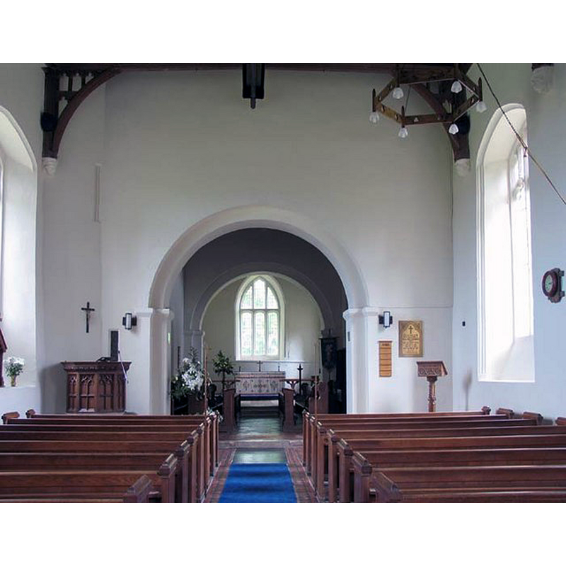
Copyright Statement: Image copyright © John Salmon, 2007
Image Source: digital photograph taken 18 May 2007 by John Salmon [www.geograph.org.uk/photo/471785] [accessed 12 October 2016]
Copyright Instructions: CC-BY-SA-2.0
INFORMATION
Font ID: 20764PIR
Object Type: Baptismal Font1
Font Century and Period/Style: 11th century, Pre-Conquest? / Norman
Church / Chapel Name: Parish Church of St. Mary
Church Patron Saint(s): St. Mary the Virgin
Church Address: 9 Crab Tree Lane, Pirton, Hertfordshire SG5 3QE
Site Location: Hertfordshire, East, England, United Kingdom
Directions to Site: Located NW of Hitchin
Ecclesiastic Region: Diocese of St. Albans
Historical Region: Hundred of Hitchin
Additional Comments: disappeared font? (the one from the Domesday-time church here)
Font Notes:
Click to view
There is an entry for this Pirton [variant spelling] in the Domesday survey [http://opendomesday.org/place/TL1431/pirton/] [accessed 12 October 2016]; it mentions a priest but not a church, thought there probably was one there. The Victoria County History (Herfordshire, vol. 3, 1912) notes: "In the 11th or early 12th century Ralph de Limesi gave the church of Pirton with the tithes of his lands there […] to the priory of St. Mary, Hertford, which he founded as a cell to St. Albans. A vicarage was ordained before the beginning of the 13th century […] The original church, consisting of a chancel, nave and central tower, was built in the 12th century"; there is no mention of a font in the VCH entry. The entry for this church in English Heritage [Listing NGR: TL1469431661] (1968) reports: "Caen stone font on Portland stone base 1883 with battered square bowl, corner shafts breaking into knobbly foliage. Fat octagonal haft and 4 stumpy columns on square chamfered base." [NB: the present [2007] font is modern; the square basin does not look battered at all; was it replaced recently?]
COORDINATES
UTM: 30U 683282 5761181
Latitude & Longitude (Decimal): 51.97105, -0.3317
Latitude & Longitude (DMS): 51° 58′ 15.78″ N, 0° 19′ 54.12″ W
REFERENCES
- Victoria County History [online], University of London, 1993-. URL: https://www.british-history.ac.uk.