Santiago de Queretaro No. 2 / Créttaro / Maxei / Ndamaxei / Santiago de Querétaro
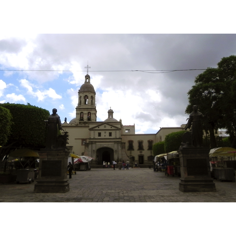
Image copyright © P.Fossas, 2012
CC-BY-SA-3.0
Results: 3 records
view of church exterior in context - west view
Copyright Statement: Image copyright © P.Fossas, 2012
Image Source: digital photograph taken 20 July 2012 by P.Fossas [https://commons.wikimedia.org/wiki/File:Iglesia_de_la_Cruz,_Queretaro.JPG] [accessed 8 October 2016]
Copyright Instructions: CC-BY-SA-3.0
view of church exterior in context - west view
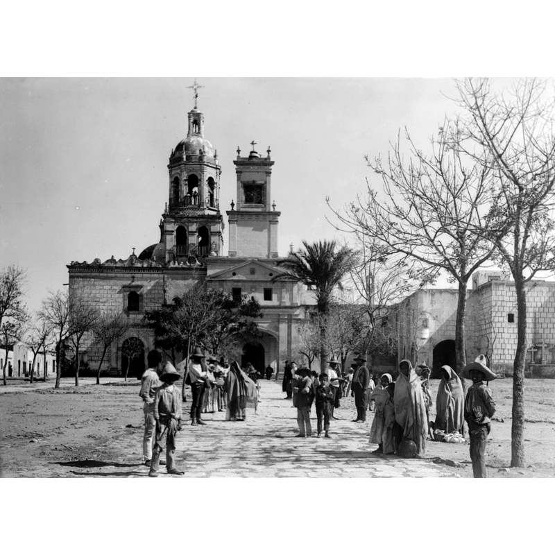
Scene Description: Source caption: "Photograph of the church of La Cruz, Queretaro, Mexico, ca.1905-1910. The open ornate dome on top and bell tower are prominent. A group of a couple dozen people are standing about the paved walkway which is sparsely lined with trees, leading through the plaza toward the church."
Copyright Statement: Image copyright © [in the public domain]
Image Source: digital reproduction by the USC Digital Library of a ca. 1905-1910 B&W photograph in the California Historical Society Collection, 1860-1960, Title Insurance and Trust, and C.C. Pierce Photography Collection, 1860-1960 [https://commons.wikimedia.org/wiki/File:Church_of_La_Cruz,_Queretaro,_Mexico,_ca.1905-1910_(CHS-644).jpg] [accessed 8 October 2016]
Copyright Instructions: PD 1923
view of church interior - nave - looking east
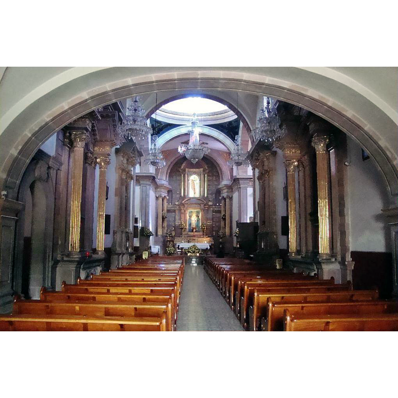
Copyright Statement: Image copyright © Enrique López-Tamayo Biosca, 2011
Image Source: digital photograph taken 14 November 2011 by Enrique López-Tamayo Biosca, Catedrales e Iglesias, Album 2719 [www.flickr.com/photos/eltb/6402871885] [accessed 8 October 2016]
Copyright Instructions: CC-BY-SA-2.0
INFORMATION
Font ID: 20760QUE
Object Type: Baptismal Font1
Font Century and Period/Style: 17th century
Church / Chapel Name: Templo y exconvento franciscano de la Santa Cruz
Font Location in Church: [disappeared]
Church Patron Saint(s): The Holy Cross
Church Notes: founded 17thC; expanded 1735; in 1867 served as general headquarters to emperor Maximiliano
Church Address: c/ Independencia s/n, Centro, 76020 Santiago de Querétaro, QRO, Mexico -- Tel.: +52 442 212 0235
Site Location: Querétaro, Mexico, North America
Directions to Site: Located 63 km SE of San Miguel de Allende, 200 km S of San Luis Potosí, 215 km NW of Ciudad de Mexico. The church is located in the Centro Histórico
Ecclesiastic Region: Diócesis de Querétaro
Additional Comments: disappeared font? (the one from the original 17thC church here)
Font Notes:
Click to view
[NB: we have no information on the original baptismal font here]
COORDINATES
UTM: 14Q 355810 2277741
Latitude & Longitude (Decimal): 20.593214, -100.383572
Latitude & Longitude (DMS): 20° 35′ 35.57″ N, 100° 23′ 0.86″ W