Ickleford / Hikleford / Icklesford / Ikeleford / Ikeligford
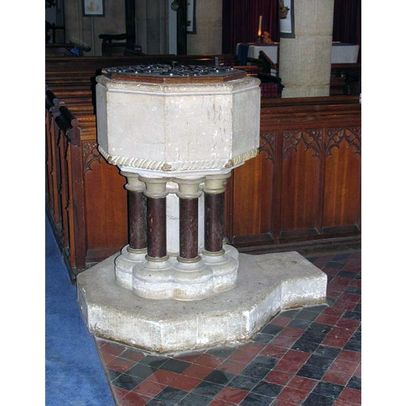
Image copyright © John Salmon, 2007
CC-BY-SA-2.0
Results: 3 records
view of font and cover
Scene Description: the modern font
Copyright Statement: Image copyright © John Salmon, 2007
Image Source: digital photograph taken 18 May 2007 by John Salmon [www.geograph.org.uk/photo/471880] [accessed 5 October 2016]
Copyright Instructions: CC-BY-SA-2.0
view of church exterior - southeast view
![EXT SE digital photograph taken 18 May 2007 by John Salmon [www.geograph.org.uk/photo/471875] [accessed 5 October 2016]
INT+MOD FONT digital photograph taken 18 May 2007 by John Salmon [www.geograph.org.uk/photo/471885] [accessed 5 October 2016]
MOD FONT digital photograph taken 18 May 2007 by John Salmon [www.geograph.org.uk/photo/471880] [accessed 5 October 2016]](/static-50478a99ec6f36a15d6234548c59f63da52304e5/compressed/1161006009_compressed.png)
Scene Description: EXT SE digital photograph taken 18 May 2007 by John Salmon [www.geograph.org.uk/photo/471875] [accessed 5 October 2016]
INT+MOD FONT digital photograph taken 18 May 2007 by John Salmon [www.geograph.org.uk/photo/471885] [accessed 5 October 2016]
MOD FONT digital photograph taken 18 May 2007 by John Salmon [www.geograph.org.uk/photo/471880] [accessed 5 October 2016]
Copyright Statement: Image copyright © John Salmon, 2007
Image Source: digital photograph taken 18 May 2007 by John Salmon [www.geograph.org.uk/photo/471875] [accessed 5 October 2016]
Copyright Instructions: CC-BY-SA-2.0
view of church interior - nave - looking southeast
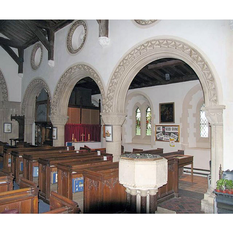
Scene Description: across to the south aisle; the modern font in the foreground
Copyright Statement: Image copyright © John Salmon, 2007
Image Source: digital photograph taken 18 May 2007 by John Salmon [www.geograph.org.uk/photo/471885] [accessed 5 October 2016]
Copyright Instructions: CC-BY-SA-2.0
INFORMATION
Font ID: 20750ICK
Object Type: Baptismal Font1?
Font Century and Period/Style: 12th century, Late Norman
Church / Chapel Name: Parish Church of St. Katherine
Church Patron Saint(s): St. Catherine of Alexandria [aka Katherine, Katharine]
Church Address: Greenfield Lane, Ickleford, Hertfordshire SG5 3TG
Site Location: Hertfordshire, East, England, United Kingdom
Directions to Site: Located off the A600, just N of Hitchin
Ecclesiastic Region: Diocese of St. Albans
Historical Region: Hundred of Hitchin -- formerly in Beds.
Additional Comments: disappeared font? (the one from the 12thC church here)
Font Notes:
Click to view
No entry found for Ickleford in the Domesday survey. The Victoria County History (Hertfordshire, vol. 3, 1912) notes: "The earliest part of the church is the nave, dating from the middle of the 12th century. The chancel and west tower were built early in the following century, and the south porch was added about the middle of the 15th century. In 1859 the church was restored and the south aisle, south chapel and north vestry were added;" there is no mention of a font in the VCH entry.
COORDINATES
UTM: 30U 686802 5761309
Latitude & Longitude (Decimal): 51.97103, -0.28045
Latitude & Longitude (DMS): 51° 58′ 15.71″ N, 0° 16′ 49.62″ W
REFERENCES
- Victoria County History [online], University of London, 1993-. URL: https://www.british-history.ac.uk.