Hexton / Hegastanestone / Hegestanestone / Hehstanstuna / Hextenestona / Hextone
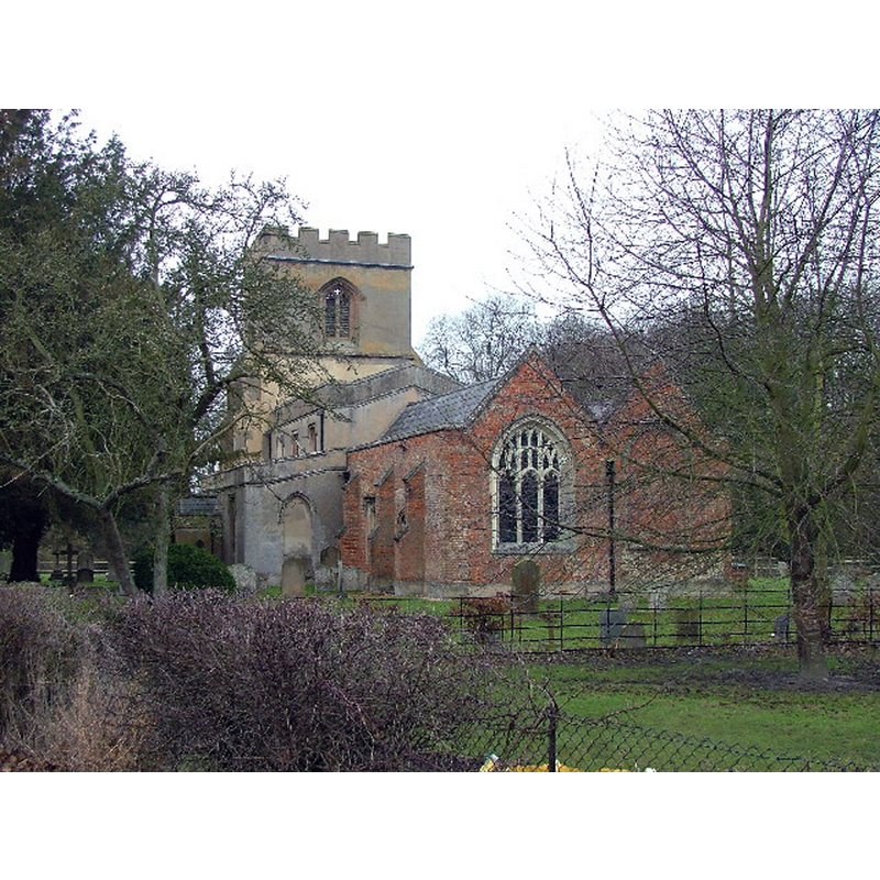
Image copyright © Robin Hall, 2006
CC-BY-SA-2.0
Results: 1 records
view of church exterior - southeast view
Copyright Statement: Image copyright © Robin Hall, 2006
Image Source: digital photograph taken 29 January 2006 by Robin Hall [www.geograph.org.uk/photo/113854] [accessed 21 September 2016]
Copyright Instructions: CC-BY-SA-2.0
INFORMATION
Font ID: 20745HEX
Object Type: Baptismal Font1?
Font Century and Period/Style: 12th century (early?), Norman
Church / Chapel Name: Parish Church of St. Faith
Church Patron Saint(s): St. Faith [aka Faith of Conques, Foy]
Church Address: Barton Road, Hitchin SG5 3JN SG5 3JN
Site Location: Hertfordshire, East, England, United Kingdom
Directions to Site: Located just W of Pegsdon, WNW of Hitchin, NNE of Luton
Ecclesiastic Region: Diocese of St. Albans
Historical Region: Hundred of Hitchin [in Domesday] -- Hundred of Cashio
Font Notes:
Click to view
There are three entries for Hexton [variant spelling] in the Domesday survey [http://opendomesday.org/place/TL1030/hexton/] [accessed 21 September 2016], none of which mentions cleric or church in it. The Victoria County History (Hertfordshire, vol. 2, 1908) notes: "Ralph bishop of Rochester (1108–14) dedicated the church of Hexton in honour of St. Faith, Virgin and Martyr […] The church of ST. FAITH has lost whatever historical interest it may have had in the early days of the Gothic revival […] The octagonal font is modern and stands at the west end of the south aisle, and there are no old fittings in the church".
COORDINATES
UTM: 30U 678900 5759820
Latitude & Longitude (Decimal): 51.960252, -0.396139
Latitude & Longitude (DMS): 51° 57′ 36.91″ N, 0° 23′ 46.1″ W
REFERENCES
- Victoria County History [online], University of London, 1993-. URL: https://www.british-history.ac.uk.