Bramfield / Bramfield nr. Hertford / Brandefelle / Brandfell / Brantefeldbury / Brantefelde / Brantfeld / Brauntesfeld
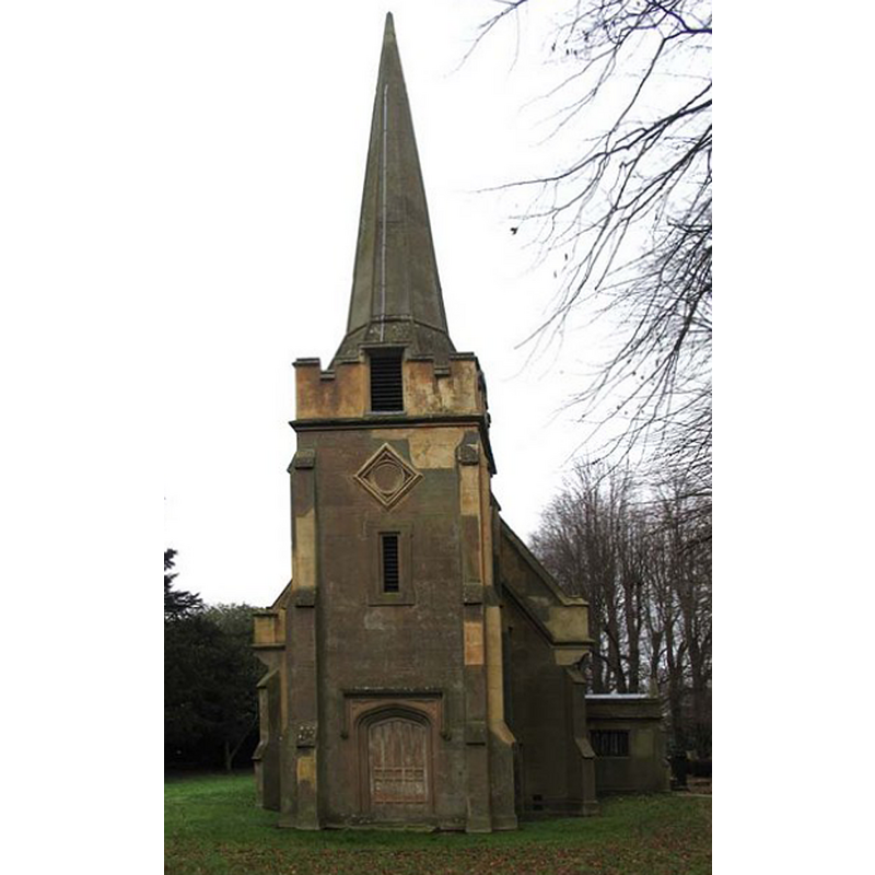
Image copyright © John Salmon, 2007
CC-BY-SA-2.0
Results: 2 records
view of church exterior - west view
Copyright Statement: Image copyright © John Salmon, 2007
Image Source: digital photograph taken 20 December 2005 by John Salmon [www.geograph.org.uk/photo/367941] [accessed 21 September 2016]
Copyright Instructions: CC-BY-SA-2.0
view of church exterior - southeast view
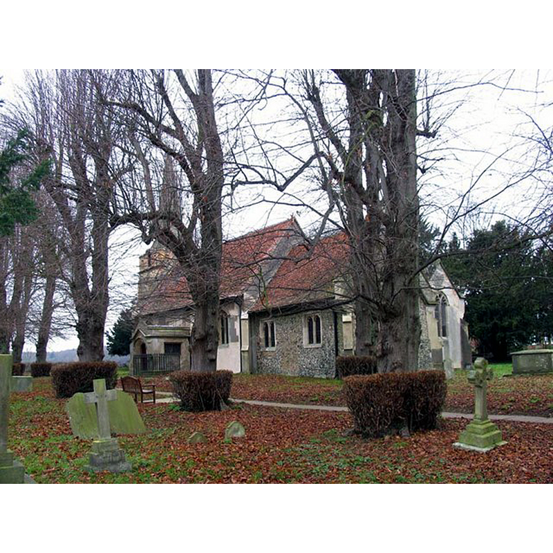
Copyright Statement: Image copyright © John Salmon, 2007
Image Source: digital photograph taken 20 December 2005 by John Salmon [www.geograph.org.uk/photo/367933] [accessed 21 September 2016]
Copyright Instructions: CC-BY-SA-2.0
INFORMATION
Font ID: 20743BRA
Object Type: Baptismal Font1?
Font Century and Period/Style: 14th century (late?), Early Perpendicular
Church / Chapel Name: Parish Church of St. Andrew
Church Patron Saint(s): St. Andrew
Church Address: 2 Bury Lane, Bramfield, Hertfordshire, SG14 2QJ
Site Location: Hertfordshire, East, England, United Kingdom
Directions to Site: Located 6 km NW of Hertford
Ecclesiastic Region: Diocese of St. Albans
Historical Region: Hundred of Hertford [in Domesday] -- Hundred of Cashio
Additional Comments: disappeared font? (the one from the 14thC church here)
Font Notes:
Click to view
There is an entry for this Bramfield [variant spelling] in the Domesday survey [http://opendomesday.org/place/TL2915/bramfield/] [accessed 21 September 2016], but it mentions neither cleric nor church here. The Victoria County History (Hertfordshire, vol. 2, 1908) notes: "The simple plan of nave and chancel has probably remained unaltered from an early date, but a drastic restoration in 1840 has removed nearly all traces of antiquity from the building. […] The west tower was entirely built in 1840 […] The ground story of the tower is occupied by a modern font"; we found no further indication to the original date of the church in the VCH entry. The entry for this church in English Heritage [Listing NGR: TL2913415592] (1986) suggests late-14th century origins for the church, with a font introduced in the 1870s restoration by C.B. Trollope.
COORDINATES
UTM: 30U 697935 5745377
Latitude & Longitude (Decimal): 51.824107, -0.12774
Latitude & Longitude (DMS): 51° 49′ 26.78″ N, 0° 7′ 39.86″ W
REFERENCES
- Victoria County History [online], University of London, 1993-. URL: https://www.british-history.ac.uk.