Bradfield St. Clare
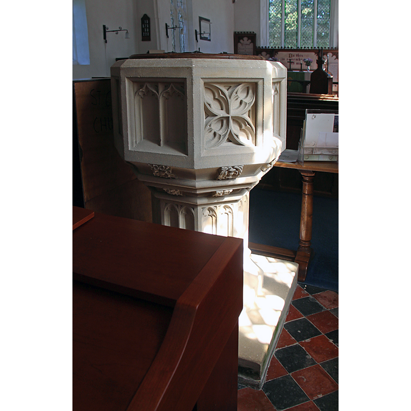
Image copyright © John Salmon, 2016
CC-BY-SA-2.0
Results: 4 records
view of font and cover
Scene Description: the modern font
Copyright Statement: Image copyright © John Salmon, 2016
Image Source: digital photograph taken 26 August 2016 by John Salmon [www.geograph.org.uk/photo/5108372] [accessed 14 September 2016]
Copyright Instructions: CC-BY-SA-2.0
view of church exterior - southwest view
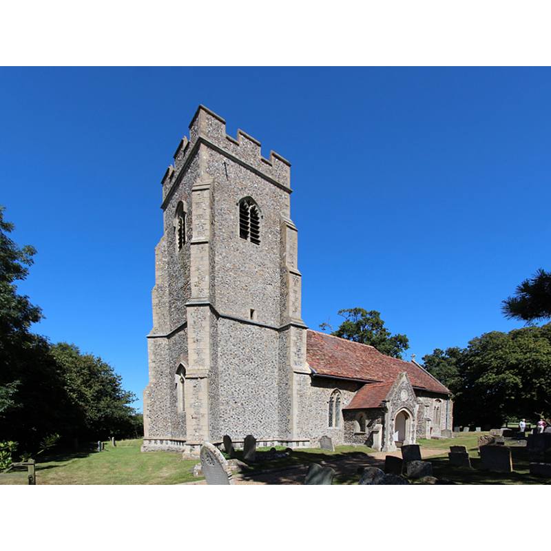
Copyright Statement: Image copyright © John Salmon, 2016
Image Source: digital photograph taken 26 August 2016 by John Salmon [www.geograph.org.uk/photo/5108360] [accessed 14 September 2016]
Copyright Instructions: CC-BY-SA-2.0
view of church exterior - southeast view
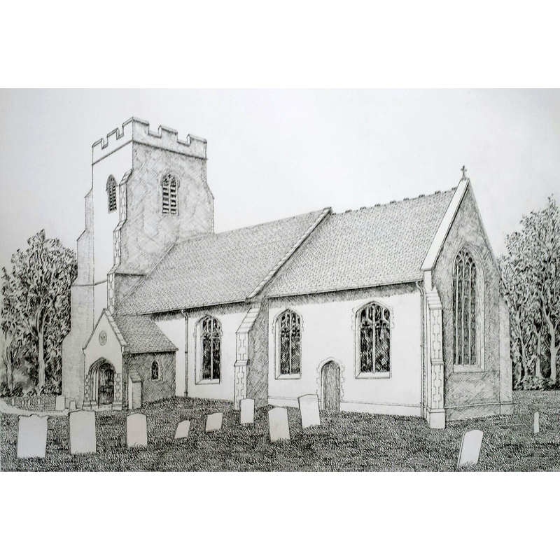
Copyright Statement: Image copyright © Robert Wilkes, 2016
Image Source: digital image of a 2016 drawing by Robert Wilkes
Copyright Instructions: Standing permission
view of church interior - nave - looking east
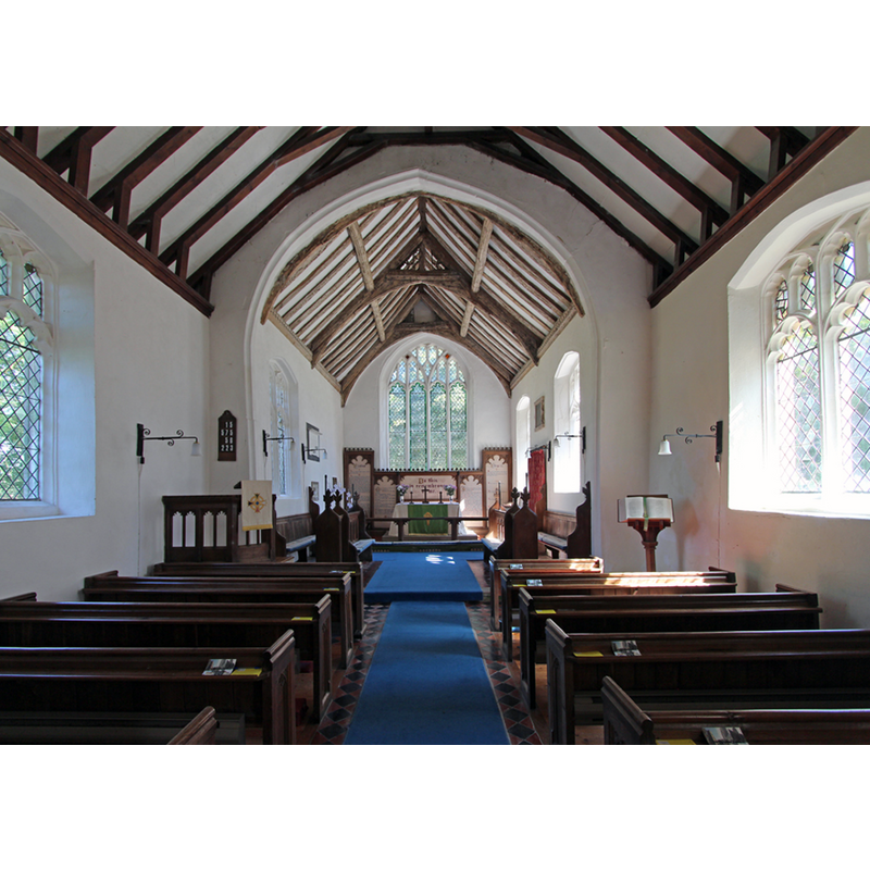
Copyright Statement: Image copyright © John Salmon, 2016
Image Source: digital photograph taken 26 August 2016 by John Salmon [www.geograph.org.uk/photo/5108364] [accessed 14 September 2016]
Copyright Instructions: CC-BY-SA-2.0
INFORMATION
Font ID: 20735BRA
Object Type: Baptismal Font1?
Font Century and Period/Style: 14th century, Decorated
Church / Chapel Name: Parish Church of St. Clare
Church Patron Saint(s): St. Claire of Assissi
Church Address: Bury Road, Bradfield St Clare, Suffolk IP30 0EE
Site Location: Suffolk, East Anglia, England, United Kingdom
Directions to Site: Located 9-10 km S of Bury St Edmunds
Ecclesiastic Region: Diocese of Ely
Historical Region: Hundred of Thedwastre [in Domesday] -- Hundred of Thedwestry
Additional Comments: disappeared font? (the one from the 14thC church here)
Font Notes:
Click to view
There are three entries for Bradfield [St George, St Clare and Combust] in the Domesday survey [http://domesdaymap.co.uk/place/] [accessed 14 September 2016], one of which reports a church and church lands in it. The present font in this 14rh-century church is moderm [NB: we have no information on the font of the 14th-century church here].
COORDINATES
UTM: 31U 348986 5783860
Latitude & Longitude (Decimal): 52.184501, 0.791017
Latitude & Longitude (DMS): 52° 11′ 4.21″ N, 0° 47′ 27.66″ E