Kings Langley / King's Langley / Langelei
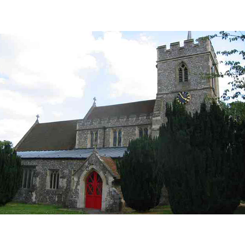
Image copyright © Jack Hill, 2005
CC-BY-SA-2.0
Results: 2 records
view of church exterior - north view
Copyright Statement: Image copyright © Jack Hill, 2005
Image Source: digital photograph taken 15 July 2005 by Jack Hill [www.geograph.org.uk/photo/27963] [accessed 19 September 2016]
Copyright Instructions: CC-BY-SA-2.0
view of church exterior - southwest view
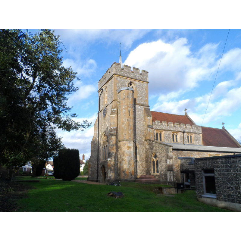
Scene Description: Source caption: "All Saints', Kings Langely. The church houses the tomb of the first Duke of York, Edmund of Langley 1341-1402. He was born and died in Langley although during his life he travelled widely on military expeditions."
Copyright Statement: Image copyright © Bikeboy, 2014
Image Source: digital photograph taken 1 February 2014 by Bikeboy [www.geograph.org.uk/photo/3833349] [accessed 19 September 2016]
Copyright Instructions: CC-BY-SA-2.0
INFORMATION
Font ID: 20734LAN
Object Type: Baptismal Font1?
Font Century and Period/Style: 12th - 13th century, Medieval
Church / Chapel Name: Parish Church of All Saints
Church Patron Saint(s): All Saints
Church Address: Church Lane, Kings Langley, Hertfordshire WD4 8JP
Site Location: Hertfordshire, East, England, United Kingdom
Directions to Site: Located off the A4251, just W of Abbot's Langley, SSE of Hemel Hempstead
Ecclesiastic Region: Diocese of St. Albans
Historical Region: Hundred of Danish [in Domesday] -- Hundred of Dacorum
Additional Comments: disappeared font? (the one from the 12th-13thC church here)
Font Notes:
Click to view
There is an entry for Kings Langley [variant spelling] in the Domesdayy survey [http://opendomesday.org/place/TL0702/kings-langley/] [accessed 14 September 2016], but it mentions neither cleric nor church in it. The Victoria County History (Hertfordshire, vol. 2, 1908) notes: "The patronage of King's Langley in early times seems to have passed with the manor of Shendish, as in 1215 a grant of the advowson by Alice wife of Ralph Chenduit, and her sons Simon and Hugh, to the prior and convent of St. Oswald, Nostell, was confirmed by King John. […] The walls of the chancel are of thirteenth-century date, and the nave probably retains the plan of a yet earlier aisleless building […] The font, in the west bay of the south arcade, is modern."
COORDINATES
UTM: 30U 676341 5731986
Latitude & Longitude (Decimal): 51.711061, -0.447523
Latitude & Longitude (DMS): 51° 42′ 39.82″ N, 0° 26′ 51.08″ W
REFERENCES
- Victoria County History [online], University of London, 1993-. URL: https://www.british-history.ac.uk.