Kensworth / Canesworda / Canesworde / Ikenesworth / Kenesburda / Kenisworye / Keynesworth / Kneysworth
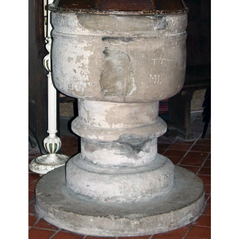
Image copyright © John Salmon, 2016
CC-BY-SA-2.0
Results: 8 records
view of font
Scene Description: notice the grafitti on its sides and the crude repairs
Copyright Statement: Image copyright © John Salmon, 2016
Image Source: edited detail of a digital photograph taken 17 June 2016 by John Salmon [www.geograph.org.uk/photo/5003528] [accessed 14 September 2016]
Copyright Instructions: CC-BY-SA-2.0
view of font and cover
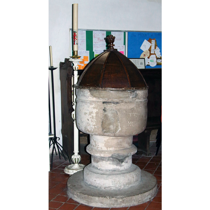
Copyright Statement: Image copyright © John Salmon, 2016
Image Source: edited detail of a digital photograph taken 17 June 2016 by John Salmon [www.geograph.org.uk/photo/5003528] [accessed 14 September 2016]
Copyright Instructions: CC-BY-SA-2.0
design element - motifs - groove
Copyright Statement: Image copyright © John Salmon, 2016
Image Source: edited detail of a digital photograph taken 17 June 2016 by John Salmon [www.geograph.org.uk/photo/5003528] [accessed 14 September 2016]
Copyright Instructions: CC-BY-SA-2.0
view of church exterior - northeast view
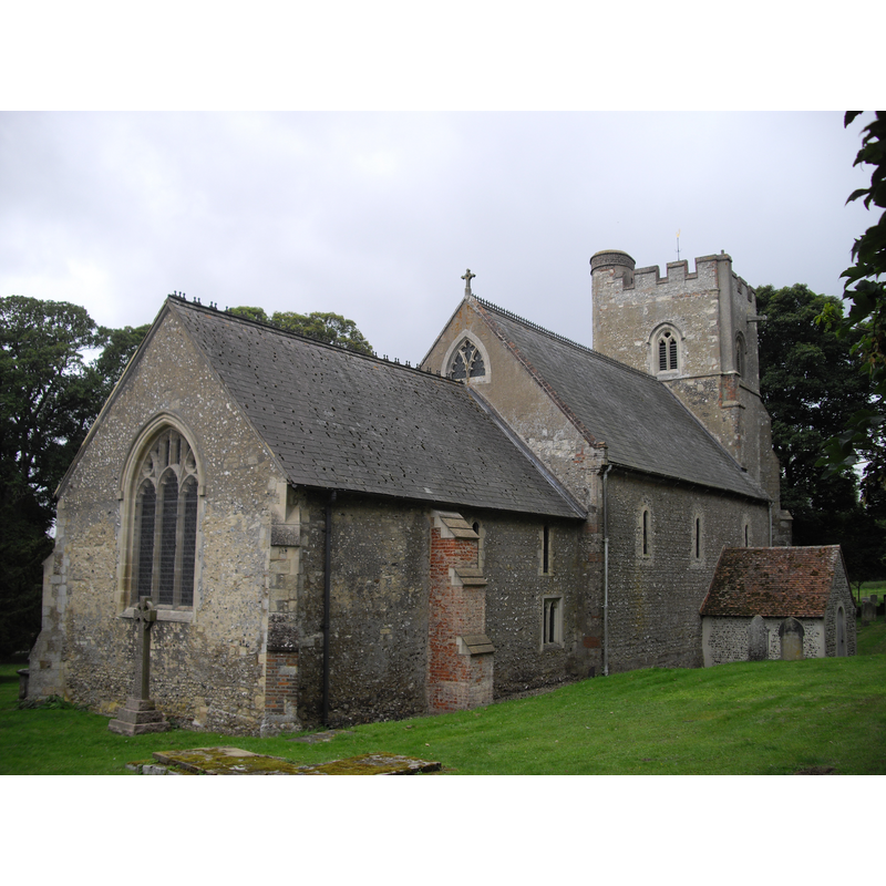
Copyright Statement: Image copyright © John Salmon, 2016
Image Source: digital photograph taken 3 September 2011 by John Lord [www.geograph.org.uk/photo/2584601] [accessed 14 September 2016]
Copyright Instructions: CC-BY-SA-2.0
view of church exterior - south view
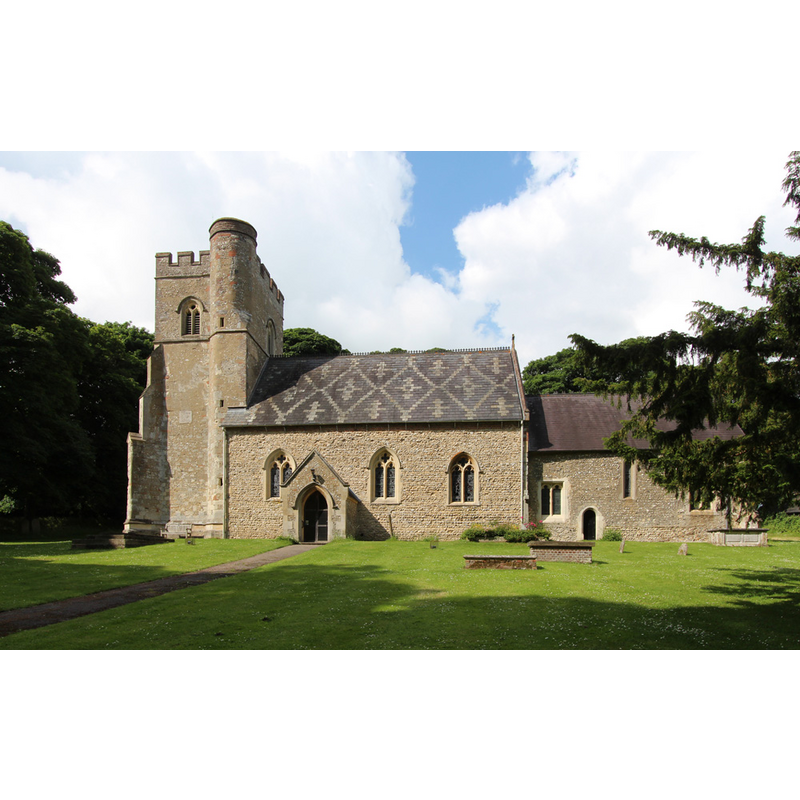
Copyright Statement: Image copyright © John Salmon, 2016
Image Source: digital photograph taken 17 June 2016 by John Salmon [www.geograph.org.uk/photo/5003515] [accessed 14 September 2016]
Copyright Instructions: CC-BY-SA-2.0
view of church interior - nave - looking east
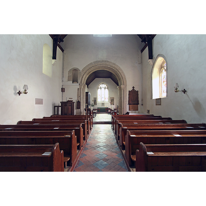
Copyright Statement: Image copyright © John Salmon, 2016
Image Source: digital photograph taken 17 June 2016 by John Salmon [www.geograph.org.uk/photo/5003518] [accessed 14 September 2016]
Copyright Instructions: CC-BY-SA-2.0
view of font cover
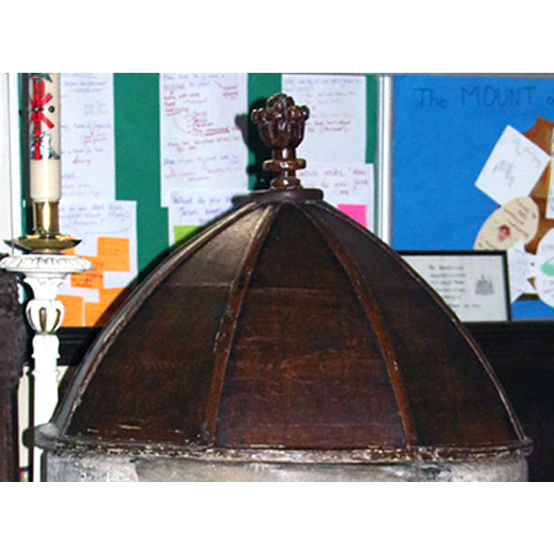
Copyright Statement: Image copyright © John Salmon, 2016
Image Source: edited detail of a digital photograph taken 17 June 2016 by John Salmon [www.geograph.org.uk/photo/5003528] [accessed 14 September 2016]
Copyright Instructions: CC-BY-SA-2.0
design element - motifs - roll moulding
Copyright Statement: Image copyright © John Salmon, 2016
Image Source: edited detail of a digital photograph taken 17 June 2016 by John Salmon [www.geograph.org.uk/photo/5003528] [accessed 14 September 2016]
Copyright Instructions: CC-BY-SA-2.0
INFORMATION
Font ID: 20733KEN
Object Type: Baptismal Font1
Font Century and Period/Style: 15th century, Late Medieval
Church / Chapel Name: Parish Church of St. Mary [aka Our Lady]
Font Location in Church: Inside the church, at the W end [cf. FontNotes]
Church Patron Saint(s): St. Mary the Virgin
Church Address: Hollick's Lane, Kensworth, Central Bedfordshire LU6 3RA
Site Location: Bedfordshire, East, England, United Kingdom
Directions to Site: Kensworth was transferred to Bedfordshire in 1897, but was originally in the hundred of Dacorum in Hertfordshire.
Historical Region: Hundred of Danish [in Domesday] -- Hundred of Dacorum -- formerly in Hertfordshire
Additional Comments: moved font? (within the church [cf. FontNotes])
Font Notes:
Click to view
There is antry for Kensworth [variant spelling] in the Domesday survey [http://opendomesday.org/place/TL0319/kensworth/] [accessed 14 September 2016], but it mentions neither cleric nor church in it. The Victoria County History (Hertfordshire, vol. 2, 1908) notes: "The west tower is an addition of the fifteenth century, and the chancel has been lengthened some 10 ft. in the same century, but with these exceptions and certain alterations to the windows, &c., the main structure remains as it was first built, somewhere about the year 1100 […] The church of Kensworth was granted to the dean and canons of London by Walter bishop of Lincoln in 1183–4 […] The font stands at the north-west of the nave, having formerly stood in the middle in front of the west doorway. It has a round bowl on a round stem with a central ring and a plain base, and though ancient is hard to date, perhaps belonging to the fifteenth century. It has a turned wooden cover with a finial, of no great age."
COORDINATES
UTM: 30U 671854 5748420
Latitude & Longitude (Decimal): 51.86007, -0.504264
Latitude & Longitude (DMS): 51° 51′ 36.25″ N, 0° 30′ 15.35″ W
MEDIUM AND MEASUREMENTS
Material: stone
Font Shape: cylindrical, mounted
Basin Interior Shape: round
Basin Exterior Shape: round
LID INFORMATION
Date: 18th - 19th century?
Material: wood, oak?
Apparatus: no
Notes: dome shaped with eight panels marked with arrises; floral finial
REFERENCES
- Victoria County History [online], University of London, 1993-. URL: https://www.british-history.ac.uk.