Guer No. 2 / Gwern-Porc'hoed / Gwern Porc'hoet / Wern
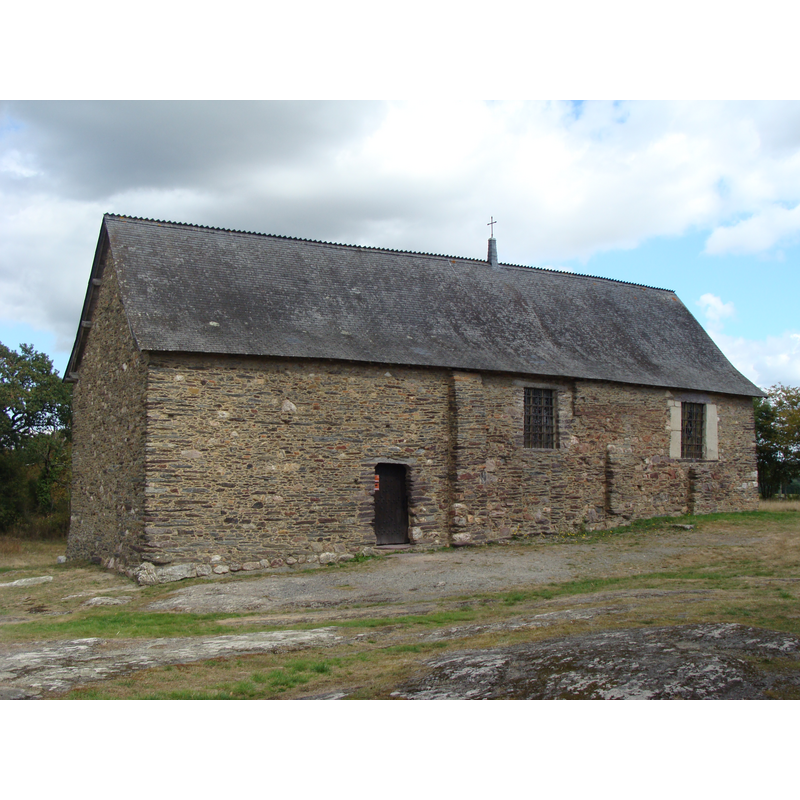
Image copyright © Pascal Greliche, 2012
CC-BY-SA-3.0
Results: 3 records
view of church exterior - southwest view
Copyright Statement: Image copyright © Pascal Greliche, 2012
Image Source: digital photograph taken 19 September 2012 by Pascal Greliche [https://commons.wikimedia.org/wiki/File:Chapelle_Saint-Étienne_de_Guer_02.JPG] [accessed 1 August 2016]
Copyright Instructions: CC-BY-SA-3.0
view of church exterior - northwest view
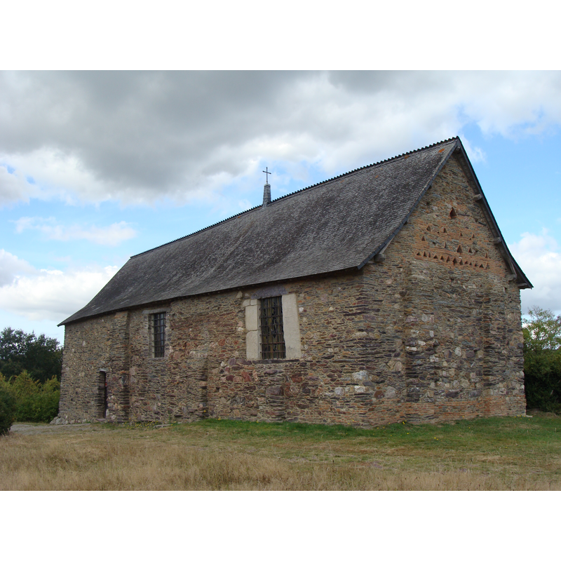
Copyright Statement: Image copyright © Pascal Greliche, 2012
Image Source: digital photograph taken 19 September 2012 by Pascal Greliche [https://commons.wikimedia.org/wiki/File:Chapelle_Saint-Étienne_de_Guer_01.JPG] [accessed 1 August 2016]
Copyright Instructions: CC-BY-SA-3.0
view of church interior - painting
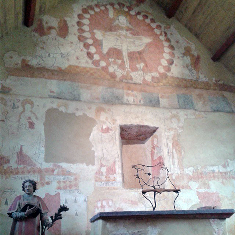
Scene Description: late-medieval (15thC?) mural paintings
Copyright Statement: Image copyright © Isa2886, 2014
Image Source: digital photograph taken 8 September 2014 by Isa2886 [https://commons.wikimedia.org/wiki/File:Peintures_Prieuré_Saint-Etienne.jpg] [accessed 1 August 2016]
Copyright Instructions: CC-BY-SA-4.0
INFORMATION
Font ID: 20685GUE
Object Type: Baptismal Font1?
Font Century and Period/Style: 9th - 12th century, Romanesque
Church / Chapel Name: Chapelle du prieuré Saint-Étienne
Font Location in Church: [disappeared]
Church Patron Saint(s): St. Stephen
Church Notes: 9thC priory (?) chapel built on Gallo-Roman site -- listed in Mérimée [ref.: PA00091244]: "Petit édifice sans doute remonté à l'époque carolingienne avec des matériaux et peut-être une partie du soubassement datant de l'époque gallo-romaine [...] 9e siècle".
Church Address: 56380 Guer, France -- Tel.: +33 2 97 93 26 74
Site Location: Morbihan, Bretagne, France, Europe
Directions to Site: Located off the D776-D773-D772-D311 confluence, just E of Porcaro, at the edge of the famous Forêt de Brocéliande, 43 km SW of Rennes
Ecclesiastic Region: Diocèse de Vannes [ancien évêché d'Alet-Saint-Malo]
Historical Region: Pays de Guer
Additional Comments: disappeared font? (wasd there a font here in earlier times?)
Font Notes:
Click to view
[NB: we have no information on a font here]
COORDINATES
UTM: 30T 561924 5306085
Latitude & Longitude (Decimal): 47.9051, -2.17139
Latitude & Longitude (DMS): 47° 54′ 18.36″ N, 2° 10′ 17″ W