Chateau-Gontier No. 1 / Château-Gontier
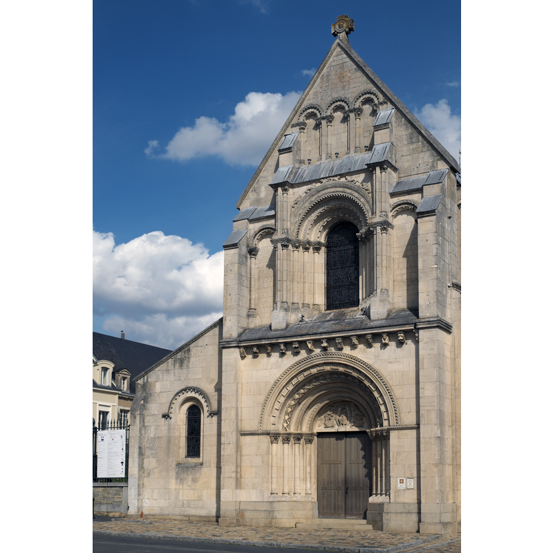
Image copyright © GFreihalter, 2015
CC-BY-SA-3.0
Results: 7 records
view of church exterior - west façade
Copyright Statement: Image copyright © GFreihalter, 2015
Image Source: digital photograph taken 18 August 2015 by GFreihalter [https://commons.wikimedia.org/wiki/File:Château-Gontier_Saint-Jean-Baptiste_242.jpg] [accessed 31 July 2016]
Copyright Instructions: CC-BY-SA-3.0
view of church exterior in context
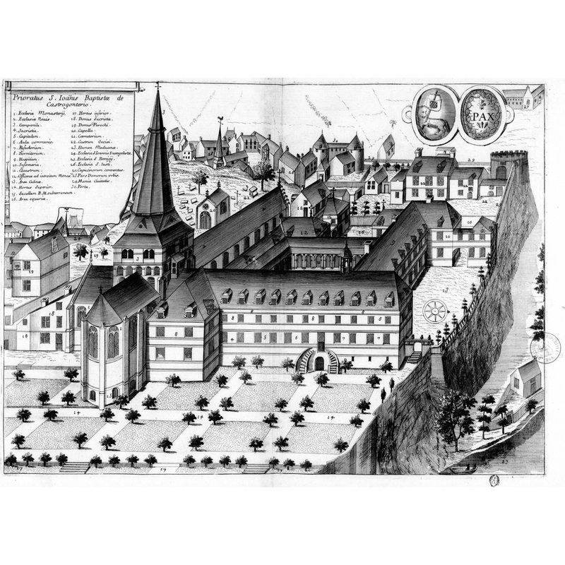
Copyright Statement: Image copyright © [in the public domain]
Image Source: digital image of a 17thC engraving in Dom Germain's Monasticon gallicanum, at the Bibliothèque nationale de France [https://commons.wikimedia.org/wiki/File:Prieuré_Saint-Jean-Baptiste_de_Château-Gontier_dans_Monasticon_gallicanum.jpg] [accessed 31 July 2016]
Copyright Instructions: CC-PD-Mark / PD-Art (PD-old-100)
view of church interior - painting
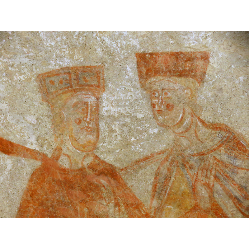
Scene Description: partial view of one of the mural paintings inside the church
Copyright Statement: Image copyright © Romain Bréget, 2012
Image Source: digital photograph taken 4 September 2012 by Romain Bréget [https://commons.wikimedia.org/wiki/File:Église_Saint-Jean-Baptiste_-_Château-Gontier_34.JPG] [accessed 31 July 2016]
Copyright Instructions: CC-BY-SA-3.0,2.5,2.0,1.0
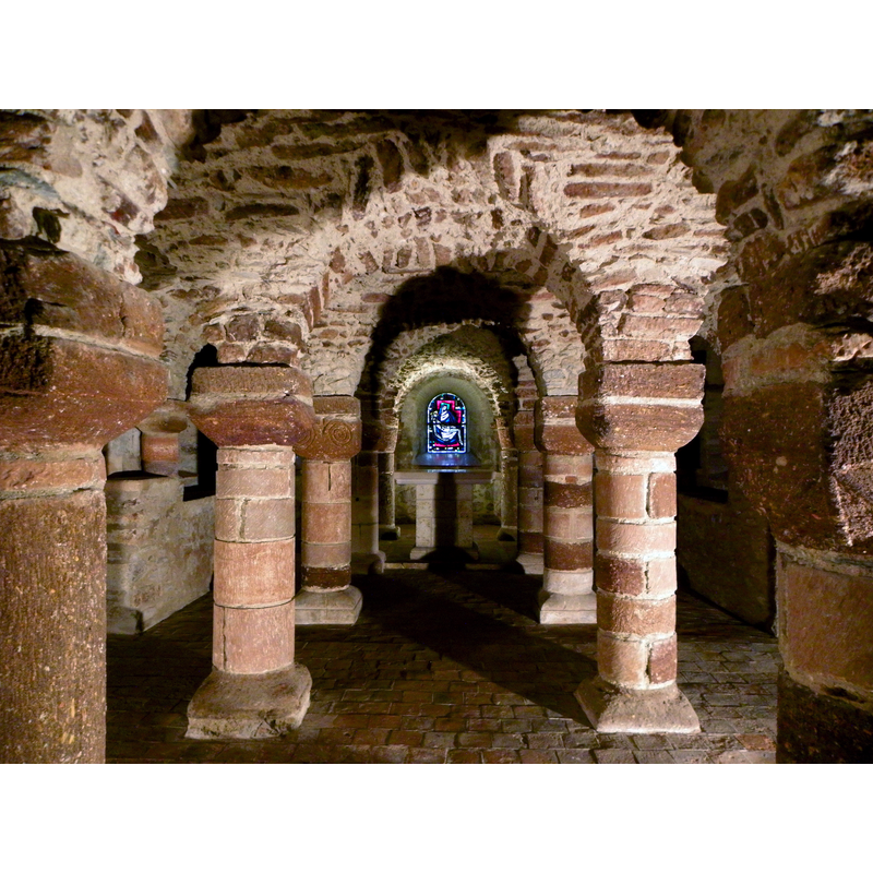
view of church interior - crypt - detail
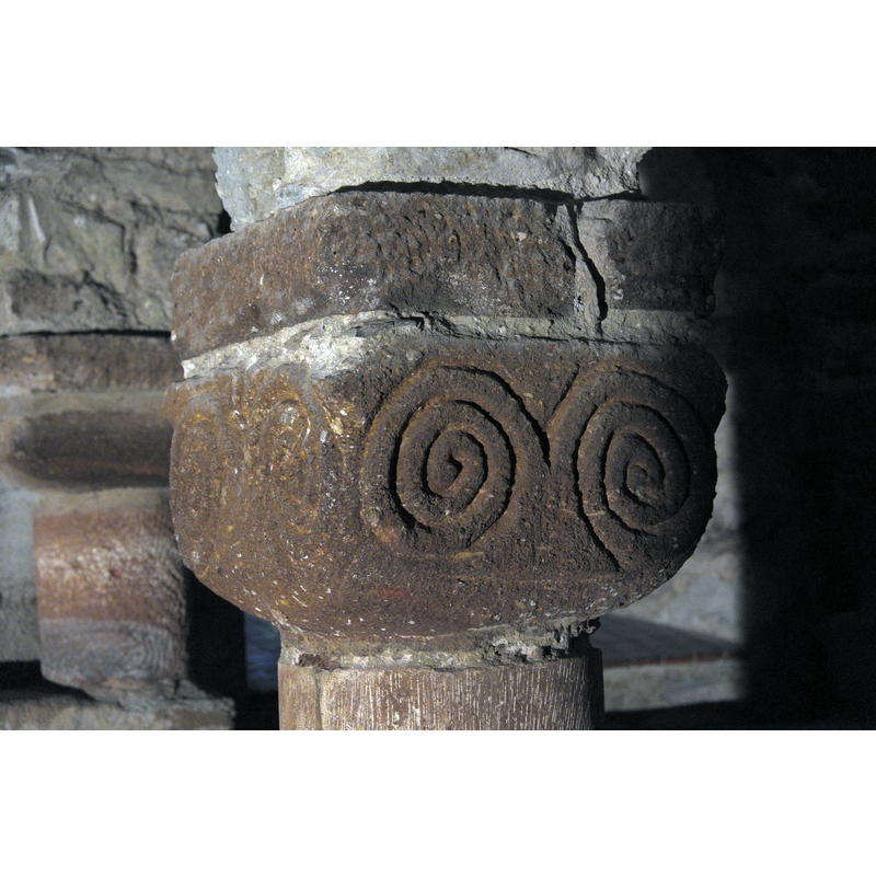
Copyright Statement: Image copyright © GFreihalter, 2015
Image Source: digital photograph taken 18 August 2015 by GFreihalter [https://commons.wikimedia.org/wiki/File:Château-Gontier_Saint-Jean-Baptiste_crypte_223.jpg] [accessed 31 July 2016]
Copyright Instructions: CC-BY-SA-3.0
view of church interior - crypt
Copyright Statement: Image copyright © GO69, 2012
Image Source: digital photograph taken 13 June 2012 by GO69 [https://commons.wikimedia.org/wiki/File:Château-Gontier_(53)_Église_Saint-Jean-Baptiste_Crypte_06.JPG] [accessed 31 July 2016]
Copyright Instructions: CC-BY-SA-4.0
view of church interior - nave - looking east
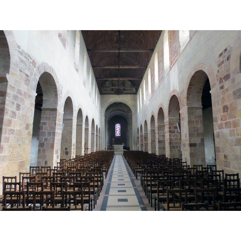
Copyright Statement: Image copyright © Romain Bréget, 2012
Image Source: digital photograph taken 4 September 2012 by Romain Bréget [https://commons.wikimedia.org/wiki/File:Église_Saint-Jean-Baptiste_-_Château-Gontier_5.JPG] [accessed 31 July 2016]
Copyright Instructions: CC-BY-SA-3.0,2.5,2.0,1.0
view of church interior - nave - looking west
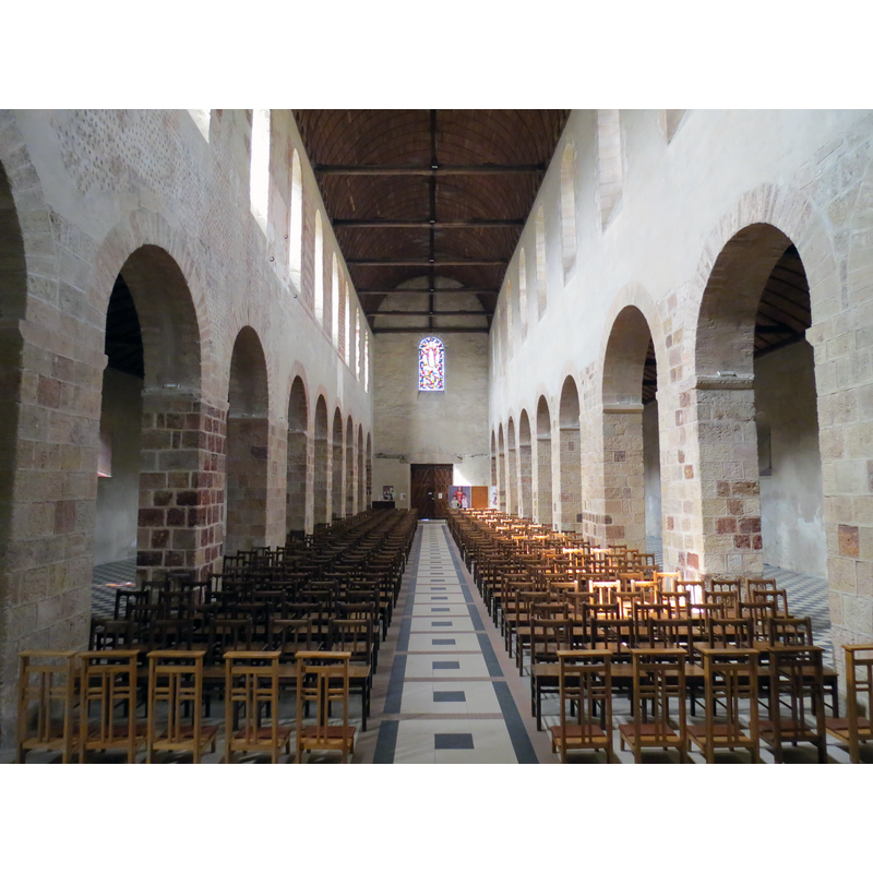
Copyright Statement: Image copyright © Romain Bréget, 2012
Image Source: digital photograph taken 4 September 2012 by Romain Bréget [https://commons.wikimedia.org/wiki/File:Église_Saint-Jean-Baptiste_-_Château-Gontier_6.JPG] [accessed 31 July 2016]
Copyright Instructions: CC-BY-SA-3.0,2.5,2.0,1.0
INFORMATION
Font ID: 20683CHA
Object Type: Baptismal Font1?
Font Century and Period/Style: 10th - 11th century, Romanesque
Church / Chapel Name: Église [ancien prieuré] Saint-Jean-Baptiste de Château-Gontier
Font Location in Church: [disappeared]
Church Patron Saint(s): St. John the Baptist
Church Notes: 10thC priory church founded by Benedictine monks from Saint-Aubin d'Angers abbey; documented by 1100; served as parish church since 12thC -- listed in Mérimée [ref.: PA00109484]
Church Address: place St Jean 53200 Château-Gontier, France
Site Location: Mayenne, Pays de la Loire, France, Europe
Directions to Site: Located off the D22-D22E crossroads, E of Craon, in the canton and arr. de Château-Gontier
Ecclesiastic Region: Diocèse de Laval
Historical Region: La Mayenne angevine, Haut-Anjou
Additional Comments: disappeared font? (the one from the original 10th-11th original priory church here)
Font Notes:
Click to view
[NB: we have no information on the font of the 10th-11th century church here]
COORDINATES
UTM: 30T 671713 5299948
Latitude & Longitude (Decimal): 47.83, -0.705531
Latitude & Longitude (DMS): 47° 49′ 48″ N, 0° 42′ 19.91″ W