Great Gaddesden / Gaddesden Magna / Gatesdene
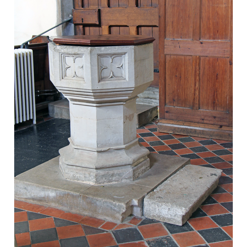
Image copyright © John Salmon, 2016
CC-BY-SA-2.0
Results: 4 records
view of font and cover
Scene Description: the 19thC font
Copyright Statement: Image copyright © John Salmon, 2016
Image Source: digital photograph taken 13 July 2016 by John Salmon [www.geograph.org.uk/photo/5054893] [accessed 13 September 2016]
Copyright Instructions: CC-BY-SA-2.0
view of church exterior - southeast view
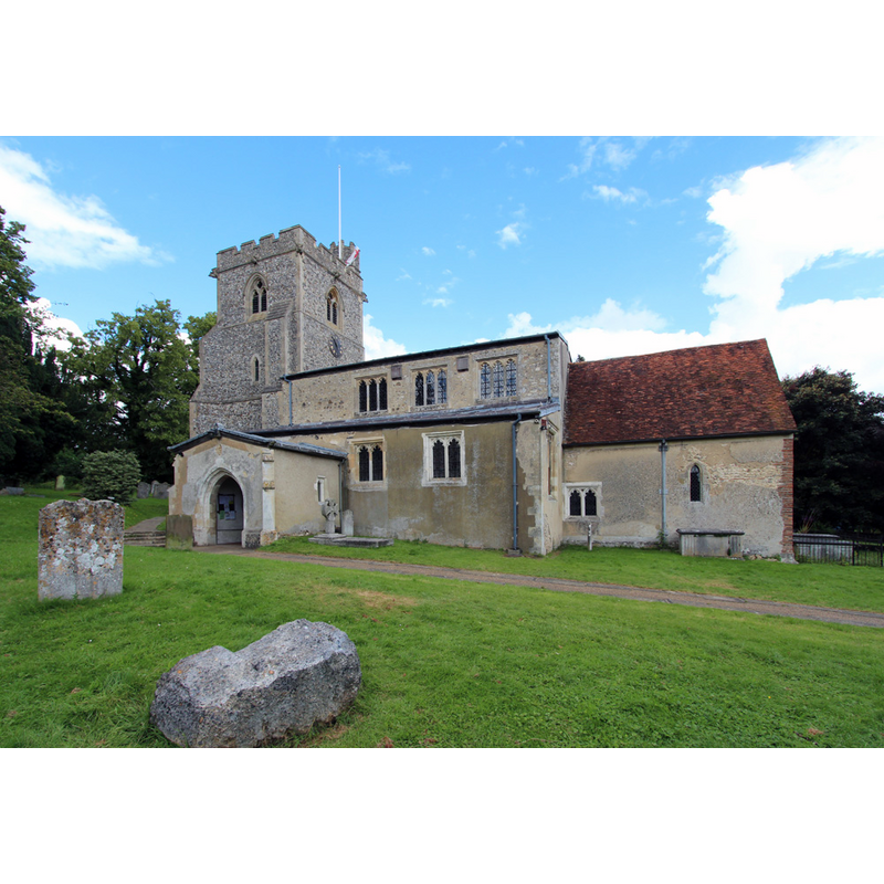
Copyright Statement: Image copyright © John Salmon, 2016
Image Source: digital photograph taken 13 July 2016 by John Salmon [www.geograph.org.uk/photo/5054635] [accessed 13 September 2016]
Copyright Instructions: CC-BY-SA-2.0
view of church interior - nave - looking west
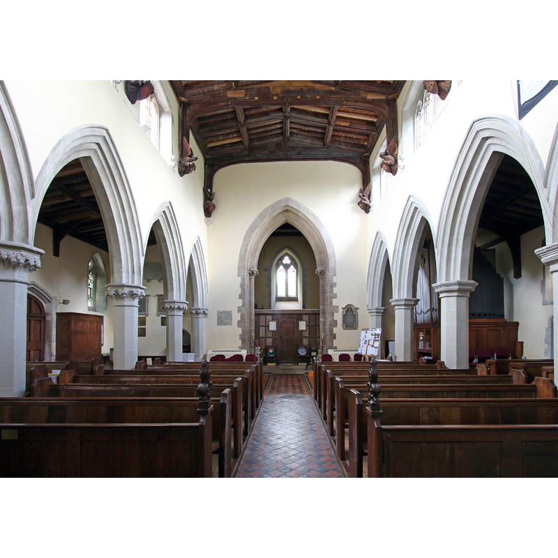
Copyright Statement: Image copyright © John Salmon, 2016
Image Source: digital photograph taken 13 July 2016 by John Salmon [www.geograph.org.uk/photo/5054650] [accessed 13 September 2016]
Copyright Instructions: CC-BY-SA-2.0
view of church interior - nave - looking east
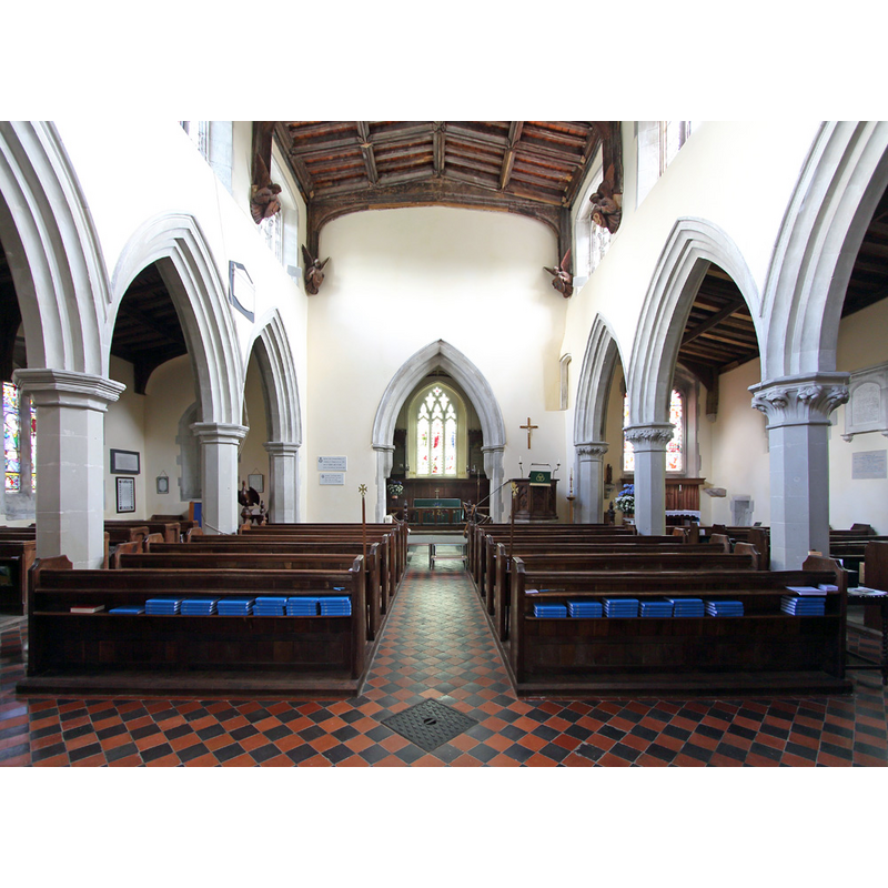
Copyright Statement: Image copyright © John Salmon, 2016
Image Source: digital photograph taken 13 July 2016 by John Salmon [www.geograph.org.uk/photo/5054639] [accessed 13 September 2016]
Copyright Instructions: CC-BY-SA-2.0
INFORMATION
Font ID: 20681GAD
Object Type: Baptismal Font1?
Font Century and Period/Style: 11th century, Pre-Conquest? / Norman
Church / Chapel Name: Parish Church of St. John the Baptist
Church Patron Saint(s): St. John the Baptist
Church Address: Piper's Hill, Great Gaddesden, Hertfordshire HP2 6HJ
Site Location: Hertfordshire, East, England, United Kingdom
Directions to Site: Located 5 km from Hemel Hempsatead, NE of Berkhamsted
Ecclesiastic Region: Diocese of St Albans
Historical Region: Hundred of Danish [in Domesday] -- Hundred of Dacorum
Additional Comments: disappeared font? (the one from the Domesday-time church here)
Font Notes:
Click to view
There is an entry for [Great] Gaddesden [variant spelling] in the Domesday survey [http://opendomesday.org/place/TL0211/great-gaddesden/] [accessed 27 July 2016]; it mentions a priest but not a church in it, though there probably was one there. The Victoria County History (Hertfordshire, vol. 2, 1908) notes: "The east wall of the chancel is the oldest part of the building […] This work can hardly be later than the early part of the twelfth century, and the plan of the chancel, and of the nave without the aisles, is probably contemporary with it. […] The church has undergone much modern repair […] The font stands near the south door, and has a modern panelled octagonal bowl on a shaft." The present font is described in English Heritahe [Listing NGR: TL0286811263] (1967): "Early C19 font octagonal with quatrefoil panel on each face."
COORDINATES
UTM: 30U 671662 5740615
Latitude & Longitude (Decimal): 51.79002, -0.510932
Latitude & Longitude (DMS): 51° 47′ 24.07″ N, 0° 30′ 39.35″ W
REFERENCES
- Victoria County History [online], University of London, 1993-. URL: https://www.british-history.ac.uk.