Aldbury / Albury / Aldeberie / Audebur
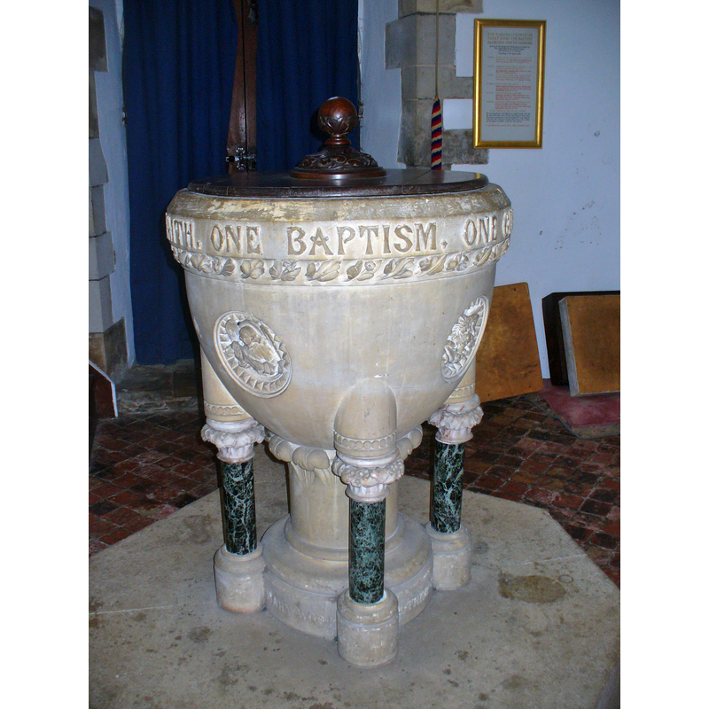
Image copyright © Colin Smith, 2016
Image and permission received from Colin Smith (e-mail of 21 November 2016)
Results: 6 records
view of font and cover
Scene Description: the modern font
Copyright Statement: Image copyright © Colin Smith, 2016
Image Source: digital photograph taken 15 August 2016 by Colin Smith
Copyright Instructions: Image and permission received from Colin Smith (e-mail of 21 November 2016)
view of church exterior in context - southeast view
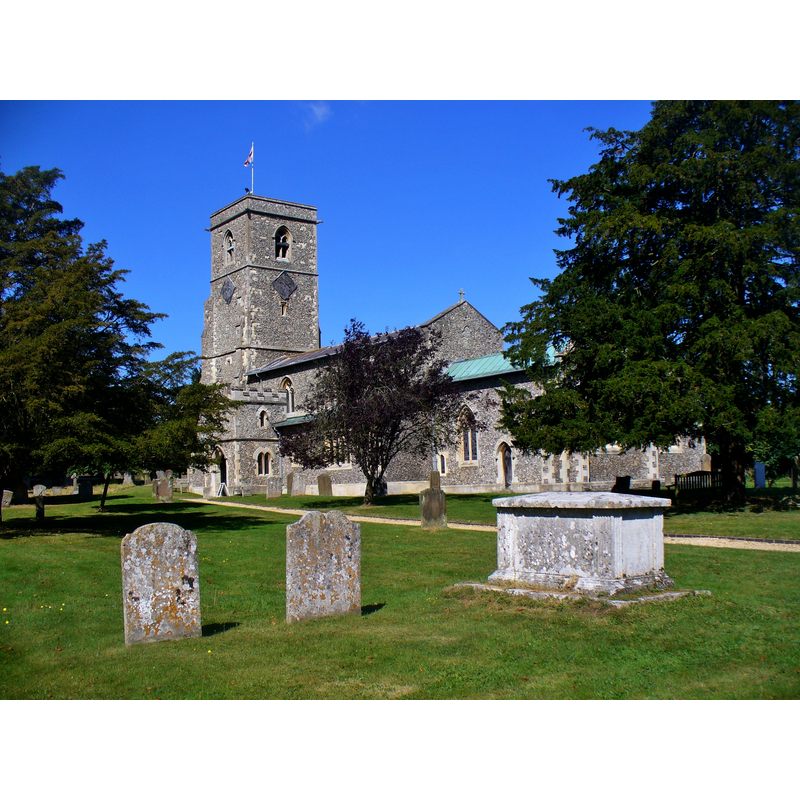
Copyright Statement: Image copyright © Colin Smith, 2016
Image Source: digital photograph taken 15 August 2016 by Colin Smith
Copyright Instructions: Image and permission received from Colin Smith (e-mail of 21 November 2016)
view of church exterior - southeast view
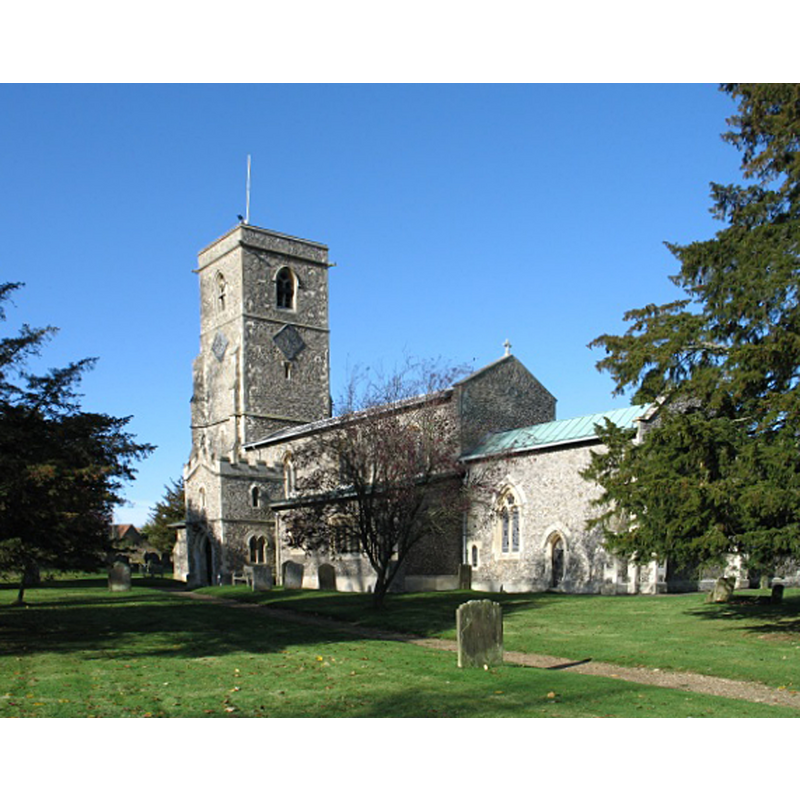
Copyright Statement: Image copyright © Gerald Masey, 2009
Image Source: digital photograph taken 2 November 2009 by Gerald Massey [www.geograph.org.uk/photo/1580348] [accessed 27 July 2016]
Copyright Instructions: CC-BY-SA-2.0
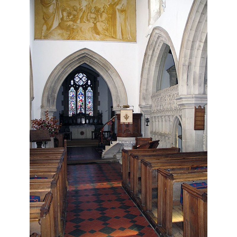
view of church interior - nave - looking east
Scene Description: with the modern font and cover in the foreground
Copyright Statement: Image copyright © Colin Smith, 2016
Image Source: digital photograph taken 15 August 2016 by Colin Smith
Copyright Instructions: Image and permission received from Colin Smith (e-mail of 21 November 2016)
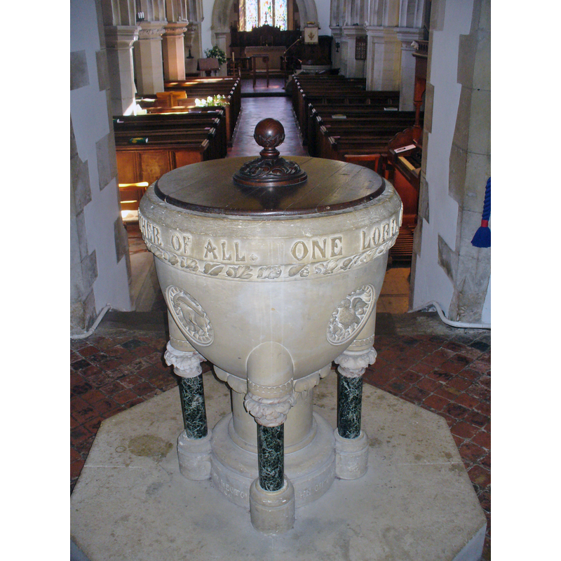
view of font and cover in context
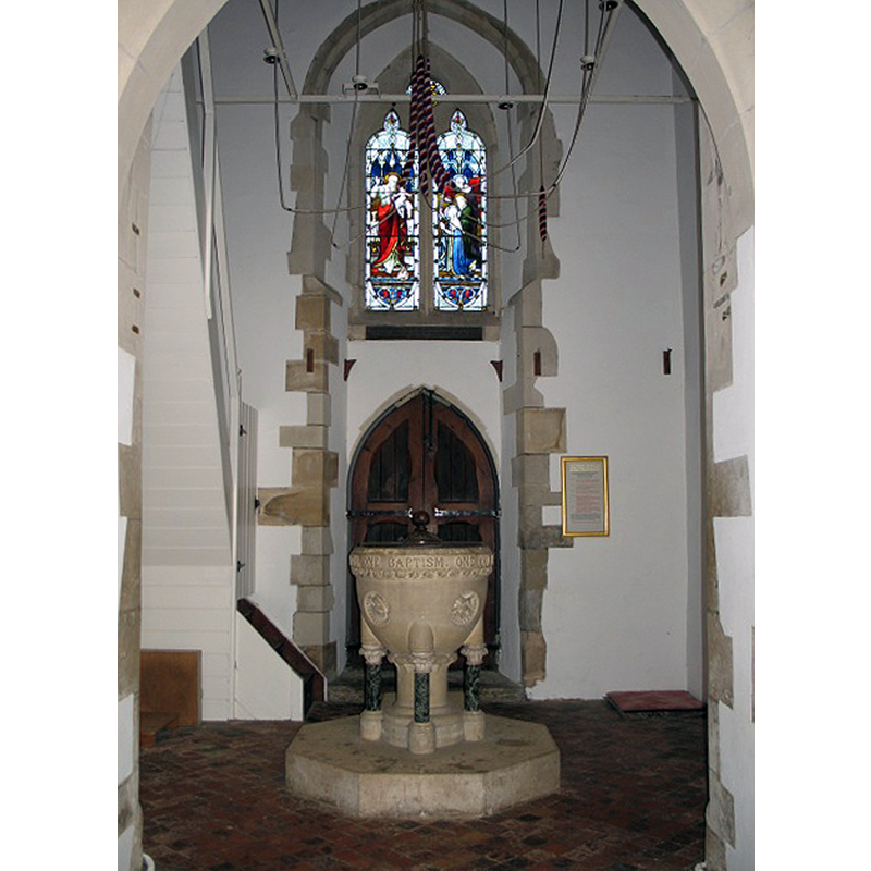
Scene Description: the modern font beneath the west tower
Copyright Statement: Image copyright © Gerald Masey, 2009
Image Source: digital photograph taken 2 November 2009 by Gerald Massey [www.geograph.org.uk/photo/1580374] [accessed 27 July 2016]
Copyright Instructions: CC-BY-SA-2.0
view of church interior - nave - looking east
Copyright Statement: Image copyright © Gerald Masey, 2009
Image Source: digital photograph taken 2 November 2009 by Gerald Massey [www.geograph.org.uk/photo/1580378] [accessed 27 July 2016]
Copyright Instructions: CC-BY-SA-2.0
INFORMATION
Font ID: 20679ALD
Object Type: Baptismal Font1?
Font Date: ca. 1220?
Font Century and Period/Style: 13th century (early?), Early English
Church / Chapel Name: Parish Church of St. John the Baptist
Church Patron Saint(s): St. John the Baptist
Church Address: Station Road, Aldbury, Hertfordshire, HP23 5RW, United Kingdom, United Kingdom -- Tel.: +44 1442 851200
Site Location: Hertfordshire, East, England, United Kingdom
Directions to Site: Located off (W) the B4506, ENE of Tring, E of Aylesbury, WNW of St Albans, near the county borders of Beds. and Bucks.
Ecclesiastic Region: Diocese of St Albans
Historical Region: Hundred of Tring [in Domesday] -- Hundred of Dacorum
Additional Comments: disappeared font? (the one from the early-13thC church here)
Font Notes:
Click to view
There is an entry for Aldbury [variant spelling] in the Domesday survey [http://opendomesday.org/place/SP9612/aldbury/] [accessed 27 July 2016], but it mentions neither cleric nor church in it. The Victoria County History (Hertford, vol. 2, 1908) notes: "The church of Aldbury was granted early in the thirteenth century by William de Bocland to the canons of St. Mary, Missenden […] Nothing older than thirteenth-century detail is now to be seen, a window at the north-east of the chancel dating from the first quarter of this century […] the present chancel was added to the east and outside the lines of an earlier chancel about 1220, the area of the old chancel being thrown into the nave. […] The font, under the tower, is modern, with a round bowl of Bath stone and a central stem flanked by four columns of serpentine."
Credit and Acknowledgements: We are grateful to Colin Smith for his photographs of this church and modern font
COORDINATES
UTM: 30U 665184 5741786
Latitude & Longitude (Decimal): 51.802494, -0.604213
Latitude & Longitude (DMS): 51° 48′ 8.98″ N, 0° 36′ 15.17″ W
REFERENCES
- Victoria County History [online], University of London, 1993-. URL: https://www.british-history.ac.uk.